| Your favorite launch | dawn patrol |
morning max | afternoon max | executive session |
|
|---|---|---|---|---|---|
| Iwash (Rooster) Rock | E30-35 | E26-29 | buns | return! | |
| Stevenson | E10-13 | E17-20 | W/G20-23 | W/G14-17 | |
| Viento | E10-13 | E17-20 | W/G20-23 | W/G14-17 | |
| Swell-Hood River | E5-10 | LTV | W/G20-23 | W/G17-20 | |
| Lyle to Doug’s | LTV | LTV | G22-25 | G22-25 | |
| Rufus, etc: 64-96kcfs flow | LTV | LTV | G22-25 | G22-25 | |
| Roosevelt & Arlington | LTV | LTV | G22-25 | G22-25 | |
| River flow last 24 hours: 64-96kcfskcfs | =River temp: 65.84F | HR High temp: 79F | |||
Gorge Wind Forecast
Hi friends! We continue with the back and forth in the wind direction for the next several days. Looking to the weekend from this far-out perspective, the wind looks calm or light/variable. Models are pretty sure about that for Saturday, and slightly less confident in no-wind weather for Sunday. Windiest days: late westerlies today and dawn patrol on Wednesday followed by strong easterlies Thursday.
Is this feeling helpful? If so, go ahead and make a contribution using Paypal to support it. Send $19.99 or more, and I’ll send the forecast to your inbox for a year.
Tuesday starts with strong east wind near Iwash (Rooster) Rock, but models say we’ll have westerlies this afternoon. Pressures at 7am were 30.18/30.26/30.24. We’ll have east wind at 30-33 at Iwash for a few hours this morning, but you’ll need to get right on it to get it. Same with Stevenson, Home Valley, and Viento. Max wind will probably be in the 17-20 range near Stevenson and 14-17 near Viento. By 11am, models have the wind at 10mph or less. As a weather system approaches from the NW, we’ll see a quick switch to westerlies. By 2pm, models have us with gusty 20-23 from Stevenson to Hood River. Later in the afternoon, they knock the wind down to gusty 14-17 from Stevenson to Hood River and drive it up to gusty 22-25 from Mosier to Arlington. It seems like this E to W switch often happens later in the day than forecast by models. Be prepared for that to happen. River flow over the last 24 hours was 64-96kcfs, river temp is 65.84F, and high temp forecast is 79F.
Wednesday starts with very strong offshore high pressure and a low moving in to central BC. This is a good combo for a decent dawn patrol. Get it quickly, because that ridge tilts positively and starts building inland during the day. That’ll knock the wind down. Call the dawn patrol 21-14 from Viento to Swell with 14-17 at Hood River, 10-13 at Stevenson, and light wind to the east of Hood River. Models drive the wind down to “calm” midday, but I’m not buying it. Best guess: 17-20 from Stevenson to Hood River from mid-morning on. To the east: less than 10mph. High temp: 68F.
Writing the complete forecast takes me 1-2 hours a day. If it saves you time, gas money, or helps you plan your life, please consider contributing.

On Thursday, a heat low sets up on the southern Oregon coast, and cold overnight temps linger in the desert. This, combined with a low spinning in the Pacific, turns the wind sharply offshore. Speaking of sharp, it’ll feel sharp and cutting early with low temps in the low 40s. Expect east wind at 32-35 near Iwash (Rooster) Rock, 25-28 at Stevenson and Home Valley, and 22-25 at Viento. The wind drops about 5mph in the afternoon at those spots and build to E 10mph east of Viento out into the desert. High temp will be 69F with high clouds early and sun later.
That was helpful in planning your life, wasn’t it? Go ahead and subscribe to the forecast using the fancy auto-renew option. Don’t like electronic payment? No problem! You can send a check or cash to: Temira / PO Box 841 / Hood River, Oregon, 97031. Thank you so much for supporting the forecast. I’m glad you find it helpful, and I appreciate your kindness in supporting the work I’m doing!

Extended: We’ll see another round of back-and-forth wind on Friday with easterlies to start and westerlies to finish. Models do not agree on how strong the west wind will be. Given that it’s frontally related, it’ll probably be gusty. For now, let’s guess 17-20ish. Saturday and Sunday are both at least 70% likely to be light wind days. Beyond that: I’m not even going to try, although the general weather picture does look warm and dry for a while. Have a great day out there today!

Jones, Sauvie Island, Oregon Coast
North/Central/South coast, waves (swell forecast provided by NWS). Wind forecast for the afternoon (unless it’s a storm on the coast, in which case that’s peak wind during the day). Wind direction N (coast/Sauvie Island) and W (Jones) unless otherwise noted. Tuesday: LTNW/N10-15/N30, W swell 6′ @ 17 seconds (PERFECT!). Wednesday: 20-25/25-30/35-40, NW 11′ @ 14. Thursday: 15/15/25, NW 10′ @ 13. Jones Tuesday: 12-15. Wednesday: 10-13. Thursday: LTE. Sauvie Island Tuesday: 11-14. Wednesday: 17-20. Thursday: LTE. Alan’s Sauvie Island Wind Sensor
Mt. Hood Weather Forecast
I’m tired. It’s on vacation.
Very basic Hood River weather forecast. Don’t plan your life around this. You really should read Temira’s Awesome Travel Advisory Service on Facebook
Clear sky this morning adds high clouds tonight. Temps start in the upper 30s and rise to the upper 70s. Light easterlies this morning. Moderate westerlies later. No rainbows. Wednesday will be partly cloudy then mostly clear. Temps start in the upper 40s and rise to the upper 60s. Moderate westerlies. No rainbows. Thursday will be high cloudy and then clear. Temps start in the low 40sd and rise to the upper 60s. Easterlies. No rainbows. Next chance of rain is late Friday.
Link to my Local-ish Outdoorsy Events Google Calendar
Please let me know of outdoor-related local-ish events. If you don’t tell me, I don’t know!
Cycling
All vehicles on HR County forest roads need a gallon of water and a shovel – it’s fire season. Please see the HRATS/Hood River County for complete details on Post Canyon closures. Newly reopened in Post: lower Trail 100 paralleling the lower part of Post Canyon Road. The Twin Tunnels Trail between Hood River and Mosier is closed due to wildfire. That means you, all of you who’ve been riding it. Kreps and Green Diamond Lands have reopened. That includes Whoopdee, Hospital Hill, and Underwood. Closed: Gorge 400 and lots of other trails due to the Whisky Creek Fire. Trail near Mt. Adams due to the Williams Mine Fire. Remember that E-bikes are not allowed on USFS non-moto trails. They are allowed on moto trails.
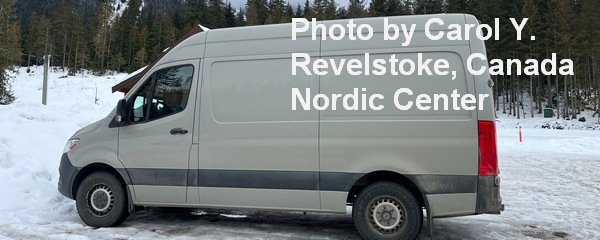
Sprinter Van of the Week!
 Click here for the Sprinter Van map of the world!!!
Have an awesome day!


