


Thank you for using this forecast. Like it? Find it useful? Support it (and me!) by sending some cash my way. What’s it cost to support me and get the email version? Not $99 a year. Nope. Not $49. Just $19.99 or more gets you a year. People are added to this list on Thursday and Sunday. My day job is crisis mental health, and I don’t have time on other days. Thanks for your patience! Click below to contribute. Thank you!!
Click here to use your PayPal
Venmo: @theGorgeismyGym
Snail Mail: PO Box 841, Hood River, Oregon 97031
(note: I am not a non-profit entity. The only way to accept credit cards with a user-defined amount is to use the ‘donate’ button. Thanks for understanding!)
Auto-renewing subscription. New! Awesome!
The Forecast
| 4a-8a | 8a-12p | 12p-4p | 4p-8p | 8p-4a | |
|---|---|---|---|---|---|
| Tuesday 1500′->4000′->2500′ |
 |
|
|
|
|
| Wednesday 2500′->6000′ |
|
|
|
|
|
| Thursday 6000′->10,000′ |
|
|
|
|
|
Mt. Hood Forecast
Very strong easterlies are the big story on Mt. Hood this morning. Those tend to affect Timberline more than they do Meadows, but with speeds like they are at the time of this report (31-50 top of Mt. Hood Express), any or all lifts could be shut down. Diminished easterlies and sunshine stick around for the rest of the week. Next possible chance of any precip at all is Tuesday, but don’t get too excited.
Tuesday’s details include some lift shutdowns thanks to very strong easterlies driven by a 1042mb high in Canada. The freezing level today will be all over the place; approximately 4000′ during the day and 2500′ overnight with extremely efficient radiational cooling that’s mitigated by the wind: NE 40 in the morning, NE 20-25 in the afternoon, and NE 25 overnight.
Wednesday also looks sunny and windy, but less windy than today. The freezing level will be 2500′ in the morning and will rise to about 6500′ in the afternoon and evening. Wind: NE 25 in the morning, NE 15 in the afternoon, and NE 20 overnight.
Thursday and Friday both look warmer: the freezing level will top out near 9000′ on Thursday and 10,000′ on Friday with slopeside temps approaching 50 on Friday. Wind will be in the 15-25 range both days out of the NE. Warm, sunny weather continues through Monday, after which about 50% of the ensemble members are hinting at some precip.
Note on wind speeds. Different wind directions are experienced in different ways on Mt. Hood. For example, west wind at 50mph will hit the slopes and exposed ridges at W 50. SW 50 may hit the ridges at SW 50, but will likely only be SW 20 below tree line. Hence the ranges for wind. Depends where you are on the mountain. Hopefully that helps clarify.
Gorge Wind Forecast
Easterlies are what it’s about through the weekend as a very strong Canadian high pressure system overpowers the northeast Pacific high pressure system. 1042Mb in Canada. 1033Mb offshore. Canada wins. Expect widespread E 20-25 this morning with a brief period of 20-30 possible at Cascade Locks. Afternoon wind settles down to 15-20 from Rooster to Hood River, 10-15 to The Dalles, and NE 20-30 east of The Dalles. River flow is 128kcfs, river temp is 47F, and high temp forecast is 62F.
Wednesday brings another round of easterlies. Rooster starts with 5-10 and Stevenson starts with 20-25. East of there: 10-15 at Viento and 5-10 elsewhere. Afternoon wind evens out to 10-15 from Stevenson all the way to Arlington with light and variable wind at Rooster. High temp: 65F. Thursday starts with E 15-20 at Rooster and Stevenson with 10-15 at Viento. Every launch in the Gorge from Rooster to Arlington gets afternoon easterlies at 10-13. High temp: 71. Easterlies continue through the weekend with temps approaching 80.
Coast, Jones, Sauvie’s
On vacation until the end of snowsports season. Will return in April or May.
Hood River Weather Forecast
Sunshine, easterlies, and mild temps all the way through the weekend. Tuesday: sunny. Temps will be in the upper 40’s early and low 60’s later. Moderate easterlies. No rainbows. Wednesday: sunny. Temps will be in the low 40’s early and mid 60’s later. Light to moderate easterlies. No rainbows. Thursday: sunny. Temps will be in the low 40’s early and low 70’s later. Light easterlies. No rainbows.
Looking for a complete Columbia Gorge forecast? Looking for more humor in your weather? Obscenities? You’re looking for my TATAS: Temira’s Awesome Travel Advisory Service on Facebook.
Cycling
Brown Pow alert everywhere! Cows are out on Hospital Hill. No parking at the corral. No dogs on the trails. No exceptions. Please respect the wishes of the landowners – they let us use their land, and in return, we respect their rules! Post Canyon: clear of snow to the top of Eldorado, perhaps to top of 140. New Whoopdee: open. Other news: Mountain View Cycles women’s ride is every Thursday, bottom of Post at 5:30pm. Dirty Fingers has Sunday gravel rides. Contact the shop for details.
Sprinter Van of the Week!
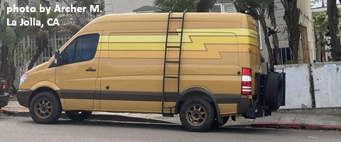 Click here for the Sprinter Van map of the world!!!
Local Events
Not much happening thanks to the pandemic… Have an awesome day!
