Thank you for using this forecast. Like it? Find it useful? Support it (and me!) by sending some cash my way. Why? It takes me an hour or two each morning to produce this, and it makes your life better, safer, and more fun. That’s worth something! You can get the email version sent to you. Not $99 a year. Nope. Not $49. Just $12.34 or more gets you a subscription. Click below to give financial support. Thank you!!
Credit card payments click here – – – – – – – – – Click here to use your PayPal
Venmo: @theGorgeismyGym
Snail Mail: PO Box 841, Hood River, Oregon 97031
(note: I am not a non-profit entity. The only way to accept credit cards with a user-defined amount is to use the ‘donate’ button. Thanks for understanding!)
Auto-renewing subscription. New! Awesome!
The Forecast
| 4a-8a | 8a-12p | 12p-4p | 4p-8p | 8p-4a | |
|---|---|---|---|---|---|
| Tuesday 0′->1500′->500′ |
 |
 |
 |
 |
 |
| Wednesday 0′->1000′->0′ |
 |
 |
 |
 |
 |
| Thursday 0′->2000′ |
 |
 |
 |
 |
 |
Mt. Hood Weather Forecast
Christmas Eve starts out sunny on the mountain. If you’re looking for sun, go get it early, as it won’t last. Just a trace of snow overnight gives way to a cloudy Christmas followed by a sunny Thursday and Friday. Next chance of snow is Sunday night, but models are far from agreeing on this.For Christmas Eve Day, sunshine is the morning weather. High clouds move in during the afternoon, and light snowfall arrives overnight. By light, I mean truly light in multiple sense. The snow level will be 0′ early, 1500′ in the afternoon, and 500′-1000′ overnight. The snow that falls will be very light and fluffy (like baby bunnies), but there won’t be enough to tell; just a trace to 1/2” falls overnight. Wind will be variable to 10mph all day.
Wednesday brings intermittent scattered snowflakes under cloudy sky. The sky clears overnight. Snow level: 0-500′ early, 500-1000′ in the afternoon, and 0′ overnight. Wind will be light and variable. Clear sky sticks around all day Thursday. The free air freezing level will be 0′ early, 500′ in the afternoon, and 2000′ after midnight. NO precip. Wind will be light and variable early, NW 15-20 in the afternoon, and WNW 15 overnight.
Friday looks clear in the morning and partly cloudy in the afternoon. The freezing level will be 2000′ in the morning and 4000′ later. Wind will be WNW 15 early and NNW 10 later. Next chance of snow appears to be on Sunday, but models do not agree on this. We’ll have to wait and see.
Gorge Wind Forecast
Tuesday wind will be light and variable all day. Wednesday starts with E 5-10 near Stevenson and 15-20 near Rooster Rock. The wind builds to 20-25 near Stevenson and 25-30 near Rooster. Thursday starts with 15-20 near Stevenson and 20-25 near Rooster. The wind backs off to 10-15 in the afternoon.COAST, JONES, SAUVIE’S: Detailed forecast is on winter break.
Hood River Weather Forecast
Nothing this morning should break up some before high clouds move in. Very light flurries are possible this evening. No accumulation. Temps will be in the mid 20’s early and upper 30’s later. Light wind. No rainbows. Wednesday looks cloudy with just a few snowflakes. Temps will be in the low 30’s early and upper 30’s later. East wind. No rainbows. Thursday looks Nothing early and partly cloudy later. Temps will be in the low 30’s early and upper 30’s later. East wind. No rainbows. Next chance of precip is Sunday, and that’s not for sure. Looking for a complete Columbia Gorge forecast? Looking for more humor in your weather? Obscenities? You’re looking for my TATAS: Temira’s Awesome Travel Advisory Service on Facebook.Road and Mountain Biking
Given that temps were below freezing on Monday night and will rise above freezing during the day Tuesday, all trails are under a freeze-thaw alert. Syncline, especially, is susceptible to this, as it is south-facing. Please don’t ride it, because you’ll do significant damage to those thawing trails. Your best bet for riding today is anything under the canopy of trees. Don’t ride up Seven Streams, as areas in the clearcut are freeze-thaw. A fun thing to do is ride up Post Canyon Road and ride down Mitchell Ridge. Repeat.Upcoming Events
It’s Christmas Eve day, and who knows what events are or are not happening. Same for Christmas day!
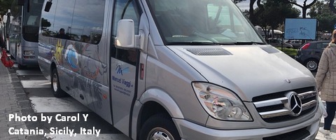
White Sprinter Van of the Week!

Click here for the White Sprinter Van map of the world!!!
Random Morning Thoughts: on vacation.
Click here for the full events calendar.
Have an awesome day today!
Temira


