Mt. Hood Snow Forecast
It’s a mostly cloudymorning on Mt. Hood, and it looks like a clear and sunny day later today. The snow level will be around 500′ while the sun is up, dropping to sea level after dark. Wind today will be NE 10-15 all day long. Wednesday looks clear and sunny during the day, cloudy in the evening, and snowy after 10pm. The snow level will be at the surface or 500′ or less all day long. We’ll see .3” WV between 10pm Wednesday and 4am Thursday for 3-5” of dry, fluffy snow. Wind on Wednesday will be NEE 10 early, building to SE 30 in the afternoon and switching to SW 30 after midnight. In a fun twist, Skibowl is opening Upper Bowl, Lower Bowl, and Multorpor on Wednesday! Meadows will be open for night skiing this weekend. Continued after the chart…
 |
4a-8a | 8a-12p | 12p-4p | 4p-8p | 8p-4a |
|---|---|---|---|---|---|
| Tuesday 500′ or less |
 |
 |
 |
 |
 |
| Wednesday 0′ |
 |
 |
 |
 |
 |
| Thursday 0′-??? |
 |
 |
 |
 |
 |
Mt. Hood Snow Forecast, continued…
Thursday looks really interesting on the hill. An incoming system brings heavy precip and fluctuating snow levels along with strong wind. The sounding model suggests the snow level will stay at 3000′ or less, mostly due to entrenched cold air. On the other hand, the 850mb model suggests the temp will rise to 2 to 4 degrees Celsius at 5000′ between 1am and 10am, giving us a snow level above 6000′. That’s a big difference, right? After 10am, the snow level will fall to 2500-3000′.
So, we’re currently looking at about .7” water value (WV) in that warm period on Thursday morning. Let’s call it a mix of freezing rain, sleet, and wet snow. That’s followed by 1.5” WV of snow, for 18-22” of new by Friday morning. Wind on Thursday will be SW 25 early, rising to SW 40 midday and turnign to WSW 50 in the afternoon and overnight.
Say “thanks for the forecasts”
by making a donation!
Keep the forecasts coming.
Does this forecast save you time, gas money, or help you have more fun in your life? Make a donation to support continued forecasting, and get the forecast in your inbox each day. Click on the button to donate. The email subscription isn’t $99/year. Not $50/year. No, just $12.34 or more gets you on the list for 12 months. Don’t PayPal? Send a check to Temira @ PO Box 841 in Hood River. Thank you for your support and thank you for trusting my forecast.

Mt. Hood Snow Forecast, finished
Friday starts off with the snow level at 2000′, dropping to 1500′ by Saturday morning. We’ll see .7” WV between 4am and 4pm Friday, for 8-9” of new snow. We’ll see another 1.1” WV overnight, for 12-15” of new snow. Wind on Friday will be WSW 50 early, WSW 30 in the afternoon, and W 25 in the evening. Saturday and Sunday currently look cold and snowy.
Simcoe Accounting
Simcoe Accounting, LLC is a full-service accounting firm. Serving clients throughout the Columbia gorge, dedicated to providing our clients with professional, personalized services and guidance in a wide range of accounting and business needs. We believe in getting it right the first time. The right service at the right time, at the right price. Contact us for a free quote by clicking the headline above.
Gorge Wind Forecast
Today looks like light east wind to start, E 20-25 midday, and light and variable wind in the afternoon. The easterlies will build overnight. Wednesday starts off with E 30-40 and picks up to E 60. Thursday looks like E 60+ to start with E 40 at 4pm, fading overnight, but probably not switching to westerly until midday Friday.
Jones, Sauvie’s, Coast Beta Test Forecast
If you click right here , you’ll find NOAA’s coast forecast.
Random Morning Thoughts
It’s 33 degrees outside this morning, and the temp is forecast to drop to 20 degrees by Wednesday morning. You know what that means? Yup, it’s time to make chicken stock!
See, the real problem with making a large batch of chicken stock is the fact that it’s hard to cool it off. However, if it’s in the 20’s outside, you can make a huge pot of chicken stock and leave it out overnight. In other words, the Gorge is your refrigerator.
This works even better when you can put the pot into a pile of snow. The Hood River Health Department would endorse this version over simply putting the pot outside in the cold air. Snow-cooling will be an option on Thursday, although the freezing rain might make it hard to access that pot when you go to retrieve it on Friday morning.
So there you go. Some real practical advice for you this morning. Be awesome. Have an awesome day.
Disclaimer required by my grad school program: I am not your therapist (but I could be 51 graduate school credits from now). I am your weather forecaster. Take everything I say with a grain of salt, and consult with your actual therapist about your mental health issues. One other thing: I plan to keep doing this forecast indefinitely, even when I am a therapist.
Gorge Weather Forecast
It’s a cloudy start to the morning with scattered sprinkles down low, flurries in the middle, and sunshine up high. Expect snowy and icy roads above 500′. We’ll see Nothing this morning with a chance of partly cloudy sky this afternoon. Temps will be in the low to mid 30’s all day. If the roads don’t dry, they’ll be icy tonight. Light wind. 5% chance of rainbows. Wednesday looks dry through midnight, after which snowfall will start. Temps will be in the low 20’s early and the upper 20’s in the afternoon. Increasing east wind. No rainbows.
Thursday starts off with heavy snowfall, switching to freezing rain after midnight. Temps will be in the low 20’s early and mid 20’s in the afternoon. We’ll see 6-8” of snow followed by up to .5” of ice. The Cascade Locks area could see double those numbers. Total snow and ice accumulation really depends on when the wind switches back to westerly, which currently looks like midday Friday.
For weather specifically directed at travel through the Gorge, please visit Temira’s Awesome Travel Advisory Service on Facebook.
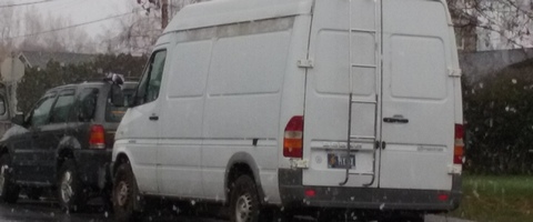
White Sprinter Van of the Day

Road and Mountain Biking
It is, of course, still too wet to ride Post, Hospital or Whoopdee. There’s snow on all the trails above 1000′. Syncline is a maybe. Road biking is about to get gnarly – expect icy roads with gravel starting Wednesday. It’s time to start thinking about freeze-thaw conditions. Once we dip below freezing, you should stop riding the trails if the temperature is above freezing. Feel free to ride where the trails stay frozen, but freeze-thaw conditions make the trails delicate and susceptible to damage.
Upcoming Events
It’s Tuesday. There’s free yoga at Flow at 4:30 and at HAVEN (Strong Women Yoga) in The Dalles at 5. There’s pickup touch rugby at 5 at the Hood River Marina Park. There’s $12 Prime Rib at Cebu tonight from 5pm to 9pm. At 6:30 this evening, there’s meditation at Yoga Samadhi led by community members until the monks return. This remains, and most likely always will, my favorite activity of the week.
Have an awesome day today!
Temira


