

GORGE WIND FORECAST
today’s gorge wind forecast
Hi friends! High pressure settled off the coast lingers into Friday and keeps the westerlies coming. For the weekend Gorge wind forecast, we’re likely to see hot weather, but the details are far from clear. Saturday, for now, looks like a light wind or perhaps calm wind day. Models are all over the place for Sunday and Monday, but they’re already in cahoots for a couple of big days next Tuesday and Wednesday. That’s likely to shift some as the weekend high pressure decides when to dissipate, but it does appear that we’ll have The Cooldown You Were Looking For next week. In the meantime…
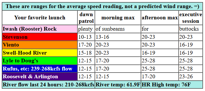
Tuesday starts with pressures of 30.25/30.16/30.13 with 30.65 off the coast. This gives us 0.09 (pdx-dls) and 0.03 (dls-psc), which is generally plenty for some wind. The metro area is likely to clear quickly today, which generally results in a drop-off in wind at the Hatchery. For the morning, westerlies should build to 20-23 from Stevenson to Mosier with 14-17 from Lyle to Doug’s. Afternoon wind drops to 16-19 from Swell to Hood River and holds at 20-23 at Stevenson, Viento, and Mosier. Between Lyle and Avery, we’ll see a slow build to 25-28 this afternoon. Rufus joins in this evening at 25-28 (river flow 239-268kcfs – a lot) and Arlington jumps in late with 23-26. River flow over the last 24 hours ranged from 210-268kcfs, river temp is 61.9F, and high temp forecast is 76F for Hood River and 78F for Arlington.

tomorrow’s gorge wind forecast
Wednesday sees a weak system swing through. Despite its lack of punch, it should keep the west side cloudy all day. Combine that with strong offshore high pressure for a solid west wind day. We’ll start with 17-20 from Viento to Arlington with light wind at cloudy and potentially drizzly Stevenson. Westerlies quickly build to 25-28 from Viento to Rufus with 17-20 at Stevenson and 20-23 at Arlington. Afternoon brings 27-30 from Viento to Arlington with cloudy, gusty 17-22 at Stevenson. If low clouds slip past the Hatch, those stronger wind speeds won’t materialize there and conditions will be super gusty. If that’s the case, just drive east. High temp: 76F for Hood River and 79F for Arlington.
extended Gorge wind forecast
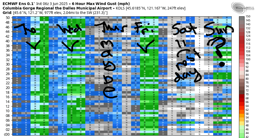
Thursday looks both warmer and lighter. After a 17-20ish start near the Hatch, westerlies drop to 15-18mph and hold for the rest of the day. High temp: 85F. Slightly stronger wind is forecast for Friday; yesterday’s forecast had a big day, but ensembles dropped way down in the latest run. We’re then set for a short heat wave this weekend. Light wind is likely Saturday. Beyond that, there’s really too much uncertainty to make a call for Sunday and Monday. For next week, however, ensembles really want to toss out cooldown wind with plenty of clouds in the metro area – big days are likely in the Corridor. Have a great day today. See you on the Nch’i Wana!
Was that helpful? I knew it was! Guess what? All of this crucial work – from your personal wind and snow reports to the invaluable TATAS updates – is made possible by my relentless efforts. Maintaining this labor of love isn’t easy. Each daily forecast takes hours. Website hosting, weather model access, and back-end admin work takes time and money. That’s where you come in.
YOUR CONTRIBUTION MAKES A DIFFERENCE
- SUPPORT ACCURATE, HYPER-LOCAL WEATHER FORECASTING
- ENABLE ACCESS FOR ALL, EVEN THOSE WITH LESS MEANS
- SUPPORT A COOL HUMAN WHO WORKS HARD SO YOU CAN PLAY
Take a moment to click one of the buttons below. Donate $19.99 or more (how much does this forecast enhance your life?) and get the email in your inbox. Whether it’s a renewing subscription (auto-renew) or a one-time donation, every contribution makes a real difference. Help me keep this labor of love alive, so we can all continue playing, commuting, and living in the Gorge with peace of mind and the best weather forecasts possible. Thank you!


Hood River, Oregon 97031


JONES BEACH, SAUVIE ISLAND, & COAST FORECAST
Wind northerly unless otherwise indicated. For coast, it’s North/Central/South with the “central” at approximately Florence. Swell forecast from NWS for central coast. Jones: westerly unless otherwise stated. Sauvie Island: northerly unless otherwise stated. Tuesday: 15-20/20/35+, NW swell 8′ at 9 seconds. Wednesday: 10-15/15/30-35, NW 6′ @ 9. Thursday: 20/20/35, NBW 6′ @ 9. Jones Tuesday: 23-26. Wednesday: LTW. Thursday: 21-24. Sauvie Island Tuesday: 17-20. Wednesday: 11-14. Thursday: 15-18.
BARE BONES HOOD RIVER WEATHER FORECAST
High clouds this morning leave us with clear sky later. Temps start in the mid 50s and rise to the mid 70s. Moderate to moderately strong westerlies. No rainbows. Wednesday will be cloudy in the morning and clear later. Temps start in the low 50s and rise to the mi d70s. Strong westerlies. Moderate westerlies early. Strong later. No rainbows. Thursday will be cloudy then clear. Temps start in the low 50s and rise to the mid 80s. Moderate westerlies. No rainbows.
TEMIRA’S AWESOME TRAVEL ADVISORY SERVICE – TUESDAY 6/3
HYPERLOCAL WEATHER FORECAST FOR THE COLUMBIA GORGE
THE DALLES, HOOD RIVER, WHITE SALMON, TROUT LAKE, STEVENSON, CASCADE LOCKS, PARKDALE, ODELL, HUSUM, BZ, MILL A, WILLARD, GOLDENDALE, RUFUS, ARLINGTON, boardman
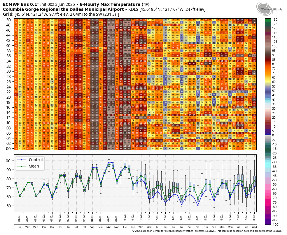
Good morning, neighbors! Standard-issue summer weather (it’s summer, according to the fish counts) continues through this week, and then we get a heat wave for the weekend. Record high temps for Hood River are 98 (Saturday), 95 (Sunday), and 92 (Monday). We’ve got a good chance of breaking records Sunday and Monday. Records for those three days in The Dalles are 100+, and are unlikely to fall. Heat should be relatively short-lived. By next Monday or Tuesday, temps cool off. Yay.
glenwood’s morning and today’s gorge weather forecast
Today is Tuesday, and Glenwood started off at 38 degrees. That’s cool enough for mittens to hold the morning coffee while sitting in the porch rocking chair. The mittens will be attached to a human, most likley, but sometimes it’s just mittens floating in the air holding the cup of coffee. Glenwood is special that way. Today’s lowland weather brings temps in the mid to upper 70s (quite pleasant) with west wind at 20mph west of The Dalles this morning with 20mph west of Mosier this afternoon and 25-30mph from Mosier to the Arlington Triangle.
tomorrow’s gorge weather forecast
Low clouds pay a visit to areas west of Hood River on Wednesday, and a little drizzle is forecast west of Cascade Locks until 2pm. Temps start around 50 degrees, maybe even in Glenwood if it’s cloudy there. With 80 degrees forecast in the desert, mid 70s on the west side, and clouds lingering much of the day for the far western Gorge, we’ll have another breezy day: 15-20mph to start and 25-30mph to finish. Wind extends all the way to the Arlington Triangle. Again. And then it disappears from the Gorge and reappears in the Bermuda Triangle, where people will be confused by the sudden arrival of cool, maritime Pacific breezes.
thursday’s gorge weather forecast
Thursday brings 10 degrees more warmth: temps max in the mid 80s all through the Gorge. Wind will be 15-20mph between Stevenson and The Dalles with light wind out in the desert, where the tumbleweeds will be very, very upset, because they won’t even have the 3-5mph needed to let them tumble. Similar weather is forecast Friday. Tumbleweeds: even more upset, but of their own making. If they’d just relax into life, they’d know that tumblewind will return eventually.
extended gorge weather forecast
High pressure settles inland for the weekend. While the details are still being haggled over, the generally picture is “hot and sunny”. Highs push into the 90s Saturday, Sunday, and Monday, with Sunday being peak heating. Need a windless day? Saturday is probably the day you’re looking for. Looking into next week, we have a fair bit of range in the high temp spread, but the general description is “cooler than the weekend”. TATAS approves that forecast. That’s all I have for now. Be kind out there in the world today. Safe travels. -TATAS
HEY! DON’T STOP READING! Is this community-focused forecast helpful to you? It sure is! It takes me a couple hours a day to write. Please join your friends and neighbors in contributing to keep it going. Venmo: @thegorgeismygym PayPal: twomirrors@gmail.com USPS: Temira / PO Box 841 / Hood River, Oregon 97031 You can test out the forecast subscription for a few days for free by signing up below. Easy! Do it!
