Random Morning Thoughts

I love forecasting weather. I love how challenging it can be. And I love those days where I get to say, “Look, I really don’t know – it’s complicated.” Today is one of those days, both for the Mt. Hood forecast and for the Columbia Gorge forecast. The only obvious part of the forecast today is the wind in the Gorge and the blizzard warning for Thursday in the western Gorge. I love saying, “I don’t know.” It makes me feel so human to say those three words. There are a lot of things we don’t know, and acknowledging that brings us closer to each other. “I don’t know” opens doors to interesting conversation, and who doesn’t love a good conversation? Now, go get those snow tires on your car, cuz the one thing I do know is that it’s going to be sub-freezing and precipitating on Thursday.
Thank you for using this forecast!
Please donate to support it!
Thank you to everyone for using this forecast. Does it save you time, gas money, or help you find more wind, powder, or just plain fun stuff to do? Please consider making a donation to keep it going! Use it here for free or make a donation and get on the mailing list for wind for the summer and Mt. Hood snow in the winter. It’s not $99/year. Not $50/year. No, just $12.34 or more gets you on the list for 12 months. Do it via PayPal/CC by clicking on my happy photo below. Don’t PayPal? You can send a check to Temira @ PO Box 841 in Hood River. Thank you for your support, and thank you for trusting my forecast. You guys mean the world to me.
 |
4a-8a | 8a-12p | 12p-4p | 4p-8p | 8p-4a |
|---|---|---|---|---|---|
| Today |  |
 |
 |
 |
 |
| Tomorrow |  |
 |
 |
 |
 |
| The next day |  |
 |
 |
 |
 |
Mt. Hood Snow
Oh boy. This is getting tricky. Let’s start with the easy stuff: Today will be partly cloudy to sunny on Mt. Hood, as east winds and a west-moving arctic cold front kick up some clouds. The free air freezing level (FAF) will be at the surface with temps in the teens at 5000’. Wind will be E 30+.
Tomorrow starts off clear, with a chance of a few clouds from easterly orographics. Clouds move in from the south in the afternoon, and snow starts falling around midnight. The FAF will be at the surface with 5000’ temps in the low double digits. Wind will be ESE 25, swinging around to westerly overnight.
Here’s where things get tricky. The incoming storm supports 5000’ temps of 2-6 degrees. In yesterday’s model run, the snow level climbed to 7000’, and we saw lots of rain and freezing rain on the mountain. As of this morning, models are showing temps remaining below freezing until Friday morning with a brief period of above-freezing temps between 4000’ and 6000’ on Friday morning before temps drop again Friday afternoon.
A lot depends on the exact storm path. At this point, I can say a few things: 1) There’s 1-2” moisture (water value/WV) coming in between 4am Thursday and 4pm Thursday, followed by another 1”+ by Friday morning. 2) If it stays snow, it’s going to be really heavy and wet. 3) There will be periods of freezing rain/sleet.
As of right now, I’d say the likely scenario is snow on Thursday on the mountain. 8-12”, followed by mixed precip Thursday night into Friday morning. But that could change if the storm track shifts. There’s a lot more moisture coming in on Friday, and P-type is also really dependent on the exact storm track.
I know that sounds like a lot of hedging. Anyone who isn’t hedging the Mt. Hood forecast at this point is misleading the reader. =)
Gorge Wind
This is easy: it’s going to be nuking east wind with sub-freezing wind chill through the weekend. The 6am gradient today was E .19. Not the biggest I’ve seen – that was E .40 – but still respectable. That gradient is going to get a lot bigger. In the meantime, expect east wind at 30-40 this morning, rising to 50-60+ this afternoon. Expect easterlies at 50-60+ tomorrow morning, falling to 40-50 in the afternoon (yeah, this is going to be a fun drive to Vancouver for me).
On Thursday, expect easterlies at 30-40 in the morning and 20-25+ in the afternoon. Along with those Thursday east winds, expect snow and possibly some freezing rain for blizzard conditions. Definitely NOT a good day to drive the Gorge. As a matter of fact, I wouldn’t be surprised to see I-84 close. So be prepared for that too.
Gorge Weather
I’m so thankful Craig M. put my snow tires on yesterday. I drove by Nelson Tire on the way to Craig’s house, and there were 40+ cars waiting. I bet there were 60+ cars at Les Schwab. I drove by both places looking for a Sprinter Van, but didn’t see one. I’m not sure if Sprinter Vans go into hibernation when it snows or what, but I guess they don’t need snow tires.
Anyway, today looks sunny and cold. Expect temps in the upper 20’s to low 30’s this morning and low 40’s this afternoon with brisk east wind, even in places that don’t normally get east wind.
Wednesday starts off sunny, but quickly becomes cloudy. Temps will be in the low 20’s early and low 30’s in the afternoon. East winds will make puffy jackets a requirement.
Snow starts falling around 4am on Thursday. You really don’t want to be on I-84 on Thursday. Call in sick if you can. Current model runs support all snow all the time (yesterday they supported snow turning to freezing rain – who knows what they’ll say tomorrow). Anyway, expect 6-12” of snow during the day on Thursday, with more snow falling overnight. The Friday forecast is iffy for temps, and it’s also iffy for precip type and quantity. As of this morning, it looks like we’ll stay sub-freezing, and it looks like the precip will stay south of us. I think we’re going to have to wait until we get closer to Friday to see what will happen.
That said, models agree that whatever happens on Friday, we’ll be back to sub-freezing temps for the weekend with light snow flurries likely.
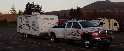
White Sprinter Van of the Day

Road and Mountain Biking
The dirt was nice on Syncline and it was nice on Whoopdee yesterday. I don’t know about Post, but it’s the place to be today because the ground will be more likely to stay frozen there. With temps sub-freezing this morning, we may or may not go to freeze-thaw on Whoopdee and Syncline. If we do, please avoid them. Freeze-thaw is the most fragile time for our trails. It’s when they become rutted and braided and generally messed up. So find something frozen (Post, Gorge 400, Buck Creek/Nestor) to ride. And roadies, get it today and tomorrow before it’s all gravel everywhere all the time!
The Clymb: free membership. Cheap gear.
Temira approves. Click to join.
Bar Mitts – Keeping cyclists’ hands warm all winter!
It’s cold out, and you still want to ride your bike, don’t you? Me too. Bikes are fun! But cold weather makes for cold hands. What’s a cyclist to do? Get some Bar Mitts! These neoprene handlebar covers keep your hands way, way warmer than the outside air. This isn’t hype. This is Temira’s personal testimonial. I begged these guys to let me advertise for them, because I have the coldest hands on the planet. Not anymore. Bar Mitts. Making it possible for me (and you) to have happy hands all winter long.
Events – email me if I’ve missed any outdoor-related events
There’s pickup touch rugby at 5:30 at the Hood River Marina tonight, and there’s the Tri Club’s headlamp run in Post Canyon at 6:15 (meet at the bottom of Post Canyon Road). Also tonight, there’s $12 Prime Rib at Cebu from 5pm to 9pm. Coming up on Thursday, it’s Snowpocalypse II, 2014.
Have an awesome day today!
Temira


