


Thank you for using this forecast. Like it? Find it useful? Support it (and me!) by sending some cash my way. What’s it cost to support me and get the email version? Not $99 a year. Nope. Not $49. Just $19.99 or more gets you a year. People are added to this list on Thursday and Sunday. My day job is crisis mental health, and I don’t have time on other days. Thanks for your patience! Click below to contribute. Thank you!!
Click here to use your PayPal
Venmo: @theGorgeismyGym
Snail Mail: PO Box 841, Hood River, Oregon 97031
(note: I am not a non-profit entity. The only way to accept credit cards with a user-defined amount is to use the ‘donate’ button. Thanks for understanding!)
Auto-renewing subscription. New! Awesome!
The Forecast
| 4a-8a | 8a-12p | 12p-4p | 4p-8p | 8p-4a | |
|---|---|---|---|---|---|
| Tuesday 2000′->1000′ |
 |
|
 |
|
 |
| Wednesday 1000′-1500′ |
|
|
|
 |
 |
| Thursday 1000′->3000′->1500′ |
|
|
|
|
|
Mt. Hood Forecast
Low snow levels and intermittent snowfall stick around through Friday. After that, models are all over the place with the temps. The only thing models do seem to mostly agree on is a period of relatively dry weather starting on Saturday. Let’s dive into the details!
Light snowfall Tuesday morning likely adds sunbreaks in the afternoon and heavier snowfall overnight. The snow level will be 2000′ in the morning, 1500′ in the afternoon, and about 1000′ overnight. Models suggest 0.1” water equivalent during the day, for 1” of powder. Overnight snowfall really depends on where the band of heaviest precipitation sets up; the wind direction isn’t all that conducive to orographic enhancement. Let’s call it 0.4” to 0.8” WE, for 5-9” of fluffy, light powder. Yay! Wind: SW 25-50 in the morning, WSW 25-40 in the afternoon, SW 15-35 in the evening, and WSW 10-15 overnight.
Light snowfall Wednesday morning gives way to clear sky and perhaps a few orographic flurries in the afternoon and evening. The snow level will be 1000-1500′ all day. Just 0.1” WE is forecast, for an inch of snow. Models like the idea of clear sky and sunshine in the afternoon, but NW wind could make a few clouds and flurries pop up. Wind: WSW 10-15 in the morning, NW 10-15 in the afternoon, and NW 15-20 overnight.
Thursday looks sunny and dry. The snow level will be 1000′ early and about 3000′ later with 5000′ temps right around 32F. No snowfall. Wind: NW 15-20 early, NW 20-30 in the afternoon, and a blistering NW 50-55 overnight. When those strong winds arrive, they could bring some unexpected snowfall with them.
Friday looks very windy with light to moderate snowfall. Snowfall will likely be higher than models predict; currently they are only saying a few inches. Looking at Saturday and Sunday, we see all sorts of variety in the models. The operational GFS, on which this forecast is nominally based, calls for sunshine and freezing levels between 5500′ and 8000′. Other models and other ensemble members call for much colder, but still dry weather. So, no certainty yet. In the meantime, the shredding remains good on the slopes!
Note on wind speeds. Different wind directions are experienced in different ways on Mt. Hood. For example, west wind at 50mph will hit the slopes and exposed ridges at W 50. SW 50 may hit the ridges at SW 50, but will likely only be SW 20 below tree line. Hence the ranges for wind. Depends where you are on the mountain. Hopefully that helps clarify.
Gorge Wind Forecast
Models are agreeing on a rare stretch of strong winter westerlies starting Thursday as offshore high pressure dominates the weather picture. For Tuesday, expect a light and variable start to the day. After sunrise, westerlies pick up to gusty 15-18 from Stevenson (rainy) to Rowena (not rainy) with gusty 20-25 from The Dalles to Arlington. Afternoon wind drops to 5-8 in the west and holds through perhaps 2pm in the eastern Gorge before starting to fade. River flow is 153kcfs, river temp is 39 degrees, and forecast high temp is 48.
Wednesday starts light and variable. There will be a brief period of morning wind at E 10-15 at Stevenson and W 10-15 at Rooster before the wind goes completely calm all through the Gorge. Thursday starts with light westerlies and picks up to W 24-27 from Viento to Arlington. Extended wind forecast are not all that accurate, but they’re fun to look at. So… Friday: 27-31. Saturday and Sunday: 21-24.
Coast, Jones, Sauvie’s
As needed until next spring and summer.
Hood River Weather Forecast
Mostly cloudy sky this morning will add showers during the day and light rain overnight. Temps will be in the mid 40’s early and upper 40’s later. Moderate westerlies. 99% chance of rainbows. Wednesday brings light rain in the morning and showers later under partly cloudy sky. Temps will be in the mid 30’s early and mid 40’s in the afternoon. Light and variable wind early turns calm. 99% chance of rainbows. Thursday looks dry. Temps will be in the mid 30’s early and mid 40’s later. Light westerlies early. Strong westerlies later. 1% chance of rainbows.
Looking for a complete Columbia Gorge forecast? Looking for more humor in your weather? Obscenities? You’re looking for my TATAS: Temira’s Awesome Travel Advisory Service on Facebook.
Cycling
We are in winter riding season, and the trails are apt to be fragile. If it was below freezing last night and is above freezing now, don’t ride. If it was below freezing last night and it is sunny now, don’t ride unless you are under a tree canopy for the entire ride. Freeze-thaw conditions, when ridden upon, result in permanent trail damage. Please consider doing something else, perhaps riding a gravel road in the trees or going to the mountain. Thank you!
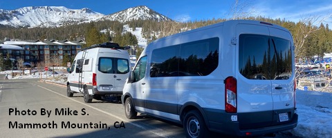
Sprinter Van of the Week!
 Click here for the Sprinter Van map of the world!!!
Local Events
Weekly events: The Kainos Coffee run happens in The Dalles every Tuesday morning at 6am. There are sailboat races at the Hood River Marina every Wednesday evening. Dirty Fingers has a group mountain bike ride (bring lights) Wednesday nights at 5:30pm. Cheno has an outdoor HIIT workout at Griffin House in Hood River at 6pm on Wednesday nights. There is a BLM rally every Tuesday evening at 5:30 at the Salmon Fountain in Hood River, and there’s a White Coats for BLM rally every Thursday at noon at 12th and May in Hood River. Have an awesome day!
