


Thank you for using this forecast. Like it? Find it useful? Support it (and me!) by sending some cash my way. What’s it cost to support me and get the email version? Not $99 a year. Nope. Not $49. Just $19.99 or more gets you a year. People are added to this list on Thursday and Sunday. My day job is crisis mental health, and I don’t have time on other days. Thanks for your patience! Click below to contribute. Thank you!!
Click here to use your PayPal
Venmo: @theGorgeismyGym
Snail Mail: PO Box 841, Hood River, Oregon 97031
(note: I am not a non-profit entity. The only way to accept credit cards with a user-defined amount is to use the ‘donate’ button. Thanks for understanding!)
Auto-renewing subscription. New! Awesome!
The Forecast
| 4a-8a | 8a-12p | 12p-4p | 4p-8p | 8p-4a | |
|---|---|---|---|---|---|
| Thursday 4000′->3000′->5500′ |
 |
 |
 |
 |
|
| Friday 6000′->3000′ |
|
|
|
|
|
| Saturday 3000′->6500′->4000′ |
|
|
|
|
 |
Mt. Hood Forecast
If you like snowy weather, you’ll like most of the forecast for the next week or so. There will be a couple exceptions: Friday morning looks dry, and rain will likely fall on Saturday night.
Thursday will see light snowfall during the day, some sunbreaks in the afternoon, and cloudy sky overnight. The snow level will be 4000′ in the morning, 3000′ in the afternoon, and 5500′ overnight, but it doesn’t look like there will be precip with that warmer period. Expect 0.3” water equivalent during the day Thursday. That’s 3” of new. A trace may fall overnight. Wind: W 40 in the morning, NW 25-30 in the afternoon, SW 5-10 in the evening, and WSW 25-30 overnight.
Friday starts with cloudy and relatively warm weather. Snow falls in the evening. It might start as rain, but probably not. Probably just wet snow. The snow level will be 6000′ for much of the day, 4500′ in the evening, and 3000′ overnight. About 0.7” WE falls in the evening for 4-6” of dense new snow. Wind: WSW 25-30 in the morning, SW 20-25 in the afternoon, and WSW 35-50 after midnight.
Saturday may start with some sunbreaks, but snow moves in quickly. Temps warm overnight, and the snow switches to rain before switching back to snow in the morning. Snow level 3000′ early, 4000′ in the afternoon, 6500′ in the evening, and 4000′ overnight. About 0.3” WE falls during the day, for 3” of new. About 1.4” WE is forecast overnight. Call it half rain and half snow, for 5-6” of new. Wind: WSW 35-50 early, SW 20-40 in the afternoon, WSW 50-70 in the evening, and W 45-50 after midnight.
Snow and colder weather returns on Sunday, and this snowy, rainy, windy cycle continues at least through next Wednesday. Enjoy!
Note on wind speeds. Different wind directions are experienced in different ways on Mt. Hood. For example, west wind at 50mph will hit the slopes and exposed ridges at W 50. SW 50 may hit the ridges at SW 50, but will likely only be SW 20 below tree line. Hence the ranges for wind. Depends where you are on the mountain. Hopefully that helps clarify.
Gorge Wind Forecast
Westerlies today won’t be anything to write home about, but they’ll be there for you if you want them. Expect gusty 20-25 ish west of Swell and east of The Dalles after late morning. The central Gorge only gets W 5-8 or so. River flow is 147kcfs and temp is 41 degrees. Friday: easterlies! 20-25 at Rooster, briefly rising to 30-35 midday and falling to nothin’ in the afternoon. Stevenson: 15-20ish all day. Saturday will have westerlies, but only west of Viento and east of The Dalles: gusty 18-22. The central Gorge will have calm wind.
Coast, Jones, Sauvie’s
As needed until next spring and summer.
Hood River Weather Forecast
It’s gray and rainy, but it might turn mostly cloudy later. Temps will be in the upper 40’s all day. Light westerlies. 68% chance of rainbows. Friday will be sprinkly, then dry for a couple hours, and then rainy in the afternoon and evening. Temps will be in the upper 30’s early and mid 40’s later. Easterlies. No rainbows. Saturday will be sprinkly in the morning and rainier and rainier as the day goes on. Temps will be near 40 early and in the upper 40’s later. Light wind. No rainbows.
Looking for a complete Columbia Gorge forecast? Looking for more humor in your weather? Obscenities? You’re looking for my TATAS: Temira’s Awesome Travel Advisory Service on Facebook.
Cycling
Volunteers needed! Columbia Area Mountain Bike Advocate (CAMBA) is doing small projects at the Syncline this winter: treadwork and trail maintenance. Show that we care and want to protect it! Due to COVID restrictions, work party numbers are limited, so if you can help, contact Ann 509-637-three seven one three. Hikers, runners, mountain bikers, and sightseers all welcome! Do be aware of the possibility of freeze-thaw (muddy) conditions, especially on trails that are not under a tree canopy. Do not ride if it was below freezing last night and is above freezing when you want to ride. The soil structure will be liquefied, and you will do permanent damage to trails. Consider riding gravel roads instead.
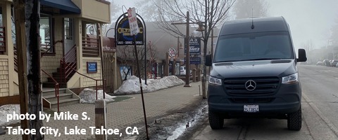
Sprinter Van of the Week!
 Click here for the Sprinter Van map of the world!!!
Local Events
Weekly events: The Kainos Coffee run happens in The Dalles every Tuesday morning at 6am. There are sailboat races at the Hood River Marina every Wednesday evening. Dirty Fingers has a group mountain bike ride (bring lights) Wednesday nights at 5:30pm. Cheno has an outdoor HIIT workout at Griffin House in Hood River at 6pm on Wednesday nights. There is a BLM rally every Tuesday evening at 5:30 at the Salmon Fountain in Hood River, and there’s a White Coats for BLM rally every Thursday at noon at 12th and May in Hood River. Have an awesome day!
