


Thank you for using this forecast. Like it? Find it useful? Support it (and me!) by sending some cash my way. Why? It takes me an hour or two each morning to produce this, and it makes your life better, safer, and more fun. That’s worth something! You can get the email version sent to you. Not $99 a year. Nope. Not $49. Just $12.34 or more gets you a subscription. Click below to give financial support. Thank you!!
Credit card payments click here – – – – – – – – – Click here to use your PayPal
Venmo: @theGorgeismyGym
Snail Mail: PO Box 841, Hood River, Oregon 97031
(note: I am not a non-profit entity. The only way to accept credit cards with a user-defined amount is to use the ‘donate’ button. Thanks for understanding!)
Auto-renewing subscription. New! Awesome!
The Forecast
CoronaChat

| 4a-8a | 8a-12p | 12p-4p | 4p-8p | 8p-4a | |
|---|---|---|---|---|---|
| Thursday 1000′->2500′->1000′ |
 |
|
|
 |
 |
| Friday 1000′->3000′ |
|
 |
|
|
|
| Saturday 2500′->4000′->3000′ |
|
|
|
|
|
Mt. Hood Weather Forecast
All ski areas and Nordic areas are closed at this time. Meadows is done for the season, and Timberline keeps re-evaluating when/if they will be able to open – after all, they are basically open year-round. If you’re thinking of backcountry skiing, please consider the impact you’d have on busy emergency rooms if you get injured, and also think about the impact on Search and Rescue crews.Mountain forecast for Thursday: sunny in the morning, high clouds and a colorful sunset (maybe) in the evening, and clouds overnight. The free air freezing level (FAF) will be 1000-1500′ in the morning, 2500′ in the afternoon, and 1000′ overnight. Wind: W 5-10 early, 15-20 in the afternoon and evening.
Friday starts with clouds and stays that way with light flurries. The snow level will be 1000′ int eh morning, 2000′ in the afternoon, and 3000′ overnight. Just a trace of snow falls during the day. An inch or so falls out of 0.1” water value (WV) overnight. Wind: W 15-20 early, WSW 15 midday, W 15 in the evening, and SW 10-15 overnight.
Saturday brings light snowfall all day. The snow level will be 3000′ early, 4000′ in the afternoon, and 3000′ overnight. About 0.1” WV falls during the day, for an inch of new. Same overnight. Wind: SW 10-15 all day and all night. A couple more inches of snow fall Sunday with the snow level at 3000′. Heavier snowfall moves in for Monday and Tuesday. After that, models disagree.
Gorge Wind Forecast
Park update comes first today: all Oregon and Washington parks are closed at this time. Port of Hood River parks and river access are also closed, although the waterfront path remains open for walking and jogging (which will probably last 24 hours, because it’s impossible to social distance when encountering someone on that path). So why are we having a wind forecast? Because it’s helpful for people other than us wind johnnies!For Thursday, we start with gradients of .06 and lo4 with westerlies at 15-20 from Viento to Swell and 10-15 other locations. High pressure offshore combines with weather moving into Canada later for 12-15 in the west and 22-26 from Rowena to Arlington. River flow is 99,600cfs and temp is 44 degrees.
Friday starts with drizzle in the west and 5-10mph westerlies. East of Hood River, the day starts with W 10-13. Afternoon wind holds in the single digits in the west and picks up to gusty 15-18 from The Dalles to Biggs with 10-13 farther east. Saturday will be light and variable in the morning with W 10-13 in the afternoon. Sunday peaks at gusty 22-25.
COAST, JONES, SAUVIE’S: Detailed forecast is on winter break.
Hood River Weather Forecast
Mostly cloudy sky this morning turns clear and then high overcast late. Temps will be near 40 early and near 50 later. Moderate westerlies. No rainbows. Friday sees on and off light sprinkles or drizzle all day. Temps will be in the upper 30’s early and low 50’s in the afternoon. Light westerlies. 99% chance of rainbows. Saturday sees sprinkles all day. Temps will be near 40 early and in the mid 50’s later. Light west wind. No rainbows. Sunday also looks showery, and heavier rain is forecast for Monday and Tuesday. Looking for a complete Columbia Gorge forecast? Looking for more humor in your weather? Obscenities? You’re looking for my TATAS: Temira’s Awesome Travel Advisory Service on Facebook.Cycling
Most trailheads in Oregon and Washington are currently closed. Staging areas in Post Canyon are now closed, but trails remain open. I suspect and hope that will change soon. Let’s be very clear about what social distancing means in terms of cycling. It means driving to the trailhead with just you or housemates in the car. It means keeping at least six feet of distance between you and any other riders. Social distancing is not these things: 1) parking at a crowded trailhead where you cannot maintain a six foot distances from others. 2) piling a bunch of friends into a car and shuttling Post Canyon or any other trail. 3) having a social chat as you ride doubletrack side-by-side. Getting outside and getting exercise is important for mental health. But you have to do it in a safe that will help us flatten the curve of this virus.Upcoming Events – this section is on vacation due to Covid-19
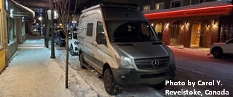
White Sprinter Van of the Week!
Click here for the White Sprinter Van map of the world!!!
Random Morning Thoughts – on break
Click here for the full events calendar.
Have an awesome day!
Temira
