


Once again, we’re not starting off with much wind. As high pressure builds offshore and into the Northwest this afternoon, we will see the westerlies pick up. It’s hard to say what will happen in the Stevenson to Hood River stretch – probably gusty 13-16 or so. East of Mosier, you can expect gusty 23-26 this afternoon, filling in all the way to Arlington. If you would like to get in the river, you may want to do it today; torrential rain over the weekend is going to bring a lot of debris into the Columbia, making for hazardous conditions for the next week or so. Continued after the chart.
| Your favorite beach | Dawn Patrol |
9am- 11:30a |
11:30a- 3pm |
3pm- dusk |
|
|---|---|---|---|---|---|
| Rooster Rock | E 17-20 | E 10-13 | LTW | LTW | |
| Rooster Rock | tanning | season | is | over | |
| Steven’s Locks | LTW | W 10-13 | W 10-13 | W 10-13 | |
| Hatchery/White Salmon Sandbar (minus a few for Hood River) | LTW | W 10-13 | W 10-13 | W 10-13 | |
| Doug’s, Lyle, Rowena | LTV | LTV | 13-16 | 23-26 | |
| Rufus, etc. | LTW | 10-13 | 23-26 | 23-26 | |
| Roosevelt, etc. | LTW | 10-13 | 23-26 | 23-26 | |

|
|||||
Gorge Wind Forecast, continued…
Expect a light wind start to the day tomorrow with periods of gusty 25-29 possible in the afternoon. That wind will be accompanied by heavy rain in the western Gorge; your best bet to find any decent wind will be way out east.
Saturday sees leftover wind from Friday’s warm front and also sees a bump from an approaching cold front. This is not, by any means, an ideal setup. However, it does look like we’ll have gusty 25-29 in the eastern Gorge, especially at Arlington, from early morning through midday.

Donate and keep the forecasts coming
See below for details.
The coast forecast is taking a break this week. We’re going to see system after system swing through, making for unreliable wind. You can read the NWS forecast if you’d like.
Jones n’ Sauvie’s beta test forecast: no wind at either of those beaches for the next three days.
Support the forecast!

Thank you for using this forecast. Does it save you time, gas money, or help you have more fun in your life? Make a donation! Get your forecast here for free or donate and get on the mailing list for year-round wind forecasts and ski season snow forecasts. Just click on my photo to donate via PayPal or credit card. The email isn’t $99/year. Not $50/year. No, just $12.34 or more gets you on the list for 12 months, and sometimes there are cool prizes. Don’t PayPal? Send a check to Temira @ PO Box 841 in Hood River. Thank you for your support, and thank you for trusting my forecast.
Abbreviated Mt. Hood Snow Forecast
We’ll stick with an abbreviated Mt. Hood snow forecast today and move into the full forecast this weekend. I think. The mountains will see showers today with the snow level at 6000′ early and 8000′ later. Expect heavy, heavy rain tomorrow with up to 4” falling on Mt. Hood with the snow level at 6500′ early and 10,000′ in the afternoon.
As the next system moves in on Saturday, we’ll see the snow level at 10,000′ in the morning and 6000′ in the afternoon. Most of the precip on Saturday (about 2.5”) will fall as rain, with a trace of snow possible at the back end of the system.
Sunday looks better for snow. The snow level will fall to 5000′ during the day, and down as low as 4000′ by Monday morning. In that period, we’ll see 1” of water value, for 8-12” of new snow at the base of Meadows and Timberline. We’ll see a few more inches of snow on Monday.
Random Morning Thoughts
It appears summer will end tomorrow. Finally. Decisively. With a bang. Break out your favorite pineapple recipes and prepare to celebrate the first Pineapple Express of the 2015-2016 season.
The great thing about the first torrential downpour happening this early… wait… I need to talk about my drive home last night. Holy ****. I have never seen it rain so hard here. I felt like I was on Maui. It was raining so hard that I was driving 40mph, could barely seen, and was hydroplaning all over the road. It was ridiculous. Anyway, back to the great thing about the first Pineapple Express happening this early…
Some of us still have energy left over from summer. Some of us are excited about the changing seasons. Some of us are excited for winter. We can channel that into excitement about the sheer force of this weekend’s weather. Get excited. Throw a pineapple party (but don’t throw pineapples – that would be wasteful). Incorporate an umbrella into your Halloween costume (looks like the heaviest rain will be 4pm-7pm Saturday). Drink Mai Tais and eat Pineapple Express cake.
And don’t forget to curl up on the couch with a good book for some well-deserverd down time this weekend while the rain falls. Pineapple Express season, everyone! Have an awesome day!
Disclaimer required by my grad school program: I am not your therapist. I am your weather forecaster. Take everything I say with a grain of salt, and consult with your actual therapist about your mental health issues.
Gorge Weather Forecast
It’s an absolutely beautiful morning out there with the golden light of the post-equinox sun shining on the trees and the puddles. If you enjoy dry weather, you will want to get out and make the most of today. Rain will start tomorrow morning and continue all day tomorrow and for much of Saturday. But back to today: temps will be in the mid 50’s early and the mid 60’s this afternoon. Moderate wind. 34% chance of rainbows this morning.
Tomorrow starts off with light rain and progresses to heavy rain as a Pineapple Express pulls into Oregon/Washington station. Temps will be in the low 50’s early and the low 60’s in the afternoon. Light wind early, moderate late. 7% chance of rainbows.
Saturday will likely see a break in the rain in the morning, but a break in the clouds is unlikely. By trick-or-treat time, say late afternoon, we’ll be in a downpour situation. Temps will be in the mid 50’s early and the low 60’s in the afternoon. Moderate wind. Sunday looks mostly cloudy early with heavy rain in the afternoon.
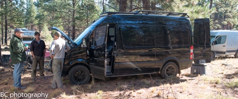
White Sprinter Van of the Day
Road and Mountain Biking
It rained over half an inch in the last 24 hours, which means that Post is a no-go. Whoopdee? Syncline? Hospital? 44 Road? I bet they’re all finally tacky, if not wet! You’ll want to get a ride in today, because this weekend’s Pineapple Express is going to shut stuff down.

The Clymb: free membership. Cheap gear.
Temira approves. Click to join.
Upcoming Events
Hello Thursday. It’s nice to see you too! If you’d like to play this evening, there’s free Tai Chi at Our Savior Church in Bingen at 6:30, free yoga at Yoga Samadhi at 6:30, and free Zumba at the Mt. Hood Community Center at 6:30. Coming up tomorrow, it’s the Kickstand Coffee Run – 4.1 miles that earns you a free cup of coffee and a donut. 7am. Kickstand.
Coming up this weekend, you have the option of a trail work party at Teacup on Saturday at 11am or a trail work party on the Cooks Meadow trail at 9am Sunday (meet at Little John for that one). Saturday is also the Pumpkin Fun Run in Parkdale: 1k, 5k, 10k, proceeds benefit the Parkdale PTO.
Have an awesome day today!
Temira
