


Thank you for using this forecast. Like it? Find it useful? Support it (and me!) by sending some cash my way. What’s it cost to support me and get the email version? Not $99 a year. Nope. Not $49. Just $19.99 or more gets you a year. People are added to this list on Thursday and Sunday. My day job is crisis mental health, and I don’t have time on other days. Thanks for your patience! Click below to contribute. Thank you!!
Click here to use your PayPal
Venmo: @theGorgeismyGym
Snail Mail: PO Box 841, Hood River, Oregon 97031
(note: I am not a non-profit entity. The only way to accept credit cards with a user-defined amount is to use the ‘donate’ button. Thanks for understanding!)
Auto-renewing subscription. New! Awesome!
The Forecast
| 4a-8a | 8a-12p | 12p-4p | 4p-8p | 8p-4a | |
|---|---|---|---|---|---|
| Thursday 0′ |
 |
|
|
|
|
| Friday 0′ |
|
|
|
 |
|
| Saturday 2000′ |
|
|
|
|
|
Mt. Hood Forecast
The lowland and highland forecast looks similar for the next few days: snow, snow and more snow. For Thursday, expect light to moderate snowfall for the 24 hour period. The snow level will initially be about 1500′, but it will drop to 0′. About 0.3” water equivalent is forecast for the day, for 3-4” dry snow. Another 0.3” WE is forecast tonight for 4-5” of champagne powder. Wind: SW 10-15 for the 24 hour period.
Friday sees light snow during the day and moderate to heavy snow (models aren’t quite clear yet) overnight. The snow level will be 0′, and temps will be very, very chilly on the mountain. Expect 0.3” WE during the day, for 2-3” powder. Another 0.6”-0.9” WE is forecast overnight, for 7-11” of the best powder ever. Wind: SW 5-10 all day building to SW 15-25 overnight.
Heavy snowfall continues Saturday with light to moderate snowfall into Sunday morning. The snow level will be 0′ in the morning, 2000′ in the afternoon, and 0′ overnight. Those snow levels, by the way, are just for snow quality reference. In many locations, the snow level will be 0′. Anyway, expect 0.8” WE during the day for 9-11” standard Cascade powder. Another 0.3” WE falls overnight. That will be lighter, so call it 4” of fluffy, dry powder. Wind: SW 15-25 all day becoming W 25 overnight.
The sun may pop out on Sunday, but light snowfall returns in the afternoon. Piles of snow are forecast overnight, but don’t expect powder; 850mb temps climb somewhere around 0C after midnight for denser snow. Westerlies pick up Sunday evening into Monday driving another round of very heavy snow. If the forecast for Sunday night into Tuesday morning holds, that period of time could pick up 3-4 feet of new. That’s on top of the snow Thursday through Saturday! Bundle up and enjoy!
Note on wind speeds. Different wind directions are experienced in different ways on Mt. Hood. For example, west wind at 50mph will hit the slopes and exposed ridges at W 50. SW 50 may hit the ridges at SW 50, but will likely only be SW 20 below tree line. Hence the ranges for wind. Depends where you are on the mountain. Hopefully that helps clarify.
Gorge Wind Forecast
Nuking easterlies continue for the next three days along with a legitimate blizzard warning on Friday night. For Thursday, expect 45-65 all day at Rooster and 35-45 at Stevenson with 20-25 at Viento. Ditto on Friday. Ditto Saturday morning with the wind fading to 35-45 at Rooster in the afternoon and holding at 30-40 at Stevenson. Temps will be sub-freezing for the period.
Coast, Jones, Sauvie’s
As needed until next spring and summer.
Hood River Weather Forecast
snow, snow, and more snow for the next 72 hours! For Thursday, the temp maxes out in the upper 20’s early and drops. Light snow continues all day. See TATAS forecast for the details. Light snowfall all day Friday transitions to heavy snow overnight. Easterlies. Temps near 20 early and in the mid 20’s later. Heavy snow Saturday morning transitions to light snow overnight. Temps: teens early, mid 20’s later. Easterlies. No, no rainbows at all. Snowfall total through Monday morning: 2 feet.
Looking for a complete Columbia Gorge forecast? Looking for more humor in your weather? Obscenities? You’re looking for my TATAS: Temira’s Awesome Travel Advisory Service on Facebook.
Cycling
We are in winter riding season, and the trails are apt to be fragile. If it was below freezing last night and is above freezing now, don’t ride. If it was below freezing last night and it is sunny now, don’t ride unless you are under a tree canopy for the entire ride. Freeze-thaw conditions, when ridden upon, result in permanent trail damage. Please consider doing something else, perhaps riding a gravel road in the trees or going to the mountain. Thank you!
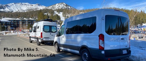
Sprinter Van of the Week!
 Click here for the Sprinter Van map of the world!!!
Local Events
Weekly events: The Kainos Coffee run happens in The Dalles every Tuesday morning at 6am. There are sailboat races at the Hood River Marina every Wednesday evening. Dirty Fingers has a group mountain bike ride (bring lights) Wednesday nights at 5:30pm. Cheno has an outdoor HIIT workout at Griffin House in Hood River at 6pm on Wednesday nights. There is a BLM rally every Tuesday evening at 5:30 at the Salmon Fountain in Hood River, and there’s a White Coats for BLM rally every Thursday at noon at 12th and May in Hood River. Have an awesome day!
