MT. HOOD SNOW FORECAST

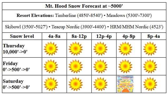
Hey skiers and snowboarders. Dry weather continues for the slopes, but there’s a twist: instead of spring skiing, we’ll have cold conditions Friday and Saturday. Temps at elevation start to warm on Sunday, and we’ll be back to spring skiing by Monday afternoon. Groomed snow right now is a mix of frozen granular and loose granular with hardpack in shady areas. If you don’t skate ski yet, this long, dry stretch is a good incentive to take it up – that’s when skating turns awesome. It complements lift-serve riding perfectly!
For today, Thursday, we have a dry weather system swinging in from the NNW. Most noticeable features of this: increasing wind and dropping temps. No precipitation is expected on the mountain. The free air freezing level starts around 10,000′ with temps in the mid 40s at 5000′. By this afternoon, the free air freezing level will be below 3000′, and it will fall nearly to 0′ tonight. Bring some extra layers if you’re headed up, and expect the snow to refreeze this afternoon as temps drop. Wind: W 25-30 this morning turning to NW 30-35 (could be a little problematic for one or two lifts) this afternoon and fading to NE 5-10 tonight. Sky coverage: clear and sunny all day.
Liking this forecast?
Friday will be sunny. The free air freezing level (FAF) starts around 0′ and doesn’t rise much. Temps at 5000′ max out in the low to mid 20s. Wind: NE 5-10 all day turning to E 15mph overnight. Saturday will be sunny and cold to start with the free air freezing level at 0′. That rises to 500′ or so in the afternoon, but warmer air on the west side could cause pockets of warm air and cold air to pop up randomly around the mountain. Wind: E 15 in the morning, variable to 10 depending on elevation in the afternoon, and N 10 overnight.
Sunday will also be sunny, but we’ll start to see a better chance of temps randomly popping above freezing as the warm west side air battles the cool east side air for dominance. FAF: 0′ with temps rising into the low 30s. Wind: N 10 all day becoming light/variable overnight. Warmer, sunny weather is forecast on Monday. Tuesday may swing a weak system through and briefly drop temps, but warm, sunny weather looks to continue Wednesday and Thursday and potentially beyond. Next chance of precip is Friday, but ensembles are not all-in on this by any means. Toss your sunscreen in your bag and head for sunny slopes. See you up there!
Was that helpful? I knew it was! Guess what? All of this crucial work – from your personal wind and snow reports to the invaluable TATAS updates – is made possible by my relentless efforts. Maintaining this labor of love isn’t easy. Each daily forecast takes hours. Website hosting, weather model access, and back-end admin work takes time and money. That’s where you come in.
YOUR CONTRIBUTION MAKES A DIFFERENCE
- SUPPORT ACCURATE, HYPER-LOCAL WEATHER FORECASTING
- ENABLE ACCESS FOR ALL, EVEN THOSE WITH LESS MEANS
- SUPPORT A COOL HUMAN WHO WORKS HARD SO YOU CAN PLAY
Take a moment to click one of the buttons below. Donate $19.99 or more (how much does this forecast enhance your life?) and get the email in your inbox. Whether it’s a renewing subscription (auto-renew) or a one-time donation, every contribution makes a real difference. Help me keep this labor of love alive, so we can all continue playing, commuting, and living in the Gorge with peace of mind and the best weather forecasts possible. Thank you!


Hood River, Oregon 97031


GORGE WIND FORECAST

Hi friends! West wind is on tap today, and a nearly calm day sets you up for rest tomorrow. Easterlies return on Saturday and stick around for the long term. Today, Thursday, starts with a flat gradient from PDX-DLS. As a cold front approaches from the NNW and high pressure builds offshore, west wind arrives. Models are indecisive about the location of the strongest wind – somewhere between Viento and Doug’s. I’m going with Viento to the Hatch starting early to mid-morning with 22-25 or a touch more. From Hood River to Mosier, you should find gusty 16-20. Less from Lyle to Doug’s, and 18-22 from Avery to Rufus. Clouds push past the Hatch (probably) late morning or early afternoon and knock the wind down to gusty 18-22. This is where things get unclear: the high-res model takes the wind to the mid-20s from Lyle to Avery, but the lower-res model (which tends to be quite accurate) doesn’t like that idea. For best Hatch results, get it in the window between the Nothing and the return of a deck of low clouds. Areas east of Rufus look light today. Stevenson should make it to 16-20. Viento, as always in these frontally-driven system, will over-perform. River flow over the last 24 hours was 90-158kcfs, river temp is 42.80F, and high temp forecast is somewhere in the mid 40s with clouds, then sun, then clouds at the Hatch.
Friday starts calm. Easterlies pick up to 15mph at both Stevenson and Iwash (Rooster) Rock in the afternoon. High temp: low 40s with sunshine. High pressure (and cold, dry air) settles in the desert for Saturday. Easterlies will be 40mph at Iwash. Stevenson starts with 25mph, rises to 30mph, and drops to 25mph in the afternoon. High temp: upper 30s and sunny. Easterlies at 30+ continue Sunday, Monday, and Thursday with lighter wind on Tuesday and Wednesday. Probably… you know how these things go. There’s a slight chance of a period of west wind on Tuesday afternoon. Have a great day on the water today!
BARE BONES HOOD RIVER WEATHER FORECAST
Nothing to start, clear sky in the morning, low clouds with sunbreaks in the afternoon. Temps start in the mid 30s and rise to the mid 40s. Moderate westerlies. 0.5% chance of rainbows. Friday will be cloudy with partial Nothing then clear. Temps start in the upper 20s to low 30s and rise to the low 40s. Calm wind. No rainbows. Saturday will be partly Nothing plus partly high clouds in the morning and mostly clear in the afternoon. Temps start in the upper 20s and rise to the upper 30s. Light easterlies. No rainbows.
TEMIRA’S AWESOME TRAVEL ADVISORY SERVICE (DETAILED GORGE WEATHER FORECAST)

Good morning, neighbors. “Not much to talk about” weather continues… That means I’ll just find some random stuff to talk about. Like this: As we progress into the weekend, the air mass turns increasingly cold and increasingly dry. This puts each and every one of you at risk for static electricity shocks. Consider yourself warned.
TODAY (THURSDAY)
Thursday swings a dry, cold weather system through. This will break up the inversion (both the Nothing cloud and the temp inversion), clear the sky, and then drag some clouds in from west to east, probably as far east as Mosier. However… NO PRECIP FOR YOU! Colder air arrives with this system; the freezing level will fall to 2000′ or so this afternoon and down to the river tonight. We should see temps peak in the mid 40s before they drop this afternoon. During the day today, we’ll see westerlies pick up to 20-30mph from Stevenson to Hood River with 15-25mph from Lyle to Bob’s Texas T-Bone. Speaking of, who is Bob?
(I asked AI, and here was the response: “I want to be careful here – while I can tell you about Bob’s Texas T-Bone restaurant in Rufus, Oregon, since this is asking about a very specific individual (Bob) at what seems to be a local restaurant, I may not have completely accurate information and could hallucinate details. I’d encourage you to verify any specifics about the owner with the restaurant directly or through local sources.”)
I am therefore consulting with YOU.
Speaking of local-only info… Some scammer has been calling people and identifying himself as “Erin Mason with the Hood River County Sheriff’s Office”. Locals will understand why this is funny.
FRIDAY
Friday starts chilly as 850mb (~5000′) temps fall to -5C and the wind turns calm. Enough moisture will be present to fire up a partial Nothing just along the river, and low clouds will linger west of Mosier. By afternoon, we should be seeing sun, although a few scattered spots of Nothing clouds are likely to linger. High temp: upper 30s.
SATURDAY
Easterlies return Friday night. They pull in colder, less moist air from the east side. This takes Saturday morning temps down into the 20s or lower (teens for Glenwood, for sure). A mini Nothing is likely to form just along the river, but it should burn off quickly.. Easterlies will be 40mph near Iwash (cock) Rock all day and 25-30mph near Stevenson. Highs make it into the upper 30s.
ETC
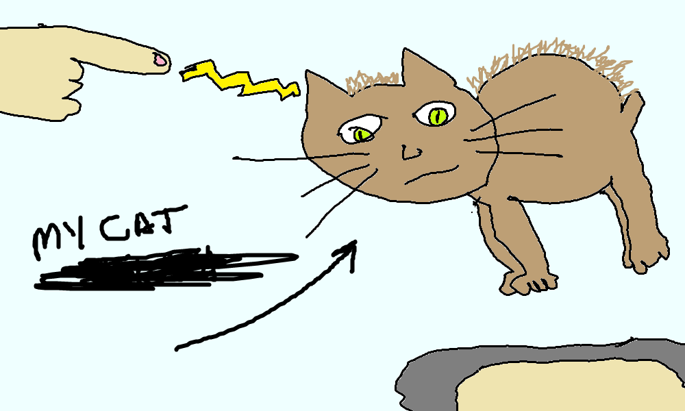
Saturday and Sunday and Monday should be cold enough, dry enough, and weekendy enough to have perfectly clear sky for that entire 72 hour period. While a temperature inversion will return, dewpoints look low enough to preclude the formation of the Nothing. As I warned you at the top of this forecast, dewpoints will be low enough that static electricity shocks will be common. Easiest way to see if it’s that dry: pet your pet. If their hair stands on end, you know it’s dry out. Want to get the biggest shocks possible? Consult the triboelectric series for advice. Safe travels. -TATAS
HEY! DON’T STOP READING! Is this community-focused forecast helpful to you? It sure it! It takes me a couple hours a day to write. Please jump in a contribute to keep it going. Venmo: @thegorgeismygym PayPal: twomirrors@gmail.com USPS: Temira / PO Box 841 / Hood River, Oregon 97031 You can test out the forecast subscription for a few days for free by clicking this link: https://subscribepage.io/YhevGc


