

Today’s Mt. Hood Weather Forecast
| Snow level | 4a-8a | 8a-12p | 12p-4p | 4p-8p | 8p-4a |
|---|---|---|---|---|---|
| Thursday 3500′->4500′ |
 |
 |
|
|
 |
| Friday 4500′->8500′ |
|
 |
 |
 |
|
| Saturday 8500′->7500′->8000′ |
|
|
|
 |
 |
Mt. Hood Snow Forecast
Hi skiers, snowboarders, and Nordic folks. Temps and precip types bounced around quite a bit on Wednesday; a fair bit of rain fell on the slopes. We’ll be back to snow on Thursday, but there’s some range in the snow amount forecast. A brief period of snow Friday morning gives away to moderate to heavy rain through Sunday. That’s followed by very warm weather (temps push 50F as 850mb temps rise to +10C) on the slopes next week. After that… models suggest colder weather will return (850mb temps dropping below 0C) at the end of next week. In the meantime…
Temps drop on the slopes tonight, and 1-2” fresh, dense snow falls at 5000′. The snow level will fall to 3500′ by Thursday morning. Wind overnight: SW 15-25. Thursday will be snowy all day into the evening and will turn dry overnight. The snow level will be around 3500′ all day and will rise to 4000-4500′ after midnight under high clouds. About 0.6” to 1.0” water equivalent (WE) is forecast during the snowy period Thursday (until 7pm ish). Call it 6-10” average-density snow. Wind will be WSW 15-20 all day and into the evening before swinging to SSW 10-20 after midnight.
Friday starts out high overcast. Very light snowfall starts an hour or two after sunrise. By afternoon, the snow will switch to rain, and by sunset, the rain will be heavy. The snow level will be 4000-4500′ early, 6500′ int eh afternoon, and 8500′ overnight. Models have about 0.2” WE prior to 4pm, for an inch of snow followed by rain. Overnight, models drag in around 1.6” rain. Temps will be +5C, almost 40F, on the slopes. Wind: SSW 10-20 in the morning becomes SW 10-20 in the afternoon and SW 15-30 overnight.
Saturday looks rainy and warm – as of today, an inch of rain is forecast. Another round of moderate rain is forecast Sunday daytime. Total precip by Monday, a warm, sunny Monday, is approximately 4”. At this point, let’s just be glad the wind is SW with this system rather than NW or W; that should limit rainfall to a not-great, but not-awful amount. Hopefully. We’ll see how that shakes out in the next few model runs. As of right now, Monday, Tuesday and Wednesday look dry and warm on the slopes. Both the GFS and the ECMWF ensembles are all in on colder weather returning at the end of next week. Let’s leave it there for now. Happy turns to you! Enjoy the snow!
A poem:
Was that forecast helpful?
Did it save you time or gas money?
Did it make your life more fun?
Then please make a contribution.
Writing this takes me an hour or two a day.
Without your support, I can’t keep it up.
Keep the forecast going.
Subscribe or donate.
And share my forecast with your friends!
 |
 |
 |
|
Not ready to subscribe? No problem – please share this forecast with all your friends too!
Or try a month for free!

Gorge Wind Forecast
Hi friends! Still not much happening in the wind world. Thursday starts with E 15 near Stevenson and light/variable wind near Iwash (Rooster) Rock. The wind turns calm in the afternoon. River flow Wednesday was 76-126kcfs, river temp is 37.22F, and high temp forecast is in the low 40’s with rain. Friday brings easterlies at 25-30 near Stevenson. Near Iwash, the wind starts at 25-30 and rises to 40ish. Expect pouring rain west of Hood River all day with high temps near 40. Saturday starts with 30-35 at Iwash and 20-25 near Stevenson. The wind drops to 15ish in the afternoon. High temp: low 40’s with rain until early afternoon. Sunday: light easterlies. No sign of westerlies in the next week or so.
 |
|
Jones, Sauvie’s, Coast Forecast – On vacation ‘til summer unless otherwise noted
Very basic Hood River weather forecast. Don’t plan your life around this. You really should read TATAS
Dry weather Wednesday night gives way to steady rain for the daylight hours on Thursday. Temps will be in the mid 30’s early and low 40’s later. Calm wind. No rainbows. Friday will be dry early and then rainy. Temps start in the mid 30’s and rise to 40 or so. Easterlies. No rainbows. Saturday will be rainy through early afternoon then dry for a few hours, then rainy again. Temps start in the mid-upper 30’s and rise to the mid 40’s. Easterlies. No rainbows. Read Temira’s Awesome Travel Advisory Service on Facebook for a detailed forecast that may help you plan your day.
Local-ish Events
Please let me know of outdoor-related local-ish events. If you don’t tell me, I don’t know!
Amayah’s Indian Cafe (Biggs) offers a free meal every first Thursday from 1-4pm. Teacup Nordic’s Apres-ski fundraiser is January 27th at The Ruins.
Regular weekly events:. NK Studio’s by-donation Tuesday morning yoga class is back. Ferment’s Tuesday night 4-mile walk/run is at 6pm. There’s meditation with monks at 5:15pm (an hour) and 6:30pm (30 minutes plus a talk) at Yoga Samadhi in White Salmon. The Tri Club is done for the season. At 7:15am on Wednesdays, there’s a run from the White Salmon Bakery. At 7am on Friday morning, there’s a run from Pine Street Bakery. On Fridays at 2:30pm, there’s a free meditation and stretching class at Yoga Samadhi. On Saturday at 9am, there’s a by-donation outdoor group fitness on the 2rd floor deck about Ferment Brewing.
Cycling
Regarding the trails in general: don’t ride in the mud. You’ll damage the trails. Don’t ride trails if it was below freezing the previous night and is above freezing when you want to ride. Ride gravel. Ride your trainer. Build trails. There are trail builders seeking extra hands on seven additional miles of trail on Whoopdee. Contact HRATS for more information. If you’re parking at Post Canyon, you will need a parking pass. Those can be purchased at many local shops or online.
Sprinter Van of the Week!
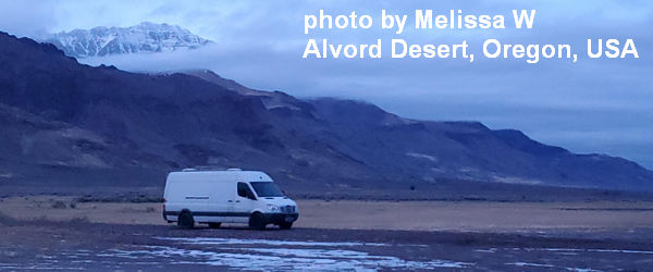 Click here for the Sprinter Van map of the world!!!
Have an awesome day!
PREVIOUS POSTS
- Sunday Mt Hood snow forecast & Gorge wind n’ weather: warm and sunny for all!
- Saturday Mt Hood snow forecast & Gorge wind n’ weather: sun and warm weather at all elevations!
- Friday Mt Hood snow forecast & Gorge wind n’ weather: warm and sunny for all. No snow in the forecast. East wind for the weekend.
- Thursday Mt Hood snow forecast & Gorge wind n’ weather: fresh snow for Mt Hood and nuking wind for the Gorge. TWO SPORT DAY!
- Wednesday Mt Hood snow forecast & Gorge wind n’ weather: something for everyone here – snow, wind, warm weather…

Have an awesome day.
Love, Temira