

| Snow level | 4a-8a | 8a-12p | 12p-4p | 4p-8p | 8p-4a |
|---|---|---|---|---|---|
| Thursday 2500′->3500′->1500′ |
 |
 |
|
 |
|
| Friday 1500′->3500′->1000′ |
 |
|
|
|
|
| Saturday 1000′->3000′->2000′ |
|
 |
|
|
|
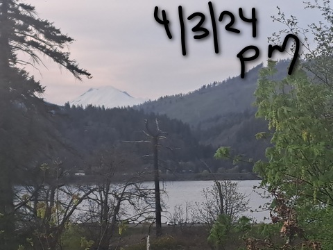
Mt. Hood Snow Forecast
On-and-off light snowfall continues through Sunday. Models still have us getting up to a foot of snow total by the end of the weekend. Monday will probably be dry, but models are split about 50/50 on whether we get additional moisture Tuesday into Wednesday next week. After that, things (probably) turn dry and somewhat warmer for at least a few days. Probably.
Wednesday night keeps high clouds over Mt. Hood. The free air freezing level will be 3000′ in the evening and 2500′ after midnight. Thursday starts cloudy with light snowfall. The snow hangs on until later afternoon and turns to flurries (or no snow at all) overnight. The snow level will be 2500′ in the morning, 3500′ in the afternoon, and 1500′ after midnight. About 0.2” to 0.5” water equivalent (WE) is forecast during the day for 2-5” new. Overnight: just a trace. Wind: NE 5-10 in the morning, WNW 20-25 in the afternoon, and NW 25-30 after midnight.
Friday starts clear and colder. High clouds move in during the afternoon. Temps at 5000′ start in the low 20’s and rise to 30 or so. The free air freezing level will be 1000′ early, 3500′ in the afternoon, and 1000′ overnight. No precip. Wind: NW 30-35 in the morning, W 35 in the afternoon and overnight.
Light to moderate snowfall is forecast Saturday into Sunday. The snow level starts around 1000-1500′ on Saturday, rises to 3000′ in the afternoon, and drops to 2000′ overnight. Modes call for about 0.5” to 0.8” WE for the 24 hour period. That’s split equally between day and night for 5-8” new snow. Wind: W 35 in the morning, W 25 in the afternoon, and W 20 overnight. Sunday probably starts with flurries and probably turns clear with the freezing level maxing out around 3500′. Enjoy!
A poem:
Was that forecast helpful?
Did it save you time or gas money?
Did it make your life more fun?
Then please make a contribution.
Writing this takes me an hour or two a day.
Without your support, I can’t keep it up.
Keep the forecast going.
Subscribe or donate.
And share my forecast with your friends!
 |
 |
 |
|
Not ready to subscribe? No problem – please share this forecast with all your friends too!
Or try a month for free!

Gorge Wind Forecast
Hi friends! Westerlies continue for several days. Models like the idea of strong wind somewhere in the Friday-Saturday timeframe, hopefully not overnight! Whether we get a big day or not, we should see westerlies of some sort for the next four days.
Thursday has us in a weird position with a low hanging out and sending wraparound rain into the east side. Why do we care? Because that’ll drive westerlies but also impact wind quality. Expect 19-22 from The Dalles to Arlington (with rain) early in the morning with 7-10 from Stevenson to The Dalles. The eastern Gorge should shut down pretty quickly. The stretch from Stevenson to The Dalles rises to 13-16 from mid-morning on under mostly cloudy sky. River flow Thursday was 101-151kcfs, river temp is 49.28F, and high temp forecast is 49F.
Friday;s setup involves a trough inland and a broad area of high pressure off the coast. While there will be bits of energy moving through, it’s a decent setup. The day starts with 14-17 from Viento to Lyle with 18-22 from Rowena to Rufus and 10-13 farther east. As the system moves inland, areas between Lyle and Arlington rise to 27-31. There should be a few hours of 21-24 from Stevenson to Lyle as well before the west side drops to 11-14 in the afternoon. High temp: 49F for Hood River and 50F for Arlington. Areas west of The Dalles will languish with 11-14 on Sunday. Between Avery and Threemile, you’ll find 24-28 with a chance at 27-31 from Rufus to Arlington. High temp: 51F.
Even more extended forecast: 14-17 Sunday all through the Gorge and light/variable wind Monday.
 |
|
Jones, Sauvie’s, Coast Forecast – On vacation ‘til summer unless otherwise noted
Very basic Hood River weather forecast. Don’t plan your life around this. You really should read TATAS
Thursday looks cloudy in the morning and mostly cloudy later. Temps start in the upper 30s and rise to the upper 40s. Moderate westerlies. 1% chance of rainbows. Friday will be cloudy. Temps start in the upper 30s and rise to the upper 40s. Moderately strong westerlies. 1% chance of rainbows. Saturday starts partly cloudy and turns mostly cloudy and maybe adds a little drizzle overnight. Temps start near 40 and rise to 50. Light westerlies. 11% chance of rainbows. Read Temira’s Awesome Travel Advisory Service on Facebook for a detailed forecast that may help you plan your day.
Local-ish Events
Please let me know of outdoor-related local-ish events. If you don’t tell me, I don’t know!
Indian Bowl and Roll (the baby sis to Amayah’s) opens April 5th in Hood Rivert. Fuchsia Saturday is April 13th at Fred Meyer. The White Salmon – Bingen community-wide yard sale is April 19th and 20th. On April 16th at 6pm, Master Gardener Denis Carlson gives a talk at the Hood River Library on controlling rodents in your garden.
Regular weekly events:. NK Studio’s by-donation Tuesday morning yoga class is back. Ferment’s Tuesday night 4-mile walk/run is at 6pm. There’s meditation with monks at 5:15pm (an hour) and 6:30pm (30 minutes plus a talk) at Yoga Samadhi in White Salmon. The Tri Club is done for the season. At 7:15am on Wednesdays, there’s a run from the White Salmon Bakery. At 7am on Friday morning, there’s a run from Pine Street Bakery. On Fridays at 2:30pm, there’s a free meditation and stretching class at Yoga Samadhi. On Saturday at 9am, there’s a by-donation outdoor group fitness on the 2rd floor deck about Ferment Brewing.
Cycling
Definitely got a Tack Alert going on out there right now – lots of good dirt. Some areas of Post are still muddy (shady, cool areas), so consider choosing a different spot to ride. You’ll have Post all summer long! Sisterwives and Kleeway in Post Canyon are currently closed for rebuilding. It’s trailbuilding season. Get on the HRATS mailing list if you’d like to help out. If you’re parking at Post Canyon, you will need a parking pass. Those can be purchased at many local shops or online.
Sprinter Van of the Week!
 Click here for the Sprinter Van map of the world!!!
Have an awesome day!
PREVIOUS POSTS
- Thursday (oops, I said Wednesday earlier) Gorge wind forecast and TATAS weather: breezy and 80-85 through Saturday. Then hotter. Then cooler. =)
- Wednesday Gorge wind forecast and TATAS weather: nuking today. Windy with pleasant temps for the next few days.
- Tuesday Gorge wind forecast and TATAS weather: breezy and warm all week. No rain.
- Monday gorge wind and weather forecast: HOT. Westerlies return late today with a nuker planned for Wednesday.
- Sunday Gorge wind forecast & TATAS weather: calm and hot for a couple days.

Have an awesome day.
Love, Temira