

GORGE WIND FORECAST
today’s gorge wind forecast
Hi friends! Westerlies continue… Despite the incoming heat wave, models are hopeful that we’ll hang on to west wind this hot weekend. It won’t be nuking, but it doesn’t look like it’ll be glassy or easterly either unless there’s a drastic change in the setup. When the heat wave breaks, it’s almost certainly going to break in the right way for us, also known as “The Cooldown You Were Looking For”. Gorge wind forecast for the middle of next week: very, very windy, potentially even nuking!
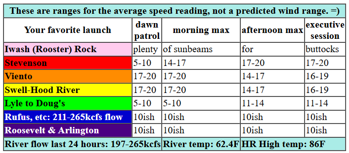
Before we all get too excited about that, let’s look at today, Thursday. Pressures started at 30.09/30.01/30.00 with westerlies in the 16-19 range from Viento to Swell. We’ll have 17-20ish for a few hours this morning from Viento to Hood River with slowly building wind at Stevenson and 13-16 at Mosier. With the metro area forecast to clear quickly, we’ll likely see the wind drop to 14-17 at Swell and Hood River midday before returning at 16-19 (Stevenson to Mosier) this evening. River flow over the last 24 hours was 197-265kcfs (211-265 at Rufus), river temp is 62.4F, and high temp forecast is 86F.

tomorrow’s gorge wind forecast
With better thermal support in the desert, Friday’s gradients should be stronger. Dawn Patrol looks like 17-20 from Viento to Swell. The wind builds to 20-23 from Stevenson to Mosier late morning. As the desert heating really kicks in mid-afternoon, westerlies rise to 24-27 from Mosier to Rufus with 19-22 from Arlington to (eventually) Threemile. Given accompanying heat in the metro area, there’s a good chance the wind will falter between Swell and Hood River early afternoon and return for the Executive Session (after 5pm). High temp: 86F for Hood River, 89F for Arlington, and 94F (there’s the kicker) at Pasco, WA. Sky: high overcast.
extended Gorge wind forecast
Hotter weather is forecast all across the land on Saturday. This squashes, but does not completely crush gradients; the metro area is forecast to be 89 degrees, while the Pasco forecast is 96 degrees. This gives us 17-20 to start, 14-17 for the midday lull, and 17-20 for the Executive Session. Wind will be focused on the Stevenson-Mosier zone. High temp for Hood River: 92F under clear sky. Even hotter weather is in the cards for Sunday, but guess what? 94 degrees in the metro area and 102 degrees in Pasco gives us continued onshore flow: for now, 18-21 is the call, subject to change.
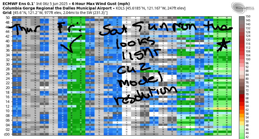
Looking beyond the weekend… high temps start to fall on Monday, and they plummet below normal for the middle of next week. Models suggest reinforcing cold air (and clouds!) for the metro area with warmth in the desert. West wind is forecast all week. Know what we call this? CLASSIC GORGE! Ensembles are adamant we’ll see very strong westerlies on Tuesday, Wednesday, and Thursday (at a minimum). As we all know, forecasting this far out can be a risky proposition, but (for now) all the signs are there for a stretch of nuking wind. As we get closer, we can talk about where you might find less wind if that’s what you need for your sport. Have a great day, everyone! I’ll see you on the Nch’i Wana!
Was that helpful? I knew it was! Guess what? All of this crucial work – from your personal wind and snow reports to the invaluable TATAS updates – is made possible by my relentless efforts. Maintaining this labor of love isn’t easy. Each daily forecast takes hours. Website hosting, weather model access, and back-end admin work takes time and money. That’s where you come in.
YOUR CONTRIBUTION MAKES A DIFFERENCE
- SUPPORT ACCURATE, HYPER-LOCAL WEATHER FORECASTING
- ENABLE ACCESS FOR ALL, EVEN THOSE WITH LESS MEANS
- SUPPORT A COOL HUMAN WHO WORKS HARD SO YOU CAN PLAY
Take a moment to click one of the buttons below. Donate $19.99 or more (how much does this forecast enhance your life?) and get the email in your inbox. Whether it’s a renewing subscription (auto-renew) or a one-time donation, every contribution makes a real difference. Help me keep this labor of love alive, so we can all continue playing, commuting, and living in the Gorge with peace of mind and the best weather forecasts possible. Thank you!


Hood River, Oregon 97031


JONES BEACH, SAUVIE ISLAND, & COAST FORECAST
Wind northerly unless otherwise indicated. For coast, it’s North/Central/South with the “central” at approximately Florence. Swell forecast from NWS for central coast. Jones: westerly unless otherwise stated. Sauvie Island: northerly unless otherwise stated. Thursday: 20/15-20/30-35, W swell 3′ at 11 seconds. Friday: 20/20-25/30-35, NW 6′ @ 9. Saturday: 10-15/15/1520, NW 6′ @ 10. Jones Thursday: 19-22. Friday: 23-26. Saturday: 13-16. Sauvie Island Thursday: 16-19. Friday: 16-19. Saturday: 11-14.
BARE BONES HOOD RIVER WEATHER FORECAST
Clear sky this morning stays that way. Temps start in the upper 50s and rise to the mid 80s. Moderate westerlies. No rainbows. Friday bring high clouds until evening when the sky will clear. Temps start in the upper 50s and rise to the mid 80s. Moderately strong westerlies. No rainbows. Saturday will be clear. Temps start in the upper 50s and rise to the low 90s. Moderate westerlies. No rainbows.
TEMIRA’S AWESOME TRAVEL ADVISORY SERVICE
HYPERLOCAL WEATHER FORECAST FOR THE COLUMBIA GORGE
THE DALLES, HOOD RIVER, WHITE SALMON, TROUT LAKE, STEVENSON, CASCADE LOCKS, PARKDALE, ODELL, HUSUM, BZ, MILL A, WILLARD, GOLDENDALE, RUFUS, ARLINGTON, boardman
Good morning, neighbors! Dry, breezy weather is in the cards for, oh, the entire summer as best I can tell looking at the ensembles for the next two weeks. Something more exciting this way comes for the weekend in the form of our first heat wave of the season. Temps in The Dalles head for the mid 90s for Sunday and potentially Monday, and the far east desert rises above 100, causing the watermelon vines to grow like a turned-on pee-pee. And that’ll be that – we’ll cool off quickly next week.
Today’s Gorge weather forecast and Glenwood’s start
It’s Thursday today. Just mentioning it for those of you who, like me, work every single day and get confused. Low clouds west of Underwood this morning give way to clear sky this afternoon. Everywhere else: sunny all day. Westerlies will be in the 15-20mph range all day west of Mosier with lighter wind to the east. Aw poop, I forgot to mention Glenwood. 43 degrees was the overnight low, but it’s already 48 degrees (at 7:22am), and everyone is ditching their puffy coats and soaking up the morning sun in T-shirts that say, “I love Glenwood, where the cold persists year-round!”
Friday’s gorge weather forecast
Slightly different weather is forecast for Friday: we’ll all have some high clouds until early evening, and then we’ll all have clear sky. With this setup, a fabulous sunrise is possible. Sunrise is 5:17am – you must be absolutely fabulous if you can manage to get up that early to appreciate the sunrise. I, being fabulous, shall get up (with the assistance of an alarm). For the rest of Friday… temps rise to the mid 80s. West wind starts at 15-20mph from Viento to Hood River and rises to 25-30mph from Stevenson to Rufus with 20-25mph from the John Day dam to Blalock Canyon to the Arlington Triangle and all the way out to Bored-Men.
extended gorge weather forecast
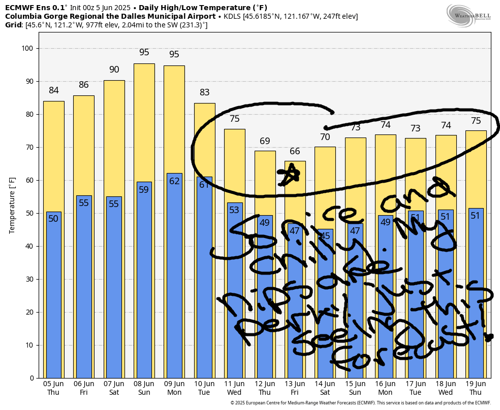
Warmer weather, low 90s, is forecast Saturday with westerlies at 15-20mph west of The Dalles. Sunday: slightly warmer, but otherwise probably the same. We start cooling off (but not much) on Monday, which leads to a little stronger wind. Blasting wind is in the forecast starting Tuesday as temps fall 5-10 degrees each day. If this keeps up, we’ll eventually be at absolute zero, and then we’ll all levitate. Of course, we’ll be frozen into blocks of ice, so we won’t be able to appreciate our newfound ability. If the Euro is right, highs next Friday, the 13th(!!) will be in the mid 60s, almost ten degrees below normal. That’s pretty rad. I like cool days and I cannot lie. All this wind and all this dry weather means that fire season should be on your radar: get the zone around your place cleaned up. Remove “burn pile”, “mowing”, and “week whacking” from the calendar next week. Check the chains on your trailer. Let’s not burn up the Gorge next week, okay? Safe travels. -TATAS
HEY! DON’T STOP READING! Is this community-focused forecast helpful to you? It sure is! It takes me a couple hours a day to write. Please join your friends and neighbors in contributing to keep it going. Venmo: @thegorgeismygym PayPal: twomirrors@gmail.com USPS: Temira / PO Box 841 / Hood River, Oregon 97031 You can test out the forecast subscription for a few days for free by signing up below. Easy! Do it!
