

Support it with a contribution!

Thank you for using this forecast. Writing it takes 60-120 minutes a day; I can only keep it going with your generous financial support. Make a contribution or subscribe and get it in your inbox with bonus material. What’s that cost? Not $99 a year. Nope. Not $49. Contribute $19.99 or more, and you’re on the list for a year. People are added to this list on Thursday and Sunday. Thanks for your patience! Click below to contribute and keep the forecast going for everyone, nearly every day.
Click here to use your PayPal
Venmo: @theGorgeismyGym
Snail Mail: Temira Lital, PO Box 841, Hood River, Oregon 97031
(note: I am not a non-profit entity. The only way to accept credit cards with a user-defined amount is to use the ‘donate’ button. Thanks for understanding!)
Auto-renewing subscription. New! Awesome!
The Forecast
| 4a-8a | 8a-12p | 12p-4p | 4p-8p | 8p-4a | |
|---|---|---|---|---|---|
| Thursday 10000′->8000′ |
 |
|
 |
|
|
| Friday 8000′->3500′ |
|
|
|
|
|
| Saturday 3500′ |
 |
|
 |
|
|
Mt. Hood Weather Forecast
Yesterday was the last of the uber-warm weather we’ll see for a good long while. The Dalles topped out at 70 yesterday, and Meadows max temp was 51. It’s all downhill temp wise from here, and the snow forecast is looking up in the extended forecast; generally speaking, cooler and wetter is coming. Our morning probability forecast for today… (GFS/ECMWF)… chance of 24” total snow by 12/16: 35%/85%. 18”: 55%/100%. 12”: 85%/100%. And… Meadows is now paying $17/hr starting wage for lift operators. Timberline is paying $13.50 starting for lifties.
For Thursday, though, it’ll still be warm. The mountain will be clear early, high overcast this afternoon, and clear again overnight. A few scattered sprinkles could drop in the morning. The snow level will be 10,000′ this morning, 7500′ this afternoon, and the free air freezing level will be 8000′ tonight. Wind: W 25 this morning, W 10 this afternoon, and variable to 10mph tonight.
Friday looks clear and sunny all day. The free air freezing level will be 8000′ all day. Colder air and precip moves in after midnight for an effective snow level of 3500′. Wind: variable to 10 early, SW 10-20 in the afternoon, and WSW 25-40 after midnight.
A bit of snow is forecast on Saturday starting around 4am. The snow level will be 3500′ early, 4000′ in the afternoon, and 2500′ after midnight. Just 0.2” water equivalent (WE) falls during the day. The sky will clear overnight. Wind: WSW 25-40 in the morning, NW 10-15 in the afternoon, and variable to 5 after midnight. Sunday starts clear and ends cloudy. Precip moves in after midnight, but the details are far from clear. Neither the temps nor the amount of precip are yet decided. We’ll wait and see, as we often do. Things are looking better – keep your patience online. You’ll be shredding soon.
Gorge Wind Forecast
Today’s your best chance for westerlies out of the next three. A cold front swings through this morning and high pressure builds behind. The coast will be windy too (northerly). Here, you’ll find 17-21 from Viento to Rufus this morning with gusty 15-18 at Stevenson. The wind will probably drop to 14-17 (Stevenson to Hood River) midday with 7-10 east of there. River flow is 142kcfs, river temp is 50F, and high temp forecast is 55F.
Friday starts with easterlies at 25-30 at Rooster and Stevenson with 20ish at Viento. The wind drops about 5mph after noon and turns gusty. High temp: 49F. Saturday starts with gusty 13-16 all through the Gorge in the morning. This starts to fade midday and becomes light and variable in the afternoon. High temp: 49F. Sunday’s forecast is currently E 20-30, but that could change – lots of uncertainty in the forecast right now.
Coast, Jones, Coast
Done until spring, unless there’s an obvious Coast or Sauvie’s or Jones day.
Hood River Weather Forecast
Mostly cloudy sky this morning might add a few sprinkles. The weather will be dry and high overcast / partly cloudy later. Temps will be in the mid 50’s all day. Moderate westerlies. 5% chance of rainbows. Friday starts with Nothing and ends sunny. Temps will be in the mid 30’s early and upper 40’s later. Easterlies. No rainbows. Saturday starts with drizzle and ends partly cloudy. Temps will be in the mid 30’s early and upper 40’s later. Light westerlies in the morning become light and variable. 97.5% chance of rainbows.
Looking for a complete Columbia Gorge forecast? Looking for more humor in your weather? Obscenities? You’re looking for my TATAS: Temira’s Awesome Travel Advisory Service on Facebook.
Cycling
FREEZE-THAW ALERT: if you notice that temps were below freezing last night and will be above freezing today, don’t ride any trail that’s not under a tree canopy. If you do so, you WILL do significant damage. DON’T DO IT! Plentiful rain recently means most tree-covered trails are muddy. Please don’t ride them either. If you do, you’ll be doing significant and possibly permanent damage. No really, please don’t. There are lots of gravel roads and lots of pavement you can ride instead. Enjoy!
Local Events
Please let me know about events. I often only hear about them if you folx let me know!
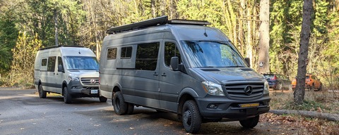
Sprinter Van of the Week!
 Click here for the Sprinter Van map of the world!!!
Have an awesome day!
Click here for the Sprinter Van map of the world!!!
Have an awesome day!
