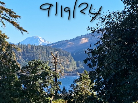
| Your favorite launch | dawn patrol |
morning max | afternoon max | executive session |
|
|---|---|---|---|---|---|
| Iwash (Rooster) Rock | sunny | sky | buns | lie | |
| Stevenson | LTW | building | 20-23 | 20-23 | |
| Viento | 15-18 | 21-24 | 23-26 | 20-23 | |
| Swell-Hood River | 15-18 | 21-24 | 23-26 | 20-23 | |
| Lyle to Doug’s | 10-13 | building | 25-28 | 20-23 | |
| Rufus, etc: 62-94kcfs flow | 10-13 | building | 25-28 | 20-23 | |
| Roosevelt & Arlington | 10-13 | building | 23-26 | 23-26 | |
| River flow last 24 hours: 62-94kcfskcfs | =River temp: 67.28F | HR High temp: 72F | |||
Gorge Wind Forecast
Hi friends! Two more days until a rest day pops up in the schedule. You’ve got this! On Saturday, you’ve got a chance at doing something other than a wind sport – the forecast calls for light/variable wind. Sunday afternoon has a chance of enough wind to get you on the river. Beyond that, we start to see quite a bit of uncertainty in the ensembles and, potentially, some switching between east wind and west wind.
Is this feeling helpful? If so, go ahead and make a contribution using Paypal to support it. Send $19.99 or more, and I’ll send the forecast to your inbox for a year.
Thursday started with pressures of 30.01/29.93/29.91 for gradients of 0.08 and 0.02. The metro area was cloudy, and a few little fluffy marine puffs made it to Hood River. Those will burn off, and eventually so will the clouds in the metro area. By mid-morning, westerlies rise to 21-24 from Viento to Hood River with 14-17 in Mosier and a slow build in Stevenson. To the east of Mosier, you’ll find 10mph or less this morning. Models have a weak front approaching from the north in the afternoon, which could disrupt wind quality/quantity some. But models also take the Viento-Mosier stretch to 23-26 late morning into early afternoon. Stevenson: 20-23. At that time, the Lyle-Rufus zone rises to 20-23. From mid-afternoon on, we have a shot at 25-28 from Mosier to Rufus with gusty 20-23 from Stevenson to Hood River and 23-26 at Arlington. Threemile: 17-20 or so. Strong-enough, but slightly lesser, westerlies hold into the executive session (after 5pm) all through the Gorge. River flow over the last 24 hours was 62-94kcfs, river temp is 67.28F, and high temp forecast is 72F for Hood River and 78F for Arlington.
The previously mentioned weak weather system passes by on Friday. This sets us up for longer-lasting clouds on the west side. Models say the day will start with 23-26 from Viento to Mosier with 13-16 east of Mosier to Rufus. Stevenson: cloudy and light to start. While the models knock the wind down to 21-24 (Stevenson to Doug’s) and hold it there for the rest of the day, I think there’s a chance we’ll beat that. High temp: 67F for Hood River.
Writing the complete forecast takes me 1-2 hours a day. If it saves you time, gas money, or helps you plan your life, please consider contributing.

High pressure builds inland on Saturday. We may see light west wind to start, but it won’t last. Expect a light/variable day. That’s perfect for recovering from all the recent wind, and it’s perfect for doing some other sort of activity. Sunday looks to start light, but it should pick up to 17-20 near Hood River in the afternoon.
That was helpful in planning your life, wasn’t it? Go ahead and subscribe to the forecast using the fancy auto-renew option. Don’t like electronic payment? No problem! You can send a check or cash to: Temira / PO Box 841 / Hood River, Oregon, 97031. Thank you so much for supporting the forecast. I’m glad you find it helpful, and I appreciate your kindness in supporting the work I’m doing!

Extended: Model agreement isn’t great to start next week, but there’s some hint of a somewhat stronger day on Tuesday. Maybe. Let’s leave it there for now. Have a great day on the river!

Jones, Sauvie Island, Oregon Coast
North/Central/South coast, waves (swell forecast provided by NWS). Wind forecast for the afternoon (unless it’s a storm on the coast, in which case that’s peak wind during the day). Wind direction N (coast/Sauvie Island) and W (Jones) unless otherwise noted. Thursday: 10-15/15-20/30, NW swell 6′ at 9 seconds. Friday: 15-20/15-20/30-35+, NW 7′ @ 10. Saturday: 20/20/30-35, NW 6′ @ 12. Jones Thursday: 16-19. Friday: 10-13. Saturday: 10-13. Sauvie Island Thursday: 11-14. Friday: 10-13. Saturday: 16-19.   Alan’s Sauvie Island Wind Sensor
Mt. Hood Weather Forecast
I’m tired. It’s on vacation.
Very basic Hood River weather forecast. Don’t plan your life around this. You really should read Temira’s Awesome Travel Advisory Service on Facebook
Mostly clear this morning with a few high clouds later. Temps start in the upper 50s and rise to the lo w70s. Moderately strong westerlies. No rainbows. Friday will be partly cloudy then mostly clear. Temps start near 50 and rise to the upper 60s. Moderately strong westerlies. No rainbows. Saturday will be sunny. Temps start in the mid 40s and rise to the mid 70s. Light/variable wind. No rainbows.
Link to my Local-ish Outdoorsy Events Google Calendar
Please let me know of outdoor-related local-ish events. If you don’t tell me, I don’t know!
Cycling
All vehicles on HR County forest roads need a gallon of water and a shovel. Check the Hood River County Foresty/Trails website for current Post Canyon area closures. Fire or fire danger closures: Whoopdee, Underwood, Hospital Hill, most of Post Canyon, Gorge 400, trails around Mt. Adams. Dog River is closed for logging and rerouting until mid-September. Open: 44 Road Trails, Ape Canyon, Lewis River, Falls Creek, Columbia Hills, Gunsight, Boulder Lakes, Siouxon, Sandy Ridge. Twin Tunnels reopened for a day or two, and then it closed again – I have photo evidence to prove this! Remember that E-bikes are not allowed on USFS non-moto trails. They are allowed on moto trails.
Sprinter Van of the Week!
 Click here for the Sprinter Van map of the world!!!
Have an awesome day!


