MT. HOOD SNOW FORECAST

Hey skiers and snowboarders! My contacts up at the mountain are telling me it’s an awesome groomer day, which also means it’s an awesome Nordic day. With sun and cool temps in the forecast all day long, you’ll want to slather on sunscreen and head for the slopes. This could potentially be a park out day at the resorts. Carpool. Take the CAT bus.
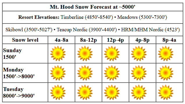
As I said, sun all day: exception – models suggest clouds could get as deep as 6000′ this afternoon, so lower elevations could see some cloudiness. Get above it for continued sun. The free air freezing level will be about 1500′ all day with temps in the low 20s. Wind is supposed to be NW 15, but it was coming out of the south and light while I was writing this. Caught the ski resorts off guard too. Anyway, the wind is supposed to be NW 15-20 all day, which shouldn’t cause any problems if it does show up. The breeze turns to N 10 overnight. Groom crew told me this morning that the groom is as good as it’s been this year. Corduroy is a mix of frozen granular and packed powder, and it’s laying down perfectly. Get some!
Liking this forecast?
Monday will be sunny all day. The free air freezing level rises from about 1000′ in the morning to 8000′ in the afternoon as temps at 5000′ rise from the low 30s to the mid-upper 30s. Wind: N 10 all day becoming NNW 10-15 overnight. Tuesday will have a few high clouds, but there will be plenty of filtered sun too. The free air freezing level rises from 8000′ in the morning to 9000′ in the afternoon. Temps max out in the low 40s. Wind: NNW 10-15 early turning light westerly in the afternoon and holding overnight. Wednesday also looks warm and sunny.
Our next weather system (likely a dry one, but potentially a little new snow) swings through on Thursday. This takes the freezing level down from 9000′ to 2000′ over the course of the day and then drops it to nearly 0′ after midnight. We’ll see moderate W to NW wind with this, but models are not optimistic about snowfall; they’re calling for a trace to a couple inches at best. Beyond Thursday, dry, cold weather continues for a couple of days, at least. We’ll leave it there for now. Enjoy the sun!
Was that helpful? I knew it was! Guess what? All of this crucial work – from your personal wind and snow reports to the invaluable TATAS updates – is made possible by my relentless efforts. Maintaining this labor of love isn’t easy. Each daily forecast takes hours. Website hosting, weather model access, and back-end admin work takes time and money. That’s where you come in.
YOUR CONTRIBUTION MAKES A DIFFERENCE
- SUPPORT ACCURATE, HYPER-LOCAL WEATHER FORECASTING
- ENABLE ACCESS FOR ALL, EVEN THOSE WITH LESS MEANS
- SUPPORT A COOL HUMAN WHO WORKS HARD SO YOU CAN PLAY
Take a moment to click one of the buttons below. Donate $19.99 or more (how much does this forecast enhance your life?) and get the email in your inbox. Whether it’s a renewing subscription (auto-renew) or a one-time donation, every contribution makes a real difference. Help me keep this labor of love alive, so we can all continue playing, commuting, and living in the Gorge with peace of mind and the best weather forecasts possible. Thank you!


Hood River, Oregon 97031


GORGE WIND FORECAST

Hi friends! What an awesome couple of days we had on the river! While there’s a slight chance of just-enough west wind today, we’ll be back to easterlies Monday through Wednesday. Models hint at the possibility of another Hatch west wind day on Thursday. I’m watching it closely. You should too! Sunday kicks off with pressures of 30.50/30.43/30.43 for a 0.07 PDX-DLS gradient. Models suggest we could see a couple hours of 15-18 from Viento to Swell or Hood River before the wind drops below 10mph this afternoon. River flow over the last 24 hours was 94-133kcfs, river temp is 43.52F, and high temp forecast is 45F with clouds in the morning and sun in the afternoon.
Monday start with E 15-20 at Iwash (Rooster) Rock and E 10 at Stevenson. The wind turns light westerly, less than 10mph, from Iwash to Swell in the afternoon. High temp: 43F with Nothing in the morning and mostly clear sky later. Tuesday starts with E 30 at Stevenson and E 35-40 at Iwash/Rooster. The wind holds until early afternoon and then fades to 35mph at Iwash and 25mph at Stevenson. High temp: 41F with a few high clouds and plenty of sun in the windy zones. Easterlies continue on Wednesday. On Thursday, a cold front swings in from the NW and potentially fires off another round of Hatch-zone west wind. Fingers crossed. See you out there if it happens!
BARE BONES HOOD RIVER FORECAST
Clouds this morning give way to sunshine this afternoon. Temps start in the low-mid 40s and rise a couple of degrees. Moderate westerlies mid-morning. Light this afternoon. No rainbows. Monday will be partly Nothing to start and mostly clear in the afternoon. Temps start in the low 30s and rise to the low 40s. Light and variable wind. No rainbows. Tuesday will be partly Nothing in the morning and partly high overcast in the afternoon. Temps start in the low 30s and rise to the low 40s. Light easterlies. No rainbows.
TEMIRA’S AWESOME TRAVEL ADVISORY FORECAST (TMI GORGE WEATHER)

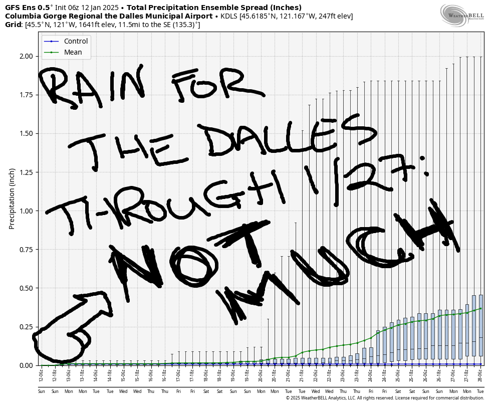
Good morning, neighbors! Dry weather is in the cards for the next week to ten days with the possible exception of a little rain on Thursday. Okay, bye. No, seriously, there’s really not much to talk about, and you know how I get when the weather is calm…
SUNDAY
Sunday happens to be “No Pants Subway Ride Day”. This does not mean to ride the subway naked. It means go in your underwear. And since we don’t have a subway, you’ll have to substitute other forms of public transportation: CAT bus, other buses, Hood River Bridge, etc. Ski lifts are not public transport, so keep your damned pants on at the resorts. It’ll be a nice day to run around in your underwear – clouds start the day in the west, and sun starts the day in the east. By the afternoon, we should be seeing mostly clear sky all through the Gorge. West wind at 15mph near Stevenson and Hood River this morning drops to less than 10mph all through the Gorge this afternoon. Ditto in the hills: lessening wind. Temps along the river max out in the mid 40s today. Freezing level: 1500′, well above crotch level, which means running around in underwear is a great idea. I’m in my underwear typing this report, and I’m perfectly comfortable!
MONDAY-WEDNESDAY
Partial Nothing near the Nch’i Wana Monday morning combines with clear sky away from it. Expect a very chilly start above the Nothing thanks to radiational cooling. By afternoon, we’ll have mostly clear sky everywhere and temps in the low 40s. The wind bounces around: easterlies at 15-20mph in the usual spots for the morning and nearly-calm or light west wind in the afternoon. Repeat for Tuesday but add in easterlies at 30-40mph near Iwash (dong) Rock and Stevenson. Ditto on Wednesday.
THURSDAY AND BEYOND
It’s possible Thursday’s weather system could drop a little moisture, but it’s far from certain. Only 50% of the ensembles have any moisture, and what they do have is rather insignificant. Dry, cooler, potentially “kinda cold” weather continues for at least a few days beyond Thursday. As anticipated, regression to the mean has moderated the forecast around the 20th; instead of single-digit temps, models now call for mid to upper 20s or warmer. Not quite cold enough to repeat the “No Pants Subway Ride” next weekend, but also not quite cold enough to freeze your nuts off. Safe travels. -TATAS
HEY! DON’T STOP READING! Is this community-focused forecast helpful to you? It sure it! It takes me a couple hours a day to write. Please jump in a contribute to keep it going. Venmo: @thegorgeismygym PayPal: twomirrors@gmail.com USPS: Temira / PO Box 841 / Hood River, Oregon 97031 You can test out the forecast subscription for a few days for free by clicking this link: https://subscribepage.io/YhevGc


