


Click on the image above to make a donation. Or, try it out! Get the email version free through the end of June – try it out! Click here.
Thank you for using this forecast. I offer it freely so you can have more fun and plan your life. It does take significant time and energy to produce. If you find yourself using it often, or if you feel your life is enhanced by this information, please make a donation. Click right here to donate. I count on your support to pay my bills, and am deeply grateful to you for choosing to help support me. You can get this forecast via email by donation. The email subscription isn’t $99/year. Not $50/year. Donating $12.34 or more gets you on the list for 12 months. Don’t PayPal? Send a check to Temira @ PO Box 841 in Hood River. Thank you for your support and thank you for trusting my forecast.
| Your favorite beach | Dawn Patrol |
9am- 11:30a |
11:30a- 3pm |
3pm- dusk |
|
|---|---|---|---|---|---|
| Rooster Rock | too | cold | hot dog | buns only | |
| Steven’s Locks | 5-10 | 13-20 | 24-29 | 24-29 | |
| Hatchery/Wunderbar | 5-10 | 15-25 | 27-32 | G 20-27 | |
| Doug’s, Lyle, Rowena | 5-10 | 15-25 | 27-32+ | 27-32 | |
| Rufus, etc. | 5-10 | 15-25 | 27-32+ | 27-32 | |
| Roosevelt, etc. | 5-10 | 10-15 | 15-20 | 25-29 | |
Gorge Wind Forecast
Happy Sunday! It’s a complicated day in the weather world. A trough of low pressure approaching from Vancouver Island (Oh, Canada!) combines with offshore high pressure, low-level stability, and a heat low over the desert (23 degree cross-Cascade temp differential today) to drive big gradients. Will those gradients result in wind? Looks like it, although the wind could get disrupted by all the “complexity” in the forecast.
We’ll start the day with 10-13 or so in the west and 5-10 in the east. As the desert heats and the trough keeps the west side cool, the wind will quickly ramp up. Looks like we’ll have 27-32 from Stevenson to Rufus by midday. If the Swell area is your choice, get on it, because it’ll probably only last a couple hours there. Longer-lasting choices: Stevenson, Hood River, Doug’s (where the poop signs are still up, but The Dalles Public Works is apparently being extra cautious), and Avery. Roosevelt will join with 26-30 from 2pm to 5pm or so, but models don’t look good for before/after that period.
This system will drag clouds in tonight. Monday starts cloudy with 5-10 in the west and 10-13 east of Mosier. In the afternoon, the wind will build to gusty 22-26 from Stevenson to The Dalles. Tuesday looks like 5-10 early and gusty 19-23 in the afternoon with 13-16 at Roosevelt. Models disagree on wind strength for Tuesday, with the ECMWF liking 23-26. Wednesday looks light, although the Euro likes stronger afternoon westerlies. Let’s just stop right there, because model differences exist in wind strength for the rest of the week!
BONUS: Jones Sunday: 10-13. Monday: 16-19. Tuesday: 16-19. Sauvie’s Sunday: X. Monday: 10-13 maybe, late. Tuesday: X. Coast (north/central/south). Sunday: 5-10/5-10/20-25, W swell 4′ at 9 seconds. Monday: 5-10/15-20/25-30, W 4′ @ 9. Tuesday: W10/X/N10, W 4′ @ 9.
Random Morning Thoughts
The random morning thoughts are currently on vacation!
Mt. Hood Mountain Weather Forecast
Sunday starts out clear on Mt. Hood. High clouds will move in. Free air freezing level (FAF) 13,000′ during the day and 6500′ after the passage of a dry cold front tonight. Wind SW 20 early, SW 35+ in the afternoon, W 15 after midnight. Monday looks partly cloudy early and clear during the day with partly cloudy sky overnight. FAF: 6500′. Wind: W 15 early, NW 10 afternoon, SW 20 overnight. Tuesday starts partly cloudy and turns clear. FAF: 6500′ early and 9000′ in the afternoon. Wind SW 20 all day. Looking long range, a system Friday into Saturday drops the snow level as low as 5000′ with up to 1/4” water value of precip.
Gorge Weather Forecast
it’s a clear start to Sunday. We’ll have high clouds later, most likely. Temps will be in the upper 50’s early and mid 70’s later. Strong west wind. No rainbows. Monday starts out cloudy and turns sunny. Temps will be in the low 50’s early and upper 60’s later. Moderate westerlies. No rainbows. Tuesday looks partly cloudy and then clear. Temps will be in the upper 40’s in the morning and low 70’s in the afternoon. Moderate westerlies. No rainbows. It’s looking increasingly likely that we’ll see some rain on Friday night into Saturday.
For weather specifically directed at travel through the Gorge, please visit Temira’s Awesome Travel Advisory Service on Facebook.
White Sprinter Van of the Week
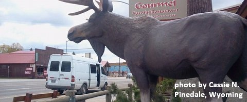
Click here for the White Sprinter Van map of the world!!!
Road and Mountain Biking
The Forest Loop road bike ride in the woods above Trout Lake is open, which means ALL the road rides are open! Saturday will be absolutely epic for road biking, especially in the morning. Light wind. Sunshine. Knebal, Eightmile and Surveyor’s are open. Fifteenmile is not. Lewis River is open. Falls Creek is open from the top down. Hospital Hill has cows on it, so there are no dogs allowed at this time.
Upcoming Events
Today’s events start with the White Salmon Springfest foot race at 8:30 and free yoga at Samadhi at 9. There’s all-ages touch rugby at the Hood River Marina at 11, and free art classes for kids at Columbia Art Center from 1-3. Parents need to be there with the kids. There are free BMC mountain bike demos today at Sandy Ridge. This afternoon from 2-5, there are kayak and Standup Paddle races and competitions happening in Husum.
Next week, all week long, volunteers will be helping rebuild the Children’s Park in Hood River. You can sign up to volunteer or to loan tools to the project by visiting the City of Hood River’s website. The latter half of next week is the Pistol River Wave Bash, nowhere near here, but involving lots of locals. The Sandy Ridge Enduro Race is next Sunday.
Click here for the full events calendar.
Have an awesome day today!
Temira
