


Thank you for using this forecast. Like it? Find it useful? Support it (and me!) by sending some cash my way. What’s it cost to support me and get the email version? Not $99 a year. Nope. Not $49. Just $19.99 or more gets you a year. People are added to this list on Thursday and Sunday. My day job is crisis mental health, and I don’t have time on other days. Thanks for your patience! Click below to contribute. Thank you!!
Click here to use your PayPal
Venmo: @theGorgeismyGym
Snail Mail: PO Box 841, Hood River, Oregon 97031
(note: I am not a non-profit entity. The only way to accept credit cards with a user-defined amount is to use the ‘donate’ button. Thanks for understanding!)
Auto-renewing subscription. New! Awesome!
The Forecast
Today’s Gorge Wind – these are ranges for the average speed, not a predicted wind range. =)
Your favorite beach
Dawn
Patrol
9am-
11:30a
11:30a-
3pm
3pm-
dusk
Rooster Rock
bare
buns
no
sun
Steven’s Locks
5-10
10-13
14-17
G17-21
Swell-Hood River
10-13
14-17
G17-21
G17-21+?
Lyle to Doug’s
10-13
G17-21
G23-26
G26-30
Rufus, etc.
10-13
G17-21
G23-26
G26-30
Roosevelt & Arlington
10-13
G17-21
G23-26
G26-30
Patrol
11:30a
3pm
dusk
Gorge Wind Forecast
While the weather setup today isn’t perfect, and it’s more reminiscent of April than June, that won’t stop the westerlies. As a matter of fact, we’re looking at a three-day stretch of stronger wind than we’ve seen for a while. Of note: Poopy Water remains a problem at the Event Site and Hood River Waterfront Park per Columbia Riverkeeper tests. Second note: river flow is over 400,000cfs. That’s too much current at Rufus, and it’s experts-only conditions in most places. Warnings aside… let’s talk about the wind!
Sunday morning falls into the “not much” category, with 7-10ish everywhere, but the wind will build some midday, perhaps to 17-20 from Stevenson to The Dalles under cloudy, drizzly sky. If you’re looking for stronger wind, you’re waiting for late afternoon. A trough of low pressure slides inland from the WSW. Offshore high pressure builds behind it. Result: strong, gusty wind coupled with some instability. Modes suggest the wind will build to gusty 26-30 this evening from Lyle to Arlington with gusty 18-22 west of Avery. Here’s the thing: rain continues east of Arlington through 8pm or so. This will have a destabilizing effect on the wind field, and hints that you may want to explore areas that are in the sunny stretch between Mosier (ish) and Maryhill (ish). Again, not a perfect setup, but perfectly reasonable for making plans. Just expect to be waiting until mid-late afternoon for best results. River flow is 373-449kcfs, river temp is 55F, and high temp forecast is 64F.
Strong offshore high pressure on Monday combines with deep low pressure in northern Idaho for a rather windy day. Dawn Patrol should be 24-27 from Avery to Boardman with 11-14 between Stevenson and The Dalles. Drizzle sticks around for much of the day west of Lyle. That means you’re headed east of there for higher-quality wind. By late morning, westerlies build to 29-33 from Avery to Arlington with 13-16 (and drizzle) west of Avery and 27-31 from Threemile to Boardman. Mid-afternoon on looks like 30-35 between Maryhill (too much current) and Boardman. West of there: 12-15ish, perhaps a bit less. High temp: 60F.
High pressure pushes inland and tilts positively on Tuesday. Westerlies continue, but they’ll have a bit of northerly at upper elevations. This tends to result in up/down conditions especially near Maryhill (too much current, so not a problem!). Dawn patrol kicks off with 22-26 from Avery to Boardman with 10-13 in the western Gorge. Midday: 14-17 from Stevenson to Hood River (with intermittent drizzle) and 26-30 from The Dalles to Boardman. As high pressure builds, the easternmost beaches (Threemile-Boardman) drop to 20-23, areas between The Dalles and Arlington hold at 26-30, and the western Gorge, still sprinkling, holds at 11-14. High temp: 63F.
As of this morning, Wednesday looks very light, or perhaps even easterly as inland high pressure combines with an offshore low. Looking deeper into the week, we have a fair bit of uncertainty, so let’s stop here. Enjoy this upcoming stretch of windy.
Jones, Sauvie’s, Coast
Coast forecast (north/central/south, waves). Swell forecast provided by NWS. Wind direction northerly unless otherwise noted. Sunday: NW10-15/NW10-15/N20-25+, W swell 4′ @ 9 seconds. Monday: W10-15/W5-10/N0-25, W 5′ @ 9. Tuesday: NW5/NW10/N30-35, W 4′ @ 8. Jones Sunday: 10-13. Monday:LTW. Tuesday: 10-13. Sauvie’s Sunday: NW14-17. Monday: NW 12-15. Tuesday: NNW10-13.
Mt. Hood Snow Forecast – Back on vacation until next fall
Hood River Weather Forecast
Clouds this morning add rain and then turn to mostly cloudy sky in the evening. Temps will be in the mid 50’s early and mid 60’s later. Moderate westerlies. 78% chance of rainbows. Monday will be cloudy with intermittent drizzle. Temps will be in the upper 40’s early and near 60 later. Moderate westerlies. 99% chance of rainbows. Tuesday will be cloudy, then mostly clear, then cloudy. Temps will be in the upper 40’s early and low 60’s later. Moderate westerlies. No rainbows.
Looking for a complete Columbia Gorge forecast? Looking for more humor in your weather? Obscenities? You’re looking for my TATAS: Temira’s Awesome Travel Advisory Service on Facebook.
Local-ish Events
Please let me know of outdoor-related local-ish events. If you don’t tell me, I don’t know!
Ferment’s Tuesday night 4-mile walk/run is at 6pm. At 7:15am on Wednesdays, there’s a run from the White Salmon Bakery. At 7am on Friday morning, you can get a donut and coffee for going for a run at Kickstand Coffee. The Small Boat paddlers have a group paddle at 6pm on Thursday at the Hatchery. Post and Pint happens Thursday evenings at 5:30 when Post is not too wet to ride. The women’s Post-and-Pinot ride is Wednesday evening at 5:30.
Cycling
It seems likely that Post is too wet to ride. Surveyor’s and Dog River are open. Courtney Road (the road that goes up above Syncline) is closed until October. Do not attempt to use it to access trails. Starting now, you will need a parking pass to park at Post Canyon. This money will support trails. Hospital Hill: cows are out – no dogs allowed. Underwood: do not enter areas that are closed due to logging operations.
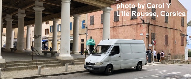
Sprinter Van of the Week!
 Click here for the Sprinter Van map of the world!!!
Have an awesome day!
