Support it with a contribution!

Thank you for using this forecast. Writing it takes 60-120 minutes a day; I can only keep it going with your generous financial support. Make a contribution or subscribe and get it in your inbox with bonus material. What’s that cost? Not $99 a year. Nope. Not $49. Contribute $19.99 or more, and you’re on the list for a year. People are added to this list on Thursday and Sunday. Thanks for your patience! Click below to contribute and keep the forecast going for everyone, nearly every day.
Click here to use your PayPal
Venmo: @theGorgeismyGym
Snail Mail: Temira Lital, PO Box 841, Hood River, Oregon 97031
(note: I am not a non-profit entity. The only way to accept credit cards with a user-defined amount is to use the ‘donate’ button. Thanks for understanding!)
Auto-renewing subscription. New! Awesome!
The Forecast
Today’s Gorge Wind – these are ranges for the average speed, not a predicted wind range. =)
Your favorite beach
Dawn
Patrol
9am-
11:30a
11:30a-
3pm
3pm-
dusk
Rooster Rock
sun
buns
super
fun!
Steven’s Locks
5-10
12-15
17-20
17-20
Viento-Hood River
17-20
17-20
17-20
17-20
Lyle to Doug’s
5-10
5-10
10-13
17-20
Rufus, etc.
15-10
10-13
5-10
5-10
Roosevelt & Arlington
5-10
5-10
LTV
LTV
Patrol
11:30a
3pm
dusk
Gorge Wind Forecast
Westerlies of varying strengths continue as far out as the forecast goes, or at least as far out as your forecaster looks. The best chance for a truly light wind day is Thursday; models currently forecast the wind to max out in the low double digits, or at best, the low teens.
Let’s look at Sunday first. Portland starts out clear, ridging is attempting to push into the eastern half of the state, and a weak low is battling offshore with CA high pressure. Not ideal. Not awful, but not idea. Early gradients were .08 and .05. Ignore the eastern Gorge – it’s unlikely to provide what you want today. Instead, focus on the Corridor. Dawn Patrol is 14-17 between Viento and The Hook with 7-10 at Stevenson and 7-10 in the eastern Gorge (exception: 20mph at Maryhill). The focus remains in the west: expect 17-20 or so between Stevenson and Hood River by late morning with 10-13 from Mosier to The Dalles and 7-10 to the east. That holds until evening when the Rowena stretch is likely to join at 15-18. River flow is 129kcfs, river temp is 69F, and high temp forecast is 86F for Hood River.
The offshore low crawls towards Vancouver Island on Monday allowing offshore pressures to increase. Portland is still likely to start the day clear, which doesn’t bode well for max speeds. A dissipating frontal system creeps towards the PNW towards the day; most likely result of that is increased gustiness all through the Gorge and an early drop in the wind west of Lyle. Taking all that into account… daybreak brings 20-23 from Viento to Mosier with 11-14 east to Arlington and west to Stevenson. By midday, the wind rises to 22-25 from Hood River to Doug’s and drops to 15-18 between Stevenson and Swell. Rufus starts to pick up midday, rising from 11-14 to 22-25 in the evening. Arlington does not join in the fun – models suggest light and variable (LTV) wind out there through evening. High temp: 86F.
Thank that dissipating front and associated troughing for a windier day on Tuesday. Portland starts cloudy. Hood River may start partly cloudy. Strong gradients greet you as you climb out of bed or off the couch. Daybreak: 24-27 from Viento to Mosier, perhaps to Doug’s if the clouds find their way past Hood River. East of Mosier: 14-17 to kick things off. By late morning or early afternoon, we’ll have 23-26 near Stevenson with 26-29 from Viento to Arlington. Rufus is likely to be a winner with 29-33. High temp: 81F for Hood River and 91F for Arlington.
Longer range (and unreliable) forecast: 25-28 for Wednesday, 14-17 for Thursday, 22-25 for Friday. Looks like another great week in the Gorge. July, as usual, is the best! Have a great time!
Coast, Jones, Coast (north/central/south, waves. Wind Coast (north/central/south, waves. Wind direction north unless otherwise noted. Swell forecast from NWS.) Sunday: 15-20/15-20/30-35, W swell 5′ at 9 seconds. Monday: NW10/NNW10-15/N25-30, W 3′ @ 8. Tuesday: 10-15/15-20+/30-35, NW 3′ @ 7. Jones Sunday: 17-20. Monday: 23-26. Tuesday: 15-18. Sauvie’s Sunday: 11-14. Monday: 13-16. Tuesday: 11-14.
Mt. Hood Weather forecast
On vacation unless some wintry weather happens.
Hood River Weather Forecast
Clear sky Sunday. Temps will be near 60 early and in the mid 80’s later. Moderate westerlies. No rainbows. Monday starts clear and ends partially high overcast. Temps will be in the low 60’s early and mid 80’s later. Moderate to strong westerlies. No rainbows. Tuesday will be sunny all day. Temps will be in the upper 50’s early and low 80’s later. Strong westerlies. No rainbows.
Looking for a complete Columbia Gorge forecast? Looking for more humor in your weather? Obscenities? You’re looking for my TATAS: Temira’s Awesome Travel Advisory Service on Facebook.
Cycling
SDS (Whoopdee, Underwood), BLC, HFM, DGS, and Kreps Land (Hospital Hill) are now closed until the end of fire season. It is also vital that people respect this closure to maintain positive relationships between the landowners and trail users.
Open trails: Post, Falls Creek, Lewis River, Sandy Ridge, Columbia Hills, Gorge 400, Plains of Abraham / Ape Canyon. 44 Road: Eightmile, Fifteenmile, Bottle Prairie, Dog River, Superconnector, Cedar, Knebal, Cooks Meadows, 450 to the top, Underhill. Siouxon and Huffman Peak are “temporarily closed” due to wildfire last year.
Maple Road in Post Canyon is closed. DO NOT drive past the closed signs. If you do so, you will jeopardize TRAIL access for the entire summer. This is the road that runs to the west, just north of the Binns/Riorden intersection. Also, the trail from the bottom of Post Canyon to Seven Streams Staging Area is now closed. It’s on private land. Respect the closure.
Local Events
The Gorge Downwind Champs start this weekend. They are looking for “volunteers” with WA alcohol server licenses to help at their beer garden at the Skamania County Fairgrounds. $25/hour. On Saturday, there is a 44 Trails work party. Get more information on the 44trails.org website.
IFPL 3 restrictions go into effect on 7/16. No more motorized use in Post Canyon trails or other trails west of Highway 35. Mountain View Cycles women’s ride is every Thursday, bottom of Post at 5:30pm. They have an all-genders ride at 6pm on Wednesday, end of the pavement on Post Canyon Road. Their shop road ride leaves at 9am on Saturday for a 2 hour ride. Dirty Fingers has the Post n’ Pint on Thursday evenings at 5:30pm from the shop. They also have the women’s Post n’ Pinot Wednesday evening at 5:30pm from the shop. Oregon E-Bikes has ladies’ rides at 7:30am Sunday and Monday. The Small Boat Group does paddles every Thursday evening at 6pm. Hatch laps are the latest thing they do.
Other weekly events. Tuesday night there’s meditation with the Pacific Hermitage Monks at 5:15 (1 hour) and 6:30 (30 minutes followed by a talk) at Yoga Samadhi in White Salmon. Triathlon practice with the Tri Club is Tuesday at 6pm at West Mayer State Park. Sailboat races happen Wednesday night from the Hood River Marina.
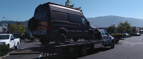
Sprinter Van of the Week!
 Click here for the Sprinter Van map of the world!!!
Have an awesome day!
Click here for the Sprinter Van map of the world!!!
Have an awesome day!