

GORGE WIND FORECAST
If you’re still seeing yesterday’s and it’s after 9am, try opening this in an incognito window

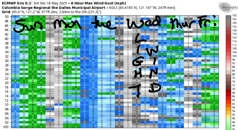
today’s gorge wind forecast
Hi friends! I feel like a bit of a broken record saying “not much coming up”, but that’s how it goes this time of year. We’ll see light westerlies today and Monday, easterlies Tuesday and Wednesday, and then a slight possibility of stronger westerlies late Thursday as a weather system swings through.
Sunday started with pressures of 30.11/30.06/30.03 with westerlies in the 13-16mph range from Viento to the Hatch. That’s about all we’ll see today. Count on that for this morning with 10-13mph elsewhere in the Gorge. The wind fades to 10-13mph in the afternoon and then increases overnight, but it’ll be dark, and the wind will therefore be useless. River flow over the last 24 hours was 89-147kcfs, river temp is 53.4F, and high temp forecast is 51F with rain from mid-morning on.
RIVER FLOW FOR SITES BETWEEN AVERY (EAST OF THE DALLES) AND RUFUS: CLICK HERE FOR JOHN DAY DAM FLOW.
RIVER FLOW FOR SITES BETWEEN STEVENSON AND DOUG’S BEACH (WEST OF THE DALLES): CLICK HERE FOR THE DALLES DAM FLOW

tomorrow’s gorge wind forecast
Monday brings a somewhat better chance of wind as clouds hang on the west side and the desert clears. Morning wind will be 10-13mph west of Rufus with 17-20mph east of Rufus to Boardman. Midday: 13-16mph from Stevenson to Avery with 18-22mph from Rufus to Boardman. As high pressure builds inland during the afternoon, westerlies fade to 7-10mph all through the Gorge. High temp: 48F.
extended Gorge wind forecast
Tuesday brings morning easterlies at 25mph at Iwash (Rooster) Rock and Stevenson with 15-20mph at Viento. After 1pm, the wind fades to 10-15mph at Stevenson and Viento and holds at 25mph at Iwash. High temp: 45F. Wednesday brings easterlies at 15-20mph. The deterministic GFS (and a few of the Euro ensemble members) give us a chance of stronger westerlies on Thursday on the heels of a cold front, but this looks low probability for now. Beyond that: increasing uncertainty, so I’ll stop for now. Have an awesome day today!
Was that helpful? I knew it was! Guess what? All of this crucial work – from your personal wind and snow reports to the invaluable TATAS updates – is made possible by my relentless efforts. Maintaining this labor of love isn’t easy. Each daily forecast takes hours. Website hosting, weather model access, and back-end admin work takes time and money. That’s where you come in.
YOUR CONTRIBUTION MAKES A DIFFERENCE
- SUPPORT ACCURATE, HYPER-LOCAL WEATHER FORECASTING
- ENABLE ACCESS FOR ALL, EVEN THOSE WITH LESS MEANS
- SUPPORT A COOL HUMAN WHO WORKS HARD SO YOU CAN PLAY
Take a moment to click one of the buttons below. Donate $19.99 or more (how much does this forecast enhance your life?) and get the email in your inbox. Whether it’s a renewing subscription (auto-renew) or a one-time donation, every contribution makes a real difference. Help me keep this labor of love alive, so we can all continue playing, commuting, and living in the Gorge with peace of mind and the best weather forecasts possible. Thank you!


Hood River, Oregon 97031


MT HOOD SNOW FORECAST

Hey skiers and snowboarders! Still no sign of the Mt Hood ski season kicking off in the next couple of weeks. Models give us a bit of rain today (Sunday) followed by heavier rain Tuesday into Wednesday. Some snow is possible in the Friday-Saturday Mt Hood snow forecast window, but that’s followed by a (mostly) dry spell for the first week of December, assuming nothing changes. That dry spell does contain some possible weather excitement… I’ll talk more about that in a bit.
Looking at Sunday, we have an incoming cold front. The snow level starts around 6500′, falls to 6000′ in the afternoon, and eventually dips to 2000′ overnight, but most of the precip will have exited the region by then. We’re looking at 0.3” rain today, 0.4” rain this evening, and 0.1” water equivalent (WE) of snow after midnight. That’s an inch or so of snow, although strong orographic (terrain/wind) support could give us 1-3” total at 5000′ if we get really lucky. Wind: W 10-15 this morning, W 20-25 this afternoon, and WNW 40-45 after midnight.
Monday starts with orographic snow flurries and sun breaks. Precip finishes up mid-morning, and high clouds move in. The snow level will be around 2000′ for the period with the freezing level dipping as low as 0′ in some areas Monday night. Just a trace of snow is forecast Monday daytime. Wind: WNW 40-45 in the morning, NW 15-20 in the afternoon, and light SW overnight.
Tuesday kicks off high overcast. A warm front arrives in the evening and takes the snow level from 2000′ to 7000′. About 1.1” precip is expected – we could see several inches of wet snow at the start of this system, but rain will quickly take over. Wind builds from light SW in the morning to SW 30-45 in the afternoon and WSW 30-40 after midnight. Models are all over the place on rain totals for Wednesday, but rain it shall be as the snow level hovers around 7000′. Too-warm weather continues into Thursday. We then see increasing uncertainty about the amount of precipitation as temps drop low enough for snow on Friday into Saturday.
Starting late next week, models dry things out. We then have both the Euro and the GFS hinting at a period of colder, dry weather. The GFS deterministic has gone off the deep end with this and is calling for extreme cold. GFS ensembles, however, are not on board with the deterministic wild card forecast. Euro ensembles hint at colder weather, but nothing out of the ordinary for the start of December. Let’s leave it there for now with all that uncertainty unresolved. Hope to see you on the snow soon!
BARE BONES HOOD RIVER WEATHER FORECAST
Clouds this morning with drizzle from mid-morning on. Temps start in the low 50s and stay there. Light westerlies. 89% chance of rainbows. Monday will be partly to mostly cloudy. Temps start in the upper 30s and rise to the upper 40s. Light to moderate westerlies. 11% chance of rainbows. Tuesday will be cloudy with rain from late afternoon on. Temps start in the low-mid 30s and rise to the mid 40s. Light easterlies. No rainbows.
TEMIRA’S AWESOME TRAVEL ADVISORY SERVICE
HYPERLOCAL WEATHER FORECAST FOR THE COLUMBIA GORGE
THE DALLES, HOOD RIVER, WHITE SALMON, TROUT LAKE, STEVENSON, CASCADE LOCKS, PARKDALE, ODELL, HUSUM, BZ, MILL A, WILLARD, GOLDENDALE, RUFUS, ARLINGTON, boardman

Good morning, neighbors! Looks like another mostly-wet week is on tap. Contained in there are a couple time periods where we could see a few snowflakes at our highest elevations. Looking at next weekend, model agreement falls apart. You may have already seen some wacky forecasts for the first week of December on social media. Don’t trust any forecasts of extreme cold – they’re based on the deterministic GFS, which is one heck of an outlier this morning. We’ll dive into that more in a bit.
Glenwood this morning
First, of course, we shall check in with Glenwood, where it’s 38 degrees this morning. Everyone’s gathered around the fire pit placing bets on how many points the Seahawks will score today against the Titans. In Glenwood, the winner of the betting pool gets a chest freezer filled with Rocky Mountain Oysters. I gotta get this forecast finished so I can get in on that!
Today’s Gorge weather forecast
Weather elsewhere this morning: mostly cloudy to the west, and a little less cloudy to the east with most places within 5 degrees of 42. That’s like six degrees of separation, which is a planet-wide thing. Here in the Gorge, we’ve got maybe two degrees of separation. Hooray for small towns and rural living! Anyway, rain arrives mid-morning as far east as Rowena and pushes into the desert (and south Wasco County, just a bit) early afternoon. Rain continues until 9pm or 10pm and then stops. Bye, rain. High temps today make it to the 51F to 53F range, warmest to the east. Wind will be westerly at 10mph or so all day.
At the tail edge of this weather system, 850mb temps fall to -4C with the snow level around 2000′. We’re not expecting any snow accumulation at 2000′, but some folks (Willard, Trout Lake, Snowden) could see just a few wet snowflakes. We can’t rule out some higher-elevation roads ending up slippery, but road surfaces are still pretty warm. Do be careful out there early Monday morning in those elevated areas!
Monday’s Gorge weather forecast
On Monday morning, Cascade Locks and areas to the west retain a bit of drizzle for a few hours before they join the rest of the Gorge in being dry. West of Mosier, you’ll find partly cloudy sky all day. To the east: mostly clear. This results in west wind at 15-20mph or so into early afternoon when the wind drops to 10mph or less. Morning temps: upper 30s with temps below freezing above 2000′. Afternoon: 48-51F.
Extended Gorge weather forecast
Tuesday morning’s temps depend on how quickly clouds arrive Monday night. It’s possible we could see a freeze, and it’s possible that could result in some patchy icy roads. Clouds increase during the day, and a warm, wet system arrives overnight with (probably) heavy precip. The front edge of this system could be cool enough and wet enough to result in a little bit wet snow at our highest elevations, but don’t panic. The snow level rises to 7000′ overnight and washes all the snow away. Bye, snow. Rain (probably) continues through Thursday (Thanksgiving, yay!), but there’s quite a bit of uncertainty in the models. Uncertainty continues into next weekend.
Things get really interesting in the models next Sunday. The GFS deterministic clearly took LSD, as it’s calling for absolutely frigid temps. Ensembles are on board with somewhat colder weather for a couple of days, but they’re definitely not on board with the GFS forecast of 0F. What do models agree on? I’m glad you asked! They do like the idea of cooler, dry weather to start December. I’ll go ahead and post the GFS image just for fun. It did get a giggle out of me this morning! Safe travels. -TATAS
HEY! DON’T STOP READING! Is this community-focused forecast helpful to you? It sure is! It takes me a couple hours a day to write. Please join your friends and neighbors in contributing to keep it going. Venmo: @thegorgeismygym PayPal: twomirrors@gmail.com USPS: Temira / PO Box 841 / Hood River, Oregon 97031 You can test out the forecast subscription for a few days for free by signing up below. Easy! Do it!
JONES BEACH, SAUVIE ISLAND, & COAST FORECAST
ON WINTER VACATION UNLESS DESPERATELY NEEDED.
