Get the email free through the end of March – try it out! Click here.
Thank you for using this forecast. I offer it freely so you can have more fun and plan your life. It does take significant time and energy to produce. If you find yourself using it often, or if you feel your life is enhanced by this information, please make a donation. Click right here to donate. I count on your support to pay my bills, and am deeply grateful to you for choosing to help support me. You can get this forecast via email by donation. The email subscription isn’t $99/year. Not $50/year. Donating $12.34 or more gets you on the list for 12 months. Don’t PayPal? Send a check to Temira @ PO Box 841 in Hood River. Thank you for your support and thank you for trusting my forecast.
| 4a-8a | 8a-12p | 12p-4p | 4p-8p | 8p-4a | |
|---|---|---|---|---|---|
| Sunday 5000′->500′ |
 |
 |
 |
 |
 |
| Monday 500′->1500′->0′ |
 |
 |
 |
 |
 |
| Tuesday 0′->5000′-4000′ |
 |
 |
 |
 |
 |
Mt. Hood Snow Forecast
Sunday’s starting off partly cloudy, but snow will move in by midday, continuing through mid-morning Monday. Tuesday brings a break from active weather, and Wednesday sees mixed precip. From Thursday on, we’ll be somewhere in the vicinity of a Pineapple Express, but models have been inconsistent about the details. They are hinting at a big snowfall at the end of next weekend, but like I said, inconsistency in details prevents a solid forecast at this time.
For Sunday, expect a partly cloudy morning. Snow starts up around 11am along with strong wind. The snow level will be 5000′ early, quickly dropping to 2500′ as the system hits and then falling to 500-1000′ overnight. About .3” water value (WV) falls by 5pm, for 2-3” of snow. Another .5-.6” WV falls tonight, for 5-7” of fluffy powder. Wind will be less-than-optimistic, unless you’re looking for wind loading: WNW 25 early, WSW 35 midday, and WNW 40-45 from mid-afternoon on. That could impact some lift operations.
Monday looks windy with snowfall in the morning and partly cloudy with flurries and plenty of sunshine in the afternoon. The snow level will be 500-1000′ early, 1500′ in the afternoon, with a free air freezing level of 0′ under clear sky overnight. About .3” WV falls in the morning, for 3” of fluffy powder. A trace to 2” may fall overnight. Wind will be WNW 45 in the morning and NW 25 in the afternoon with W 15 overnight.
Tuesday looks sunny to start and cloudy in the afternoon with flurries possible overnight. The free air freezing level will be 0′ early, 5000′ in the afternoon, with a snow level of 4000′ overnight. Wind will W 15 early, SW 20 in the afternoon, and W 25 after midnight. Rain moves in sometime Wednesday and continues through Saturday. Details on amounts are not clear, but it is possible that the rain could be quite heavy at times.
Random Morning Thoughts
One of the things we therapist people think about is “mood-directed behavior” vs. “goal-directed behavior.” In terms of mental health, the question is this: Is your mood controlling you, or are you doing things to change it?
When people get depressed or anxious, the former happens, and it can be hard to do anything because there’s so much internal pain. Doing something positive (going for a walk, for example, or getting out of bed) is really the only way to start impacting this. Sometimes we don’t have any internal strength left to make it happen. That’s when friends, family, and social supports come in!
If you or someone you care about gets stuck in the Swamps of Sadness (or anxiety), you can help them by making them do something with you. The more the activity challenges their current negative self-talk, the better off they’ll be. Think of this as loaning some of your forward momentum to someone else, so they can relearn how to move on their own. May you be free from suffering. Have an awesome day.
Disclaimer required by my grad school program: I am not your therapist, but I am seeing clients at this time at Comprehensive Healthcare in White Salmon. In the meantime, I am your weather forecaster. Take everything I say with a grain of salt, and consult with your actual therapist about your mental health issues. One other thing: I plan to keep doing this forecast indefinitely. Forecasting and counseling are both deeply meaningful and nourishing to me.
Gorge Wind Forecast
It’s Sunday, and we remain in a westerly flow pattern for the next couple of days. A cold front approaching today will amp up the west wind, but it’ll be gusty. To start the day, we’ll have 17-20 in the west and 10-13 east of The Dalles. As this system moves closer, rain will start up west of Hood River with gusty 15-18 under the clouds. Farther east, where the sky will be clearer, you’ll find gusty 24-27. You’ll probably need to head east of The Dalles.
Monday sees that cold front move through with high pressure building offshore. The wind should be more reliable than Sunday. We’ll have gusty 24-29 in the morning (with temps in the mid 30’s!). In the afternoon, the wind will steady out with 18-22 from Stevenson to Mosier and 26-30 from The Dalles to Arlington. Avery through Rufus will likely be the sweet spot Monday. Tuesday looks light and variable.
Gorge Weather Forecast
It’s a partly cloudy start to the day. Rain will move in midday, continuing through the evening. Snow is possible above 500′ tonight. Temps will be in the mid 40’s early and mid 50’s this afternoon. Moderate to strong west wind. 99% chance of rainbows. Monday may start off with wet snow or snow mixed with rain. That’ll taper off mid-morning. Temps will be in the mid 30’s early and near 50 in the afternoon. Strong west wind. 99% chance of rainbows. Tuesday looks sunny and dry early, cloudy by the afternoon, and perhaps sprinkly overnight. There will be frost Tuesday morning. Temps will be near 30 early and near 60 in the afternoon. Light and variable wind. No rainbows.
For weather specifically directed at travel through the Gorge, please visit Temira’s Awesome Travel Advisory Service on Facebook.
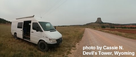
White Sprinter Van of the Week

Click here for the White Sprinter Van map of the world!!!
Road and Mountain Biking
The Brown was definitely as pow as it gets yesterday. It’ll be the same for a couple hours this morning, but then the rain will start up, and that’ll be the end of that for a few days as rain continues through Tuesday morning. Next best chance to ride Post will be late Tuesday or early Wednesday. Steady rain arrives Thursday. Dirty Fingers has a group ride at 9am today. Bring raingear.
Upcoming Events
for today, there’s by-donation yoga at Samadhi at 9am, ping pong at the Armory at 10am, meditation at Flow at 11am, pickup touch rugby at the Hood River Waterfront Park at 11am, YogaFaith at Pure Yoga in The Dalles at 4pm, and restorative yoga at Pure Yoga in Hood River at 6pm.
Dirty Fingers has a group gravel ride at 9am (Gilhouly, I believe. Expect rain.) followed by viewing of the Tour de Flanders at 3pm. Looking ahead to next weekend, there’s a garden party at Pacific Hermitage starting at 10:30am on Saturday – potluck meal followed by garden work followed by tea time with the monks.
Click here for the full events calendar.
Have an awesome day today!
Temira


