Distance: 33.5 mile loop or 56.8 mile lollipop
Elevation gain: 2868′ or 4659′
Best time of year: Late spring or early summer into autumn
If you look at the list of road bike rides, there’s one called the Trout Lake Loop. It’s 52 miles. This is the backwards, mixed surface, inner-loop, somewhat related version of the same ride. Okay, they’re not really similar at all. Best part: the long, perfectly paved climb of the road biking version turns into your downhill to the finish on this one.
Park at the Trout Lake Ranger station. Don’t forget to get your free mushroom harvesting permit, just in case. Head west on 141. Take a right on Trout Creek Road, also known as Forest Road 88. It’s flat and a bit rolly and rather sunny for the first several miles. Thankfully, you’ll move into the forest. Next, grind up an 8-9% hill for just about a mile. If it’s really hot, stop at one of the many streams and soak your jersey.
Take a right on a well-used, but not marked gravel road. It’s numbered 8810 (no sign to be seen!), and will show up just as you’re ready for a break from the hill. I’ll get ya a photo of the turn next time I ride it. In the meantime, use the dang GPX file, okay? This road drops down a rather steep hill. Watch out – it gets quite rough near the bottom, but only for about 100-200 feet. You’ll then enjoy an excellent road surface and 1-3% grade for about 4 miles. A short steeper climb warms you up for the real deal: 5 miles at 5-6% followed by another 4 miles at 1-2%.
Don’t freak out. It’s all forested, much of it is shady, and once you get past the Sleeping Beauty trailhead, you won’t see any cars. Added bonus: there’s often a temperature and humidity inversion. When you get up to the easier climbing, you’re likely to find cooler, less humid air. You’ll also find streams. Bring a filter, and bring bug spray. If you stop, you’ll may become lunch for the black flies.
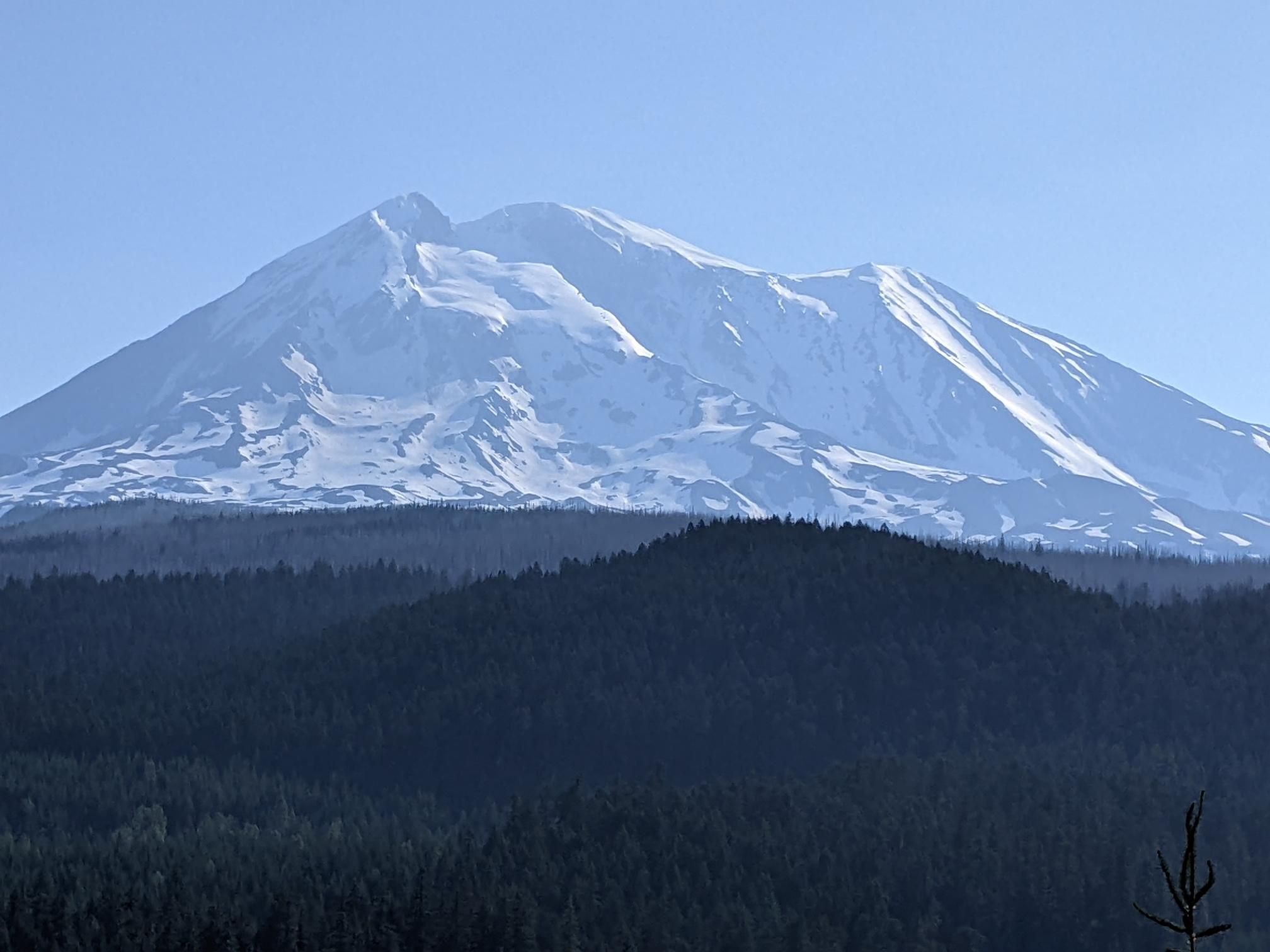
After all this climbing, the road turns flat with views of the Indian Creek Heaven Wildernness and peeks at the peak of Mt. Adams. The PCT crosses the road twice too. Enjoy the flats and the old-growth forest for the last few miles.
You’ll pop out on Forest Road 23, a gorgeous two-lane blacktop beauty. Take a right. Stop for the spectacular view of Mt. Adams at the beginning of the descent. This descent, it’s a stellar one. The pavement is nearly-perfect, and the grade ranges from -5% to -1%. You’ll do a little bit of climbing here and there, but you’ll never come close to your granny gear. When you emerge from the forest into the Trout Lake Valley, you’ll run into the road to Cold Creek. Stay right (it’s obvious). It’s a couple miles into Trout Lake, where you’ll swing right to go back to the ranger station.
For a (much) longer version, you can go left at the intersection with the 23 Road. Follow that to the 90, and take a left. Then take a left on to the 88 and loop back to Trout lake. Most of that will be on paved road, and there will be a fair bit of weekend traffic. Distance: 56 miles. Elevation Gain: 4659′.
\This road is so well traveled because it takes you to the Sleeping Beauty Hike. But we’re cyclists, and we don’t hike. You’re going to grind right on past that.