


Thank you for using this forecast. Like it? Find it useful? Support it (and me!) by sending some cash my way. What’s it cost to support me and get the email version? Not $99 a year. Nope. Not $49. Just $19.99 or more gets you a year. Click below to contribute. Thank you!!
Click here to use your PayPal
Venmo: @theGorgeismyGym
Snail Mail: PO Box 841, Hood River, Oregon 97031
(note: I am not a non-profit entity. The only way to accept credit cards with a user-defined amount is to use the ‘donate’ button. Thanks for understanding!)
Auto-renewing subscription. New! Awesome!
The Forecast
| 4a-8a | 8a-12p | 12p-4p | 4p-8p | 8p-4a | |
|---|---|---|---|---|---|
| Saturday 6000′->3500′->7000′ |
 |
|
 |
 |
|
| Sunday 5500′-7000′->8500′ |
|
|
|
|
|
| Monday 8500′->500′ |
|
 |
 |
 |
|
Mt. Hood Forecast
Wild weather is on tap this weekend for Mt. Hood. Your best chance for mellow weather is Saturday daytime. After that? Chaotic, all the way through Monday! For Saturday, the precip starts out alternating between rain and snow, switches to flurries during the day, and ramps up to heavy or very heavy rain overnight. The snow level will be around 5500′ early, 4000′ during the day, and 7000′ overnight. About 0.1” water equivalent (WE) falls during the day, for 1/2” to 1” of wet snow. Tonight’s forecast calls for 3-4” of rain. Wind: W 30 during the day, WSW 30-55 in the afternoon, W 60 in the evening (bye, lifts), and W 55 overnight.
With the snow level bouncing around between 5000′ and 7000′ early Sunday along with strong wind, icing could be a problem for the ski areas. Models are a bit conflicted about snow levels Sunday daytime; the 850mb temp is forecast to be about 3C… call it mixed precipitation, or alternating snow and rain at 5000′. Pure rain returns overnight. The snow level will be 5500′ ish during the day, 6500′ around sunset, and 8500′ overnight. About 0.9” WE is forecast during the day. Goodness only knows the ratio of snow and rain. Another 0.9” WE falls as rain overnight. Wind: W 55 early, W 40 daytime, WSW 30-45 evening, and WSW 30-55 after midnight.
Monday brings light rain during the day and moderate snow from early afternoon on. The snow level will be 8500′ early, 6000′ late morning, and 1000-1500′ early afternoon, falling to 500-1000′ overnight. About 0.3” WE falls as rain during the day, 0.5” WE falls in the transition period (2-3” wet snow), and 0.4” WE falls overnight for 4-5” powder. Wind: WSW 30-55 early, SW 35-65 mid-morning, W 60 (bye, lifts) in the afternoon and evening, and NW 35-40 overnight. Flurries continue Tuesday morning along with plenty of sun. After that: warmer and sunnier with snow on Xmas.
Note about wind speeds: model-predicted wind speeds often reflect the wind on higher exposed ridges, but aren’t as accurate about wind on the ski slopes. Direction plays a big role. So, a model-predicted W 40 will actually be W 40 on the slopes. Model-predicted SW 40 might be SW 40 on the higher ridges, but will only be SW 15-20 on the slopes. Model predicted NW 30 might actually be NW 35 or 40!Hence the ranges. Take the lower end as what to expect, and take the higher end as the wind at Palmer and Cascade. Hope that helps!
Gorge Wind Forecast
Westerlies bounce around a fair bit today, generally in the 13-16 range in various locations as far east as Biggs. Chase it if you want. Doesn’t look consistent. River flow is 144kcfs, river temp is 44, and high temp is forecast at 51. Sunday starts with W 25-30 west of Hood River with calm wind east of there. Afternoon: gusty 12-15 or a bit more in the eastern Gorge and heavy rain in the west. High temp: 53. Monday starts with E 10-15 and quickly switches to W 25-30 in the western Gorge and W 35-40+ east of The Dalles. High temp: 53, dropping rapidly in the afternoon.Coast, Jones, Sauvie’s
As needed until next spring and summer.Hood River Weather Forecast
Cloudy weather Friday morning turns partly cloudy midday. Rain starts up after 7pm. Temps will be int eh upper 40’s all day. Light westerlies. 7% chance of rainbows. Saturday brings a few sprinkles in the day and heavy rain overnight. Temps will be in the mid 40’s early and near 50 later. Moderate westerlies east and west of the calm central Gorge. 5% chance of rainbows. Sunday will be rainy, maybe even very rainy. Temps will be in the low 40’s early and mid 50’s (WARM!!!) later. Moderate westerlies. 89% chance of rainbows. Looking for a complete Columbia Gorge forecast? Looking for more humor in your weather? Obscenities? You’re looking for my TATAS: Temira’s Awesome Travel Advisory Service on Facebook.Cycling
Sprinkly, mostly cloudy daytime weather turns rainy tonight. Temps will be near 50 all day. Light to moderate westerlies. 99% chance of rainbows. Sunday will be rainy all day. Temps will be in the low 40’s early and low 50’s later. Light westerlies. 7% chance of rainbows. Monday looks rainy. Temps will be in the mid 40’s early and low 50’s later. Strong westerlies. 99% chance of double rainbows.Sprinter Van of the Week!
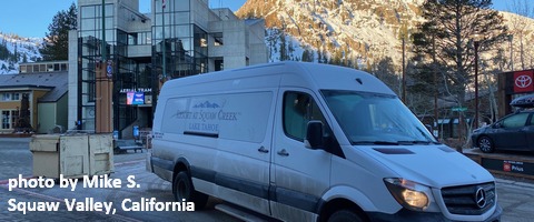 Click here for the Sprinter Van map of the world!!!
