

Support it with a contribution!

Thank you for using this forecast. Writing it takes 60-120 minutes a day; I can only keep it going with your generous financial support. Make a contribution or subscribe and get it in your inbox with bonus material. What’s that cost? Not $99 a year. Nope. Not $49. Contribute $19.99 or more, and you’re on the list for a year. People are added to this list on Thursday and Sunday. Thanks for your patience! Click below to contribute and keep the forecast going for everyone, nearly every day.
Click here to use your PayPal
Venmo: @theGorgeismyGym
Snail Mail: Temira Lital, PO Box 841, Hood River, Oregon 97031
(note: I am not a non-profit entity. The only way to accept credit cards with a user-defined amount is to use the ‘donate’ button. Thanks for understanding!)
Auto-renewing subscription. New! Awesome!
The Forecast
Today’s Gorge Wind – these are ranges for the average speed, not a predicted wind range. =)
Your favorite beach
Dawn
Patrol
9am-
11:30a
11:30a-
3pm
3pm-
dusk
Rooster Rock
overcast
sky
buns
cry!
Steven’s Locks
5-10
10-13
13-16
13-16
Viento
16-21
13-16
16-21
13-16
Swell-Hood River
16-19
11-14
20-23?
11-14
Lyle to Doug’s
11-14
5-10
16-20
22-25?
Rufus, etc.
LTV
LTV
16-20
22-25+?
Roosevelt & Arlington
LTV
LTV
16-20
22-25+?
Patrol
11:30a
3pm
dusk
Gorge Wind Forecast
Complicated weather today combines with smoke over the region for a tricky wind forecast. Things don’t get much easier to predict this week. Expect your forecasts, no matter who’s doing them, to contain a lot of spread and a lot of caveats.
Let’s look at Saturday. Elevated smoke and elevated convection are the two main complications today. Models predict gusty 22-26 from Mosier to The Dalles midday and gusty 24-28 from Rowena to Arlington (gusty 12-15 western Gorge) this afternoon through about 5pm. We’ll start with that. Unfortunately, the two factors driving that afternoon wind increase are unreliable. The first is heat – 100F+ in the far east and Columbia Basin is forecast, and that would drop the pressure and increase the gradient. Smoke is going to lower the max temps, so we’ll lose some driving force there. Our second complication is an impulse moving along the coast this afternoon. That could fire off convection later today and throw thunderstorms into the mix. So… with gradients at 0.10 (pdx-dls) and E .02 (dls-psc) to start the day, and wind at 16-21 from Viento to Hood River, you’ll want to simply get what you can. If you wait until later, you’ll likely be driving east of Mosier for stronger wind. River flow is 107kcfs, river temp is 70F, and high temp forecast is 89F.
Looking at Sunday, we have a very muggy day with continued elevated smoke. Sky coverage will impact max temps again. Daybreak brings west 20-24 from Viento to Moiser with 10-13 at Stevenson and 14-17 east of Mosier to Arlington. The wind holds through midday. If the desert can heat up despite the elevated smoke, we’ll have 24-27+ from Stevenson to The Dalles in the afternoon with 12-15 at Rufus and 10-13 at Arlington. High temp: 93.
Significant instability is forecast for Monday. That would impact the wind forecast, except there isn’t much wind forecast: just 8-11 to start, light westerly most of the day, and 10-13, maybe, from Stevenson to Hood River in the evening. High temp: 94F.
Tuesday looks light. Wednesday may have low/mid 20’s (gusty). Thunderstorm potential is there both days. Looking at Thursday, we see our first Pacific weather system of the season. High temps are forecast to drop 25-35 (!!) degrees between Wednesday and Thursday. Expect a very windy, gusty day. Some ensemble members have significant thunderstorm potential for Thursday as well. Keep your expectations relatively low for the next week, and get what you can when you can!
Coast, Jones, Coast
Coast (north/central/south, waves. Wind direction north unless otherwise noted. Swell forecast from NWS.) Saturday: 10-15/10-15/20-25+, SW swell 1′ at 10 seconds. Sunday: 10-15/20-25/25-30, W 3′ @ 8. Monday: 25-30/15-20/20-25?, W 3′ @ 8. Jones Saturday: 11-14. Sunday: 23-26. Monday: 12-15. Sauvie’s Saturday: NNW 8-11. Sunday: 10-13. Monday: 12-15+.
Mt. Hood Weather forecast
On vacation unless some wintry weather happens.
Hood River Weather Forecast
Upper-level smoke and clouds persist all day. Temps will be near 80 early and near 90 later. Moderate to strong westerlies. Chance of sprinkles. Chance of thunder later. No rainbows. Sunday will be partly cloudy, smoky up above, and muggy. Temps will be in the mid 70’s early and low 90’s later. Moderate to strong westerlies. No rainbows. Monday looks partly high overcast with smoke above. Temps will be in the mid 60’s early and mid 90’s later. Light westerlies. Good chance of thunderstorms. No rainbows.
Looking for a complete Columbia Gorge forecast? Looking for more humor in your weather? Obscenities? You’re looking for my TATAS: Temira’s Awesome Travel Advisory Service on Facebook.
Cycling
SDS (Whoopdee, Underwood), BLC, HFM, DGS, and Kreps Land (Hospital Hill) are now closed until the end of fire season. It is also vital that people respect this closure to maintain positive relationships between the landowners and trail users. DNR land in Eastern Washington (Buck Creek / Nestor Peak) is all closed to recreation due to fire danger.
Open trails: Post, Falls Creek, Lewis River, Sandy Ridge, Columbia Hills, Gorge 400, Plains of Abraham / Ape Canyon. 44 Road: Eightmile, Fifteenmile, Bottle Prairie, Dog River, Superconnector, Cedar, Knebal, Cooks Meadows, 450 to the top, Gunsight, Underhill. Siouxon and Huffman Peak are “temporarily closed” due to wildfire last year.
Maple Road in Post Canyon is closed. DO NOT drive past the closed signs. If you do so, you will jeopardize TRAIL access for the entire summer. This is the road that runs to the west, just north of the Binns/Riorden intersection. Also, the trail from the bottom of Post Canyon to Seven Streams Staging Area is now closed. It’s on private land. Respect the closure.
Local Events
The Hood River County Fair runs through Saturday. Cheno’s workout is every Saturday at 10am at the Ferment Lawn in Hood River ($10).
IFPL 3 restrictions west of Highway 35 (source: Hood River County email) went into effect on 7/16. No more motorized use in Post Canyon trails. Mountain View Cycles women’s ride is every Thursday, bottom of Post at 5:30pm. They have an all-genders ride at 6pm on Wednesday, end of the pavement on Post Canyon Road. Their shop road ride leaves at 9am on Saturday for a 2 hour ride. Dirty Fingers has the Post n’ Pint on Thursday evenings at 5:30pm from the shop. They also have the women’s Post n’ Pinot Wednesday evening at 5:30pm from the shop. Oregon E-Bikes has ladies’ rides at 7:30am Sunday and Monday. The Small Boat Group does paddles every Thursday evening at 6pm at the Hatchery.
Other weekly events. Tuesday night there’s meditation with the Pacific Hermitage Monks at 5:15 (1 hour) and 6:30 (30 minutes followed by a talk) at Yoga Samadhi in White Salmon. Triathlon practice with the Tri Club is Tuesday at 6pm at West Mayer State Park. Sailboat races happen Wednesday night from the Hood River Marina. There are also lesser races on Friday nights.
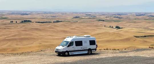
Sprinter Van of the Week!
 Click here for the Sprinter Van map of the world!!!
Have an awesome day!
Click here for the Sprinter Van map of the world!!!
Have an awesome day!
