


Click on the image above to make a donation. Or, try it out! Get the email version free through the end of June – try it out! Click here.
Thank you for using this forecast. I offer it freely so you can have more fun and plan your life. It does take significant time and energy to produce. If you find yourself using it often, or if you feel your life is enhanced by this information, please make a donation. Click right here to donate. I count on your support to pay my bills, and am deeply grateful to you for choosing to help support me. You can get this forecast via email by donation. The email subscription isn’t $99/year. Not $50/year. Donating $12.34 or more gets you on the list for 12 months. Don’t PayPal? Send a check to Temira @ PO Box 841 in Hood River. Thank you for your support and thank you for trusting my forecast.
| Your favorite beach | Dawn Patrol |
9am- 11:30a |
11:30a- 3pm |
3pm- dusk |
|
|---|---|---|---|---|---|
| Rooster Rock | too | cold | hot dog | buns only | |
| Steven’s Locks | light | light | 5-10 | 10-13 | |
| Hatchery/Wunderbar | light | light | 5-10 | 10-13 | |
| Doug’s, Lyle, Rowena | light | light | 5-10 | 10-13 | |
| Rufus, etc. | light | light | light | light | |
| Roosevelt, etc. | light | light | light | light | |
Gorge Wind Forecast
it’s Saturday, and I slept in today, thank goodness. There’s not much wind to speak of today. We’ll have calm wind through midday. Early in the afternoon, we’ll see a slow build to 10-13. The wind will arise first at Stevenson and slowly fill in east of there, making it to Hood River and the Rowena stretch after 2pm and 5pm respectively. River flow today at The Dalles is 442kcfs. Temp is 57 degrees.
Tomorrow looks different. A low pressure system approaches the coast while high pressure remains offshore. A 25 degree cross-Cascade temp gradient and a heat low in the desert contribute to a ginormous pressure differential between the west and the east. In the morning (and maybe into the afternoon), we’ll have a low-level inversion that’ll help keep the wind on the river. In other words, this is a good setup, but there are factors that’ll make the wind up and down and potentially unreliable.
So… We’ll start Sunday with 12-15 from Stevenson to Hood River. By 1pm, we should have gusty 27-32 from Stevenson to Rufus. Arlington will join with 25-29 (water speed, not meter speed) after 2pm. Given the setup, the most reliable locations will likely be Stevenson, Hood River, the Lyle stretch, Avery, and the grain silos near Maryhill. There will almost certainly be a 2-3 hour period of good wind at Swell as well. Very strong current below John Day Dam makes the Rufus stretch of river experts only at this time.
Clouds push in Sunday night shifting Monday’s wind east. The day starts with 12-15 from Lyle to arlington with 5-10 in the west. Monday afternoon, especially late afternoon, looks like 22-26 from Viento to Rufus. Tuesday currently looks like 13-16. Models disagree on the wind strength after that.
BONUS: Jones Saturday: 18-21. Sunday: 20-23. Monday: 12-15. Sauvie’s Saturday: 10-13 late. Sunday: 17=20. Monday: X. Coast (north/central/south). Saturday: 15-20/15-20/25-30. W swell 4′ at 10 seconds. Sunday: W5/X/15-20, W 4′ @ 9. Monday: W5/15-20/25-30, W 4′ @ 9.
Random Morning Thoughts
The random morning thoughts are currently on vacation!
Mt. Hood Mountain Weather Forecast
Scattered high clouds for Saturday. Free air freezing level (FAF) 11,000′ this morning and 13,000′ this afternoon. Wind SW 10-15 early, SW 20 afternoon and evening. Sunday will have increasing clouds. There may be some light rain and a few flurries overnight. No accumulation. The snow level will be 13,000′ during the day, falling to 5500′ after midnight. Wind will be SW 20 in the morning, SW 45 in the afternoon, and W 20 after midnight. Monday looks clear. FAF 5500 int eh morning and 6500′ in the afternoon. Wind W 20 in the morning and W 10 in the afternoon.
Gorge Weather Forecast
There are some high clouds scattered about today, and that’s the way things will be. Temps will be in the mid 50’s early and low 80’s later. No wind until late in the day, when we’ll have light westerlies. NO rainbows. Sunday will likely have high clouds all day and low clouds overnight. Temps will be in the low 50’s early and mid 70’s in the afternoon. Strong westerlies. No rainbows. Monday looks cloudy in the morning with a slight chance of sprinkles and partly cloudy to clear in the afternoon. Moderate westerlies. 1% chance of rainbows. In a fun twist, the GFS and ECMWF are both liking the idea of actual rain next Saturday. I’m interested to see if that actually pans out.
For weather specifically directed at travel through the Gorge, please visit Temira’s Awesome Travel Advisory Service on Facebook.
White Sprinter Van of the Week
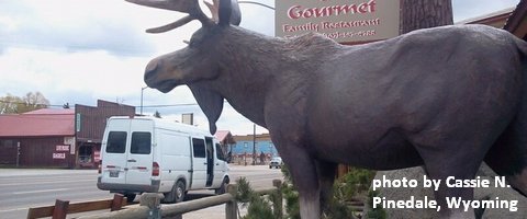
Click here for the White Sprinter Van map of the world!!!
Road and Mountain Biking
The Forest Loop road bike ride in the woods above Trout Lake is open, which means ALL the road rides are open! Saturday will be absolutely epic for road biking, especially in the morning. Light wind. Sunshine. Knebal, Eightmile and Surveyor’s are open. Fifteenmile is not. Lewis River is open. Falls Creek is open from the top down. Hospital Hill has cows on it, so there are no dogs allowed at this time.
Upcoming Events
The White Salmon Riverfest is all weekend long with the Green Truss extreme Kayaking race today and kayak and standup paddle competitions tomorrow afternoon in Husum. The Riverfest Symposium is tonight at the Husum Fire Station. The are work parties this morning at Northwestern Park, BZ Falls, the Weldon Wagon Trail, and also in Trout Lake.
Pine Hollow has a Standup Paddle race today and Pacific hermitage has a garden party. There’s also a trail run in Post Canyon at 8 and a group road bike ride form Mountain View Cycles at 9.
Coming up tomorrow, there are free BMC mountain bike demos at Sandy Ridge. Speaking of mountain biking, Falls Creek is confirmed open top to bottom, and on the road biking side, the Forest Loop above Trout Lake is also open.
Click here for the full events calendar.
Have an awesome day today!
Temira
