


Thank you for using this forecast. Like it? Find it useful? Support it (and me!) by sending some cash my way. What’s it cost to support me and get the email version? Not $99 a year. Nope. Not $49. Just $19.99 or more gets you a year. People are added to this list on Thursday and Sunday. My day job is crisis mental health, and I don’t have time on other days. Thanks for your patience! Click below to contribute. Thank you!!
 |
|
 |
Thank you for contributing and keeping this forecast going! Not ready to subscribe? No problem – please share this forecast with all your friends too! I appreciate your support!
The Forecast
| Your favorite beach | Dawn Patrol |
9am- 11:30a |
11:30a- 3pm |
3pm- dusk |
|
|---|---|---|---|---|---|
| Rooster Rock | tanning | buns | oh so | fun | |
| Stevenson | LTW | LTW | 10-13 | 12-15 | |
| Viento | 13-16 | LTW | 10-13 | 12-15 | |
| Swell (CLOSED) -Hood River | LTW | LTW | 10-13 | 12-15 | |
| Lyle to Doug’s | LTW | LTW | 10-13 | 15-18 | |
| Rufus, etc. | LTV | LTV | LTV | LTV | |
| Roosevelt & Arlington | LTV | LTV | LTV | LTV | |
Gorge Wind Forecast
Good morning, everyone! Today’s a good day for a rest from wind sports. Give that elbow tendinitis a break. If you absolutely don’t want a rest day, that’s okay! We should see just enough wind early evening for many of you to jump in the Columbia for relief from the heat. Strong wind is forecast Sunday and Monday before a potential rest on Tuesday. Maybe. I wouldn’t be surprised if that Tuesday forecast shifts.
Saturday starts with pressures of 30.05/30.01/30.01 for gradients of 0.04 and 0.00. Hmm. That’s not much at all, is it? The wind will be calmish for the morning. Early in the afternoon, it rises to 10-13 from Stevenson to Hood River. A slow build to 12-15 from Stevenson to Hood River is likely before the wind shifts eastward. Head between Lyle and Doug’s for 15-18 this evening. West of there, you’ll find 10ish. River flow yesterday was 120-227kcfs, river temp is 71F, and high temp forecast is 96F.
Cooler air on the west side starts us off with a windier start on Sunday. This situation will be dynamic and evolving thanks to an approaching trough. IN situations like this, the Corridor is generally not the best place to spend your day. Indeed, the models indicate that too. The day starts with a dawn patrol at 21-24 from Viento to Mosier. Get on that quickly. The wind quickly falls to 17-20 from Viento to Hood River and builds to 11-14 east to Arlington. That’s the plan for a couple hours. The wind then build to 22-25 from Mosier to The Dalles with 13-16 between Stevenson and Hood River. Wait a little longer, and you’ll be gifted with Lyle to Arlington as desert heating way outpaces west side heat. High temp: 87F.
Deep marine clouds set the stage for a windy Monday. Those clouds are going to push past Hood River. Take that as a suggestion that you too should head east. Dawn Patrol will be 24-27 from Viento to Arlington with 10-13 near Stevenson. Under the clouds, that wind will be quite gusty. Give the wind a few hours, and you’ll find 27-31 from Avery to Arlington with gusty 21-24 from Mosier to Doug’s and 10-13 from Stevenson to Hood River. High temp for Hood River: 76F. Lesser wind is forecast on Tuesday. Despite some spread in the models, it looks like we’ll hold on to some sort of west wind next week, but we’ll need a little more clarity in the forecast before making promises. Stay cool today!
| FORECAST SPONSORED BY / AWESOME COMPANIES TO SUPPORT | |
 |
|
Jones, Sauvie’s, Coast
Wind speed in knots. Direction Northerly unless otherwise noted for Coast. Westerly for Jones. Northerly for Sauvie Island. North/Central/South, waves. Wave forecast provided by NWS. Saturday: 20/20/25-30, W swell 3′ at 10 seconds. Sunday: NW10/10-15/25-30, W 3′ @ 9. Monday: LTNW/N5-10/25-30, W 2′ @ 9.. Jones Saturday: 21-24. Sunday: 19-22. Monday: LTW. Sauvie Island Saturday: 15-18. Sunday: 12-15. Monday: NW10.
Mt. Hood Snow Forecast
On vacation until fall unless something extraordinary happens.
Hood River Weather Forecast
Clear sky this morning intermittently adds high clouds today. Temps will be in the upper 50’s early and mid 90’s later. Light wind this morning. Light to moderate westerlies later. No rainbows. Sunday will be intermittently high overcast. Temps start in the low 60’s and rise to the upper 80’s. Moderate westerlies. No rainbows. Monday starts with low clouds. Temps will be in the upper 50’s early and mid 70’s later. Moderate to strong westerlies. NO rainbows.
Looking for a complete Columbia Gorge forecast? Looking for more humor in your weather? Obscenities? You’re looking for my TATAS: Temira’s Awesome Travel Advisory Service on Facebook.
Local-ish Events
Please let me know of outdoor-related local-ish events. If you don’t tell me, I don’t know!
Today’s the last day of the Gorge Downwind Champs. The Blowout is scheduled for this weekend.
There’s a free weekly wing foil orientation at the Hook Thursdays in July and August from 5:30pm to 7:30pm brought to you by Wylde Wind and Water and CGW2. On Tuesday and Thursday mornings at 9am, Max from GoFoil will be teaching flatwater foil pop-up technique at the Event Site. You can demo some GoFoil gear there too! He hopes to also teach bump classes in the afternoon on those days should the Hatch reopen.
Regular weekly events: NK Studios in Bingen has a donation-based yoga class at 7:30am every Tuesday. Ferment’s Tuesday night 4-mile walk/run is at 6pm. There’s meditation with monks at 5:15pm (an hour) and 6:30pm (30 minutes plus a talk) at Yoga Samadhi in White Salmon. At 7:15am on Wednesdays, there’s a run from the White Salmon Bakery. At 7am on Friday morning, there’s a run from Pine Street Bakery. On Fridays at 2:30pm, there’s a free meditation and stretching class at Yoga Samadhi. On Saturday at 9am, there’s a by-donation outdoor group fitness on the 2rd floor deck above Ferment Brewing.
Regular bike rides (thanks to the Hood River Area Trail Stewards for collecting). Tuesday is Mountain View’s ride. Meet at 5:45pm on Post Canyon Drive where the pavement ends. Wednesday is the Evo/Kickstand all-ability, no-drop Post Canyon ride. 5:30 from the shop or join along the way. All abilities welcome. Thursday is Mountain View’s women’s ride. 5:30pm, Seven Streams Trailhead. No drop. Thursday is also the Dirty Fingers Post and Pint. 5:30 from the shop or later at Family Man. This is hardcore, race-pace. Saturday morning is the Mountain View road/gravel ride. Two hours. 12-14mph average speed. Starting May 6th, Oregon Ebikes has the women’s ride at 8:30am. Meet at Seven Streams parking lot for a 1.5 to 2 hour ride.
Cycling
All trails on the 44 Road are now open. There is a fire near Boulder Lakes, and that area is under a level 3 evacuation order. That probably means Gunsight is closed at this time. Plains of Abraham is open. That completes our reporting for the summer: all trails are now open! Logging is happening on Hospital Hill. This means you cannot make a full circle – there is no connection between the front side and back side. You could ride Bad Wolf and Millennium as a loop. You can ride Roll Baby Roll and Triple Bypass as a loop. You cannot access Treehugger/Crazy Fingers at this time. Always remember to consider gravel riding! If you’re parking at Post Canyon, you will need a parking pass. Those can be purchased at many local shops or online.
Valuable Advice for Gardeners Inhabiting Neighboring Areas
It’s July. You should still be succession planting lettuce and beets. Yum.
Sprinter Van of the Week!
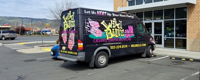 Click here for the Sprinter Van map of the world!!!
Have an awesome day!
