| Your favorite launch | dawn patrol |
morning max | afternoon max | executive session |
|
|---|---|---|---|---|---|
| Iwash (Rooster) Rock | clouds | stay | buns | play | |
| Stevenson | LTW | 10-13 | 15-18 | 15-18 | |
| Viento | 15-18 | 15-18 | 15-18 | 15-18 | |
| Swell-Hood River | 15-18 | 15-18 | 15-18 | 15-18 | |
| Lyle to Doug’s | 10-13 | 18-22 | 20-23 | 20-23 | |
| Rufus, etc: 59-74kcfs flow | 10-13 | 14-17 | 17-20 | 17-20 | |
| Roosevelt & Arlington | 7-10 | 7-10 | 10-13 | 10-13 | |
| River flow last 24 hours: 59-74kcfskcfs | =River temp: 68.36F | HR High temp: 72F | |||
Gorge Wind Forecast
Hi friends! Westerlies continue for the long haul. The lightest day of the next five looks to be Sunday, and the windiest day looks to be Tuesday. That Tuesday session will focus out east. Temps will remain in the 70-75 zone for much of this period. The exception is Tuesday, when temps will max out below 70. Plan your wetsuit selection accordingly.
Is this feeling helpful? If so, go ahead and make a contribution using Paypal to support it. Send $19.99 or more, and I’ll send the forecast to your inbox for a year.
Saturday starts with pressures of 29.92/29.85/29.83 for early gradients of 0.07 and 0.02. The early focus, despite all the clouds, will be to the west where the gradient is strongest. Viento to Swell started at 16-19. To the east, the wind was generally in the 10-13 range, and in Stevenson, where the clouds were thick and dark, the day started with 0-5mph. Clouds take their time dissipating today. Offshore high pressure combines with a weak thermal gradient for a gradual build in the wind. Models suggest the Stevenson to Hood River zone will all fill in at 15-18 late morning. Mosier to Avery rises to 18-22 with Rufus at 14-17. Afternoon wind peaks at 20-23 between Mosier and Avery with Rufus rising to 17-20, areas east of Rufus remaining under 15mph, and the Stevenson to Hood River stretch dropping to 14-17. River flow over the last 24 hours was 59-74kcfs, river temp is 68.36F, and high temp forecast is 72F for Hood River.
Weaker wind is forecast for Sunday, although there’s a chance reality could be the models. If we look at what the models have to say, we find this: 10-13 from Viento to Swell to start with 5-10 or less everywhere else. The wind stays light most of the day. We could see a bump to 14-17 from Stevenson to Hood River in the evening thanks to increasing offshore high pressure and a bit of a thermal gradient across the Cascades. No promises. High temp: 70F under partly cloudy sky.
Writing the complete forecast takes me 1-2 hours a day. If it saves you time, gas money, or helps you plan your life, please consider contributing.

We previously talked about the possibility of strong westerlies for the executive (after 5pm) session on Monday. Models keep pushing the arrival of the wind later. The latest version starts Monday with 10-13mph all the way from Stevenson to Arlington. Not much more happens until early afternoon. We then see 17-20mph from Stevenson to Mosier. After that, the wind slowly builds to 22-25 form Stevenson to Rufus around sunset. Models do hint that Swell will drop into the 15-18mph range in the evening. High temp: 75F.
That was helpful in planning your life, wasn’t it? Go ahead and subscribe to the forecast using the fancy auto-renew option. Don’t like electronic payment? No problem! You can send a check or cash to: Temira / PO Box 841 / Hood River, Oregon, 97031. Thank you so much for supporting the forecast. I’m glad you find it helpful, and I appreciate your kindness in supporting the work I’m doing!

Extended: a strong weather system approaches on Tuesday. It’ll have ample support aloft. With rain forecast for the west side, you’ll probably be heading east. That said, models do give us a mid to upper 20s dawn patrol from Viento to Mosier before the wind shifts. There’s been a lot of back-and-forth and up-and-down over the last few days. The latest model run calls for 30-33mph east of The Dalles Tuesday afternoon. Wednesday looks lighter. We start to see more range in model outputs beyond that, so we’ll leave it here for now. Have a great day today!

Jones, Sauvie Island, Oregon Coast
North/Central/South coast, waves (swell forecast provided by NWS). Wind forecast for the afternoon (unless it’s a storm on the coast, in which case that’s peak wind during the day). Wind direction N (coast/Sauvie Island) and W (Jones) unless otherwise noted. Saturday: LTNW/NW5-10/N20-25, NW swell 5′ at 10 seconds. Sunday: 20/20/25-30, NW 6′ @ 10. Monday: 15-20/15-20/25-30, NW 6′ @ 9. Jones Saturday: 11-14. Sunday: 16-19. Monday: 19-22. Sauvie Island Saturday: 11-14. Sunday: 15-18. Monday: 17-20.   Alan’s Sauvie Island Wind Sensor
Mt. Hood Weather Forecast
I’m tired. It’s on vacation.
Very basic Hood River weather forecast. Don’t plan your life around this. You really should read Temira’s Awesome Travel Advisory Service on Facebook
Clouds this morning mostly disappear this afternoon. Temps start near 60 and rise to the low 70s. Moderate westerlies. No rainbows. Sunday will be mostly cloudy then partly cloudy. Temps start near 50 and rise to 70. Light to moderate westerlies. No rainbows. Monday will be mostly clear. Temps start in the upper 40s and rise to the mi d70s. Moderate to moderately strong westerlies. No rainbows.
Link to my Local-ish Outdoorsy Events Google Calendar
Please let me know of outdoor-related local-ish events. If you don’t tell me, I don’t know!
Cycling
All vehicles on HR County forest roads need a gallon of water and a shovel. Fire or fire danger closures: Whoopdee, Underwood, Hospital Hill, most of Post Canyon, Gorge 400, trails around Mt. Adams. Dog River is closed for logging and rerouting until mid-September. Open: 44 Road Trails, Ape Canyon, Lewis River, Falls Creek, Columbia Hills, Gunsight, Boulder Lakes, Siouxon, Sandy Ridge. Twin Tunnels reopened for a day or two, and then it closed again – I have photo evidence to prove this! Remember that E-bikes are not allowed on USFS non-moto trails. They are allowed on moto trails.
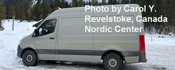
Sprinter Van of the Week!
 Click here for the Sprinter Van map of the world!!!
Have an awesome day!


