


Thank you for using this forecast. Like it? Find it useful? Support it (and me!) by sending some cash my way. What’s it cost to support me and get the email version? Not $99 a year. Nope. Not $49. Just $19.99 or more gets you a year. People are added to this list on Thursday and Sunday. My day job is crisis mental health, and I don’t have time on other days. Thanks for your patience! Click below to contribute. Thank you!!
Click here to use your PayPal
Venmo: @theGorgeismyGym
Snail Mail: PO Box 841, Hood River, Oregon 97031
(note: I am not a non-profit entity. The only way to accept credit cards with a user-defined amount is to use the ‘donate’ button. Thanks for understanding!)
Auto-renewing subscription. New! Awesome!
The Forecast
Today’s Gorge Wind – these are ranges for the average speed, not a predicted wind range. =)
Your favorite beach
Dawn
Patrol
9am-
11:30a
11:30a-
3pm
3pm-
dusk
Rooster Rock
buns
todaybun
A
okay
Steven’s Locks
LTW
5-10
10-13
10-13
Swell-Hood River
LTW
7-10
13-16
18-22
Lyle to Doug’s
LTW
7-10
13-16
18-22
Rufus, etc.
LTW
7-10
10-13
18-22
Roosevelt & Arlington
LTW
LTW
7-10
10-13
Patrol
11:30a
3pm
dusk
Gorge Wind Forecast
Yesterday’s gusty and unreliable westerlies still got plenty of you on the water, and that’s always a good thing. You’ll have steadier wind today and Wednesday with light easterlies all across the land on Tuesday. Models start to diverge in their solutions on Thursday, and the uncertainty widens over the weekend, although there are hints of wind on Saturday and especially Sunday. Don’t make plans based on that yet! Note: river flow is approaching 400kcfs. That’s a lot of current. Make sure you are prepared for self-rescue, and make sure you have the skills to be out in that kind of flow.
Monday starts with weak offshore high pressure and weaker high pressure inland. Daybreak gradients of .04 (pdx-dls) and .03 (dls-psc) hint at some wind. Combine that with an offshore reading of 1023mb. We’ll see light westerlies all through the Gorge to start. The wind builds slowly today. By 2pm, we should have 13-16 from Viento to Avery with 10-13 at Stevenson and 10-13 east of Avery. Desert heating adds a bit more to the mix later in the afternoon; 18-22 from Viento to Rufus seems reasonable with 10-13 west of Viento and 10-13 at Arlington. River flow is very high: 369-382kcfs, which really takes the Rufus stretch out of the picture for now. River temp is 55F. High temp forecast is 69F.
High pressure builds inland on Tuesday daytime, and a very weak weather system swings through overnight. The day starts calm. Midday: E 15-20 from Rooster to Viento. Afternoon: the easterlies may dip to 10-15 between Rooster and Viento, but they’ll rise to 5-10 from Swell to Arlington. High temp: 77F.
A weak front swings through in the wee hours of Wednesday. Yet another offshore low approaches late in the evening. IN between those two events, California high pressure might exert just enough influence for you to be on the river. the current forecast is 12-15 to start the day from Rowena to Boardman with 7-10 from Stevenson to Lyle. Midday: gusty 15-18 from Stevenson to Rufus with 7-10 east of Rufus. Afternoon: gusty 18-22 from Viento to Doug’s with 12-15 at Rufus, light westerlies in the desert, and 10-13 at Stevenson.
Forecast certainty plummets as we move into the Thursday-Sunday period. Some models have us under the biggest rainstorm in decades. Some have us warm and dry. We’ll keep a close eye on this, and I’ll give you a weekend forecast when models have more agreement. Have a great week!
Jones, Sauvie’s, Coast
Coast forecast (north/central/south, waves). Swell forecast provided by NWS. Wind direction northerly unless otherwise noted. Monday: LTNW/NW5-10/N20-25, SW swell 4′ at 8 seconds. Tuesday: LTE->LTW/LTE->LTW/LTV->S10-15, W swell 5′ @ 9. Wednesday: LTW?LTW/N10-15, SW 6′ @ 9. Jones Monday: 7-10. Tuesday: 11-14. Wednesday: LTW. Sauvie’s Monday: N5-10. Tuesday: W5-10. Wednesday: LTN.
Mt. Hood Snow Forecast – Back on vacation until next fall
Hood River Weather Forecast
Partly cloudy sky this morning turns clear later. Temps will be in the low 50’s early and upper 60’s later. Moderate westerlies. No rainbows. Tuesday will be clear to start then overcast then drizzly overnight. Temps will be in the upper 40’s early and upper 70’s later. Light easterlies. No rainbows. Wednesday will be partly cloudy, then clear, then high overcast. Temps will be in the mid 50’s early and mid 70’s later. Moderate westerlies. No rainbows.
Looking for a complete Columbia Gorge forecast? Looking for more humor in your weather? Obscenities? You’re looking for my TATAS: Temira’s Awesome Travel Advisory Service on Facebook.
Local-ish Events
Please let me know of outdoor-related local-ish events. If you don’t tell me, I don’t know!
Ferment’s Tuesday night 4-mile walk/run is at 6pm. At 7:15am on Wednesdays, there’s a run from the White Salmon Bakery. At 7am on Friday morning, you can get a donut and coffee for going for a run at Kickstand Coffee. The Small Boat paddlers have a group paddle at 6pm on Thursday at the Hatchery. Post and Pint happens Thursday evenings at 5:30 when Post is not too wet to ride. The women’s Post-and-Pinot ride is Wednesday evening at 5:30.
Cycling
There was an event on 5/22 on Dog River trail, which suggests it may be open. That’s not confirmed. A good portion of the Eldorado Trail (below the intersection with Riorden Hills Road (near the top, below the clearcut) is closed starting today for at least the next few days. Do not enter that area for your safety. Courtney Road (the road that goes up above Syncline) is closed until October. Do not attempt to use it to access trails. Starting now, you will need a parking pass to park at Post Canyon. This money will support trails. Hospital Hill: cows are out – no dogs allowed. Underwood: do not enter areas that are closed due to logging operations.
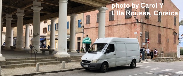
Sprinter Van of the Week!
 Click here for the Sprinter Van map of the world!!!
Have an awesome day!
