


Thank you for using this forecast. Like it? Find it useful? Support it (and me!) by sending some cash my way. What’s it cost to support me and get the email version? Not $99 a year. Nope. Not $49. Just $19.99 or more gets you a year. Click below to contribute. Thank you!!
Click here to use your PayPal
Venmo: @theGorgeismyGym
Snail Mail: PO Box 841, Hood River, Oregon 97031
(note: I am not a non-profit entity. The only way to accept credit cards with a user-defined amount is to use the ‘donate’ button. Thanks for understanding!)
Auto-renewing subscription. New! Awesome!
The Forecast
| 4a-8a | 8a-12p | 12p-4p | 4p-8p | 8p-4a | |
|---|---|---|---|---|---|
| Monday 6500′->1000′ |
 |
 |
|
 |
 |
| Tuesday 1000′->0′ |
 |
|
|
 |
|
| Wednesday 0′->10,000′ |
|
|
|
|
|
Mt. Hood Forecast
Rain on the mountain Monday morning switches to snow in the afternoon and evening. We’re then looking at a few dry days on the hill before the next round of snow moves in on Christmas Day. For Monday, expect a warm and rainy morning (it’s 40 degrees up there!). A cold front moves in around sunset and takes the snow level from 6500′ down to 1000′-1500′ or so in a matter of a few hours or less. About 0.6” water equivalent (WE) falls as rain. Another 0.6”-0.9” WE falls as snow overnight (orographics and the NW direction might give us more than models predict). That gives us 6-9” of fresh to work into the icy base. Wind: SW 20-45 int eh morning, SW 30-65 in the afternoon, NW 45-50+ around sunset and overnight.
Tuesday starts with flurries and ends clear. The snow level will be 1000′ all day. The freezing level drops to the surface overnight. About 0.1” WE falls as snow during the day, for an inch of new. No snow overnight. Wind: NW 45-50 early fades to NNW 15-20 in the afternoon and NE 10 overnight.
Wednesday and Thursday both look clear and warm. On Wednesday, the free air freezing level (above the inversion) starts at 0′ and rises to 9000′-10,000′ for slope-side temps in the upper 30’s in the afternoon. NO precip. Wind: NE 10 early, S 10 in the afternoon, and SW 15 overnight. Thursday will be clear and sunny all day with temps in the low 40’s above the inversion. No precip. Wind: SW 10-20 all day and SW 15-30 overnight.
It looks like snow will move in sometime on Christmas Day and continues through Saturday. Models do not agree on timing nor amounts. They are hinting at snow or ice in the Hood River valley, though, which could make for messy drives to the mountain. Stay tuned!
Gorge Wind Forecast
Light easterlies Monday morning give way to NUKING westerlies on Monday afternoon. Will it arrive early enough to beat the solstice darkness? Maybe. Expect E 10-20 early. The wind turns westerly late morning with gusty 18-23 west and east of the central Gorge. Mid-to-late afternoon, westerlies pick up to 30-40 all through the Gorge, all the way from Rooster Rock to Boardman. Sunset is 4:25pm, so stage yourself before the wind starts, and please ride with a partner and keep them in sight. If you are going in the river today, watch out for debris – all that rain over the last couple of days has washed logs and sticks and goodness knows what else into the Columbia.
Tuesday starts with W 10-13 in the western Gorge and 18-22 east of The Dalles. Afternoon wind fades to W 7-10 everywhere as high pressure builds inland. Wednesday starts cold (upper 20’s) with easterlies at 30-35 from Rooster to Stevenson in the morning with 40-45 at Rooster, 30-35 at Stevenson, and 20-25 at Viento in the afternoon.
Coast, Jones, Sauvie’s
As needed until next spring and summer.
Hood River Weather Forecast
Drizzle this morning turns to moderate or heavy rain between 1pm and 7pm. After that, showers. Temps will be in the mid 40’s early and upper 50’s (WARM!) in the afternoon. Light easterlies early. Moderate westerlies midday. Very strong to nuking westerlies mid to late afternoon into the night. 99% chance of rainbows. Tuesday starts with a few sprinkles and some icy roads away from the wind and above 500′. Temps will be in the upper 30’s early and mid 40’s later. Moderate westerlies turn light in the afternoon. 93% chance of rainbows. Wednesday will be Nothing and then mostly cloudy. Temps will be in the upper 20’s early and low 40’s later. Easterlies. No rainbows. Looking for a complete Columbia Gorge forecast? Looking for more humor in your weather? Obscenities? You’re looking for my TATAS: Temira’s Awesome Travel Advisory Service on Facebook.
Cycling
Volunteers needed! Columbia Area Mountain Bike Advocate (CAMBA) is doing small projects at the Syncline this winter: treadwork and trail maintenance. Show that we care and want to protect it! Due to COVID restrictions, work party numbers are limited, so if you can help, contact Ann 509-637-three seven one three. Hikers, runners, mountain bikers, and sightseers all welcome! Do be aware of the possibility of freeze-thaw (muddy) conditions, especially on trails that are not under a tree canopy. Do not ride if it was below freezing last night and is above freezing when you want to ride. The soil structure will be liquefied, and you will do permanent damage to trails. Consider riding gravel roads instead.
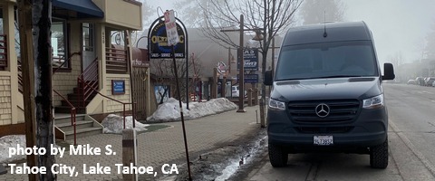
Sprinter Van of the Week!
 Click here for the Sprinter Van map of the world!!!
Local Events
Weekly events: The Kainos Coffee run happens in The Dalles every Tuesday morning at 6am. There are sailboat races at the Hood River Marina every Wednesday evening. Dirty Fingers has a group mountain bike ride (bring lights) Wednesday nights at 5:30pm. Cheno has an outdoor HIIT workout at Griffin House in Hood River at 6pm on Wednesday nights. There is a BLM rally every Tuesday evening at 5:30 at the Salmon Fountain in Hood River, and there’s a White Coats for BLM rally every Thursday at noon at 12th and May in Hood River. Have an awesome day!
