Random Morning Thoughts

I was driving around yesterday after windsurfing, and I had this feeling of utter relaxation. I stopped my thoughts and had a look at where that nice feeling was coming from. Part of it was that I’d just gotten off the water, sure. Part of it was being part of a community of silly people who think windsurfing in 30+mph is fun. And part of it was anticipation of Snowpocalypse II, 2014. I was pretty surprised to see that part. After all, snow and ice are a pain in the butt.
But then I realized that a snowstorm is one of the few things that allows me to stop and take some time for myself without feeling pressure to get s**t done. And the point of that is that I probably don’t take enough Me Days. None of us do. So even if you can’t turn Snowpocalypse II, 2014 into a Me Day, plan one for the near future. Because you deserve it. But before you go all “me day” on everyone today, go put your freakin’ snow tires on, okay?
Thank you for using this forecast!
Please donate to support it!
Thank you to everyone for using this forecast. Does it save you time, gas money, or help you find more wind, powder, or just plain fun stuff to do? Please consider making a donation to keep it going! Use it here for free or make a donation and get on the mailing list for wind for the summer and Mt. Hood snow in the winter. It’s not $99/year. Not $50/year. No, just $12.34 or more gets you on the list for 12 months. Do it via PayPal/CC by clicking on my happy photo below. Don’t PayPal? You can send a check to Temira @ PO Box 841 in Hood River. Thank you for your support, and thank you for trusting my forecast. You guys mean the world to me.

 |
4a-8a | 8a-12p | 12p-4p | 4p-8p | 8p-4a |
|---|---|---|---|---|---|
| Today |  |
|
|
|
|
| Tomorrow | |
|
|
|
|
| The next day | |
 |
 |
 |
 |
Mt. Hood Snow
The next 2.5 days will be sunny and dry on Mt. Hood. The free air freezing level (FAF) will be around 1000’ all day today with NE wind at 15-20 becoming E at 15-25 this afternoon. Tomorrow sees the FAF at the surface with 5000’ temps in the teens (brrrrrr). Wind will be E 20-30.
Wednesday starts off sunny with the FAF at the surface and 5000’ temps in the low double-digits. Clouds move in during the afternoon, and precip starts around midnight. The snow level will initially be at the surface due to a deep cold pool, but this is a warm system moving in, and temps in this system support a snow level of 7000’. So, expect some snow to fall on Wednesday night, perhaps 2-4” if we are lucky, before a switch to mixed precip. Wind on Wednesday will be E 30 early, switching to W 15 in the evening and rising to W 40 overnight.
So, we may start as snow in the wee hours of Thursday, but we’ll likely see a switch to a mix of sleet and freezing rain by daybreak, as temps rise above freezing at the 7000’ level. We’ll see 1” water value between 10pm Wednesday and 10am Thursday, for a lot of mixed winter precip on top of the snow that falls initially. By Thursday afternoon, when the next weather system hits, the snow level will be around 7000’. Expect 2-3” of rain Thursday night into Friday morning.
Models diverge on the weekend forecast.
Gorge Wind
.I really was convinced that I was done windsurfing for the year until I read my own forecast yesterday, saw the numbers on the river, and saw temps in the mid 50’s. I had a lovely time at Rowena with Dale and Sam and Todd and some other folks. Sounds like Rufus was epic, so good work to those of you who risked the drive. No word on Arlington or Threemile, but I betcha they were good too. It was a nearly perfect weather setup, after all.
We started the week with a pdx-dls gradient of W .03, but the west gradient will switch to east quickly today, and we’ll end up with easterlies at 26-30 at Rooster and 22-25 at Steven’s Locks by afternoon.
Tomorrow brings east wind at 40-50+. Wednesday brings easterlies at 50-60+. Thursday starts with easterlies at 30-40+. The east wind will fade on Thursday as a weather system pushes over the top, attempting to swing Gorge gradients around. It looks like it will take until the wee hours of Friday for us to go back to west wind.
Gorge Weather
As of this morning, it still looks like you’ll want your snow tires on by late Wednesday night, but it’s looking like temps will warm up faster than earlier model runs, so it’s just going to be a snowstorm, not a Snowpocalypse.
In the meantime, expect a sunny day today. Temps will be in the low 40’s early and the low 50’s this afternoon. No rainbows, duh. Tomorrow looks sunny and cold. Temps will be in the low 30’s early and the upper 30’s in the afternoon. Expect east wind to pick up through the whole Gorge today, tomorrow and Wednesday.
Wednesday starts off sunny, and then clouds move in during the afternoon. Temps will be in the mid 20’s early and the mid 30’s in the afternoon, returning to sub-freezing overnight. Precip will start around 1am Thursday morning, and that’s probably going to be snow.
We’re looking at .5” water value coming in before 10am on Thursday, and that’s going to fall as a mix of snow and freezing rain. Expect 2-3” of snow early, followed by freezing rain as upper-elevation temps warm above freezing. We’ll see a break in the precip between 10am and 4pm. The tricky part of this forecast is what happens after 4pm Thursday when the next system, containing 1-2” water value, hits us.
The 12k surface temp model for the Gorge predicts we won’t go above freezing until midnight on Thursday. If that’s correct, we could see .2-.5” freezing rain before a switch to rain. I’m leaning away from that scenario, but what do I know? Either way, we’re going to see snow and freezing rain on Thursday morning, so get those snow tires on and dust off your sled.
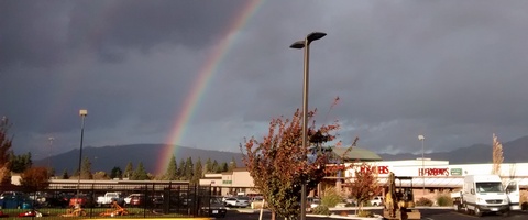
White Sprinter Van of the Day with Double Rainbow – Hell yeah!
Road and Mountain Biking
Today would be a great day to ride Syncline or Whoopdee, because they’re both likely to go freeze-thaw tonight, when sub-freezing temps are forecast. And if they don’t go freeze-thaw tonight, it’ll happen tomorrow night, when we’re looking at a low in the mid 20’s. So ride today. Do it while you can! And road bikers, I’m serious: you have today, tomorrow and Wednesday to ride before the roads are covered in gravel.

The Clymb: free membership. Cheap gear.
Temira approves. Click to join.
Events – email me if I’ve missed any outdoor-related events
It occurred to me that I can use my phone to look at Google Calendar, since my computer won’t do it. Tonight is community Yoga, free or by donation, at 6:30 at Yoga Samadhi in White Salmon. There’s pickup touch rugby at 5:30 at the Hood River Marina tomorrow night, and there’s the Tri Club’s headlamp run in Post Canyon at 6:15 (meet at the bottom of Post Canyon Road). Also tomorrow night, there’s $12 Prime Rib at Cebu from 5pm to 9pm.
Have an awesome day today!
Temira