


Thank you for using this forecast. Like it? Find it useful? Support it (and me!) by sending some cash my way. What’s it cost to support me and get the email version? Not $99 a year. Nope. Not $49. Just $19.99 or more gets you a year. People are added to this list on Thursday and Sunday. My day job is crisis mental health, and I don’t have time on other days. Thanks for your patience! Click below to contribute. Thank you!!
 |
|
 |
Thank you for contributing and keeping this forecast going! Not ready to subscribe? No problem – please share this forecast with all your friends too! I appreciate your support!
The Forecast
| Your favorite beach | Dawn Patrol |
9am- 11:30a |
11:30a- 3pm |
3pm- dusk |
|
|---|---|---|---|---|---|
| Iwash (Rooster) Rock | E50 | E50 | E40 | E40 | |
| Stevenson | E30-35 | E35 | E30-35 | E30-35 | |
| Viento | E20-25 | E20-25 | E20 | E20 | |
| Swell-Hood River | LTE | LTE | LTE | LTE | |
| Lyle to Doug’s | LTE | LTE | LTE | LTE | |
| Rufus, etc. | LTE | LTE | LTE | LTE | |
| Roosevelt & Arlington | LTV | LTV | LTV | LTV | |
Gorge Wind Forecast
 Ripping easterlies continue for the next couple of days before fading. There’s still a chance of big west wind on Sunday. Despite the enthusiasm of the operational GFS, the ensembles aren’t on board with this. So, we’ll have to wait a few days and see if more members agree with this plan. In the meantime…
Monday starts with pressures of 30.21/30.43/30.43 for an east gradient of 0.22. Nice, very nice! Iwash (Rooster) was 50mph to start the day. Stevenson: 28. Viento: 23. Thanks, iWind/iKite for those numbers. The wind rises to 30-35 near Stevenson midday. In the afternoon, Iwash drops to 40, and Stevenson holds near 30. River flow yesterday was 102-146kcfs, river temp is 50F, and high temp forecast is 40F. Tuesday starts with 30-35 at Stevenson and 40-45 at Iwash. Afternoon wind drops to 20-25 at Stevenson and 30-35 at Iwash. High temp: 39F. Wednesday starts with 25ish from Iwash to Stevenson. Iwash turns nearly calm midday, and Stevenson drops to 15. High temp: 42F.
Less wind is forecast Thursday through Saturday. Sunday’s the wild card – the operational GFS brings a deep, compact low through the PNW to the north of the Columbia. If this pans out, we’ll have westerlies at 40+ all the way from Stevenson east to Boardman. Fingers crossed for y’all – I’ll be out of town that day, but I’ll cheer for you if it happens!

| FORECAST SPONSORED BY / AWESOME COMPANIES TO SUPPORT | |
 |
|
Jones, Sauvie’s, Coast – On vacation ‘til summer unless otherwise noted
Mt. Hood Snow Forecast – intermittent forecasts until ski season
Good news: there’s snow in the forecast Thursday through early Saturday. Bad news: there’s lots of rain, Pineapple Express style, in the forecast starting midday Saturday through next Tuesday or so. Models don’t yet agree on how much snow or how much rain, but the general picture is consistent.
Between now and then, the mountain sees three days of sunshine. Contrast that with the fog and low clouds many places, and you’ll find the slopes, snow or no snow, are the place to be! Monday will be sunny. The free air freezing level (FAF) will be 11,000′ all day. Wind will be light southerly. Tuesday will be sunny in the morning with a few scattered high clouds later. The FAF starts at 10k, falls to 7000′ by the afternoon, and drops to 6000′ overnight. Wind: W 15 in the morning, NW 5-10 in the afternoon, and W 10 overnight. Wednesday: partly cloudy with a FAF at 6000′ in the morning and 4000′ in the afternoon. W wind at 10-15mph.
Light snowfall starts late morning (probably) on Thursday, and the intensity picks up overnight. The snow level near Mt. Hood will vary from 0-1000′ when the precip arrives, and it may fall to 0′ in the Gorge overnight. Effective snow level for snow quality purposes based on 5000′ temps: 4000′ during the day and 2000-2500′ after midnight. About 0.1” water equivalent falls before sunset for an inch of new. Overnight 0.2” to 0.4” is forecast for 2-4” new. Wind: W 10 early, SW 10-20 in the afternoon, and WNW 25-30 after midnight. Snow continues on Friday with the snow level around 2500′. It’s unclear how much snow we’ll pick up. Call it 6-12” for now. Snow continues through midday Saturday before switching to rain. The intraquartile range for snow before the switch to rain is 12-23”. Fingers crossed. Once it switches, models hint at LOTS of rain between Saturday midday and next Tuesday. Ho hum. That’s the wrong kind of precipitation and the wrong amount of it for sure!
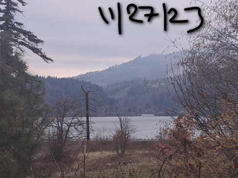
Hood River Weather Forecast
Nothing sticks around for most of the day. Temps will be in the low 30’s early and near 40 later. Easterlies. No rainbows. Tuesday will be Nothing early and partly cloudy later. Temps start in the mid 20’s and rise to the upper 30’s. Easterlies. No rainbows. Ditto on Wednesday, expect the wind should turn nearly calm in the afternoon. A little snow (or mixed precip) is possible Thursday night.
Looking for a complete Columbia Gorge forecast? Looking for more humor in your weather? Obscenities? You’re looking for my TATAS: Temira’s Awesome Travel Advisory Service on Facebook.
Local-ish Events
Please let me know of outdoor-related local-ish events. If you don’t tell me, I don’t know!
Amayah’s has their one-year anniversary party in Biggs. Also, every first Thursday, 1pm to 4pm, they are offering free meals to all. Yup. That’s right. Free Amayah’s once a month!
Regular weekly events:. NK Studio’s by-donation Tuesday morning yoga class is back. Ferment’s Tuesday night 4-mile walk/run is at 6pm. There’s meditation with monks at 5:15pm (an hour) and 6:30pm (30 minutes plus a talk) at Yoga Samadhi in White Salmon. The Tri Club is done for the season. At 7:15am on Wednesdays, there’s a run from the White Salmon Bakery. At 7am on Friday morning, there’s a run from Pine Street Bakery. On Fridays at 2:30pm, there’s a free meditation and stretching class at Yoga Samadhi. On Saturday at 9am, there’s a by-donation outdoor group fitness on the 2rd floor deck about Ferment Brewing.
Cycling
Regarding the trails in general: don’t ride in the mud. You’ll damage the trails. Don’t ride trails if it was below freezing the previous night and is above freezing when you want to ride. Ride gravel. Ride your trainer. Build trails. There are trail builders seeking extra hands on seven additional miles of trail on Whoopdee. Contact HRATS for more information. If you’re parking at Post Canyon, you will need a parking pass. Those can be purchased at many local shops or online.
Sprinter Van of the Week!
 Click here for the Sprinter Van map of the world!!!
Have an awesome day!
