


Thank you for using this forecast. Like it? Find it useful? Support it (and me!) by sending some cash my way. What’s it cost to support me and get the email version? Not $99 a year. Nope. Not $49. Just $19.99 or more gets you a year. People are added to this list on Thursday and Sunday. My day job is crisis mental health, and I don’t have time on other days. Thanks for your patience! Click below to contribute. Thank you!!
 |
|
 |
Thank you for contributing and keeping this forecast going! Not ready to subscribe? No problem – please share this forecast with all your friends too! I appreciate your support!
The Forecast
| Snow level | 4a-8a | 8a-12p | 12p-4p | 4p-8p | 8p-4a |
|---|---|---|---|---|---|
| Monday 4000′->6000′ |
 |
|
|
|
 |
| Tuesday 6000->4000′ |
|
|
 |
 |
|
| Wednesday 4000′ |
|
 |
|
|
|
Mt. Hood Snow Forecast
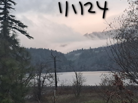
Happy new year, skiers and snowboarders and Nordic folk. It’s a sunny start to the new year on Mt. Hood, and we have good news in the forecast. Hooray! Starting Friday, the pattern shifts to cooler/wetter, and system after system sweeps in from the northwest, the ideal setup for Mt. Hood. By the end of next week, Skibowl and Teacup should join the already-open Timberline and Meadows. 14 day snowfall percentiles look great. 25Th: 39”. 50th: 51”. 90th: 70”.
Let’s look at Monday, day one of 2024. Clear sky sticks around all day. High clouds arrive after midnight. The free air freezing level (FAF) will be 4000′ in the morning, 5500′ in the afternoon, and 6000′ after midnight. No precip. Wind: light SW all day long building to S 10-20 after midnight. Darn ideal for a cruiser groomer day on Mt. Hood!
Tuesday starts cloudy. Snow arrives late morning or early afternoon and sticks around all night. Models aren’t sure just how much snow, but they’re more optimistic today than they were yesterday. The snow level will be 6000′ early, 4000′ when the precip arrives, and 3500-4000′ after midnight. About 0.1” water equivalent (WE) is forecast before sunset, for an inch of new. Overnight, models drag in 0.2” to 0.3” WE for 2-3” additional snow. Wind: S 10-20 in the morning, SW 10-20 in the afternoon, and light southerly after midnight.
Light snow on Wednesday morning gives way to partly cloudy sky in the afternoon and clear sky overnight. The snow level will be around 4000′ for the 24 hour period. About 0.1” WE is forecast before the weather turns dry. That’s just one more inch of snow. Wind: Light southerly in the morning, light easterly in the afternoon, and NW 10-15 after midnight.
Clear weather on Thursday should be great for riding some packed powder groom. Significant snowfall (finally!) arrives on Friday. Models still don’t agree on how much snow or how much wind (the latest run has enough wind to shut down all the resorts and knock down some trees, but that wasn’t what we had in the models yesterday). We should pick up at least a foot of snow from this system. Snow continues during the day on Saturday and tapers off Saturday night leaving us with a mostly dry day on Sunday. The snow level for this system will be 2500′ to start and will fall to 1500′ or less. That’s great news for Skibowl, Teacup, and Meadows Nordic, as well as good news for powder hounds at Timberline and Meadows. Looking at the extended forecast, we have a series of systems coming in from the NW with temps remaining cool. Good. Very good. Happy new year!
Gorge Wind Forecast
 Hi friends, and happy new year! 2024 kicks off with three days of easterlies followed by a light day and perhaps a shot at a west wind day on Friday. More on that potential westerly day later. Monday starts with pressures of 30.22/30.31/30.33 for east gradients of 0.11 and 0.02. The Iwash (Rooster) and Viento sensors are down, but I’d guess 35-40 at Iwash with 20-25 at Stevenson. Easterlies hold under cloudy sky. River flow yesterday was 112-131kcfs, river temp is 45F, and high temp forecast is 44F.
Tuesday looks a bit windier, but there will be rain in the afternoon. Get on it if you want it! The day starts with 25-30 at Stevenson and 40-45 at Iwash. The wind dips to 35 midday at Iwash and returns at 35-40, but remember, it’ll be raining in that later time period. High temp: 41F under cloudy sky. Wednesday starts with drizzle and ends dry with low clouds in the western Gorge. Wind will be 30ish at Iwash in the morning and 20-25 in the afternoon. Stevenson: 20-25 fading to 15-20. High temp: 43F. Thursday looks either light easterly or calm. Models have been all over the place on the forecast for Friday. The latest run is the best of them all. It calls for a compact low to sweep inland midday with high pressure building behind. This would result in a few hours of W 40 all the way from Stevenson to Threemile. Ensembles are NOT on board with this as of today, but some sort of west wind is likely Friday. Keep in mind that yesterday’s forecast for Friday was in the upper teens (I actually don’t think I wrote down a number, but that’s what it was). So… vote for today’s model run, and also vote against regression to the mean. Have a great first day of 2024!

| FORECAST SPONSORED BY / AWESOME COMPANIES TO SUPPORT | |
 |
|
Jones, Sauvie’s, Coast – On vacation ‘til summer unless otherwise noted
Hood River Weather Forecast
Nothing sticks around all day. Temps will be in the upper 30’s early and low to mid 40’s later. Easterlies. No rainbows. Tuesday will be Nothing. Drizzly arrives in the afternoon. Temps start in the mid 30’s and rise to the low 40’s. Easterlies. No rainbows. Wednesday will be cloudy with a chance of sun breaks. Drizzly in the morning gives way to mostly dry weather in the afternoon. Temps start in the mid 30’s and rise to the low 40’s. Easterlies. 18% chance of rainbows.
Looking for a complete Columbia Gorge forecast? Looking for more humor in your weather? Obscenities? You’re looking for my TATAS: Temira’s Awesome Travel Advisory Service on Facebook.
Local-ish Events
Please let me know of outdoor-related local-ish events. If you don’t tell me, I don’t know!
Registration is open for Gorge Ultimate winter league. Sign up here: https://gorge.ultimatecentral.com/e/winter-league-2024 – Teacup has an après ski fundraiser at the Ruins on January 27th. $25. Amayah’s Indian Cafe (Biggs) offers a free meal every first Thursday from 1-4pm.
Regular weekly events:. NK Studio’s by-donation Tuesday morning yoga class is back. Ferment’s Tuesday night 4-mile walk/run is at 6pm. There’s meditation with monks at 5:15pm (an hour) and 6:30pm (30 minutes plus a talk) at Yoga Samadhi in White Salmon. The Tri Club is done for the season. At 7:15am on Wednesdays, there’s a run from the White Salmon Bakery. At 7am on Friday morning, there’s a run from Pine Street Bakery. On Fridays at 2:30pm, there’s a free meditation and stretching class at Yoga Samadhi. On Saturday at 9am, there’s a by-donation outdoor group fitness on the 2rd floor deck about Ferment Brewing.
Cycling
Regarding the trails in general: don’t ride in the mud. You’ll damage the trails. Don’t ride trails if it was below freezing the previous night and is above freezing when you want to ride. Ride gravel. Ride your trainer. Build trails. There are trail builders seeking extra hands on seven additional miles of trail on Whoopdee. Contact HRATS for more information. If you’re parking at Post Canyon, you will need a parking pass. Those can be purchased at many local shops or online.
Sprinter Van of the Week!
 Click here for the Sprinter Van map of the world!!!
Have an awesome day!
PREVIOUS POSTS
- Sunday Mt Hood snow forecast & Gorge wind n’ weather: mild and (mostly) dry this week…
- Pi Day Mt Hood snow forecast & Gorge wind n’ weather: “high winds may affect lift ops” and will also make for a nice windsport day in the Gorge.
- Friday Mt Hood snow forecast (rain) and Gorge wind (west) n’ weather: heavy rain for the slopes and strong, gusty westerlies in the Gorge
- Thursday Mt Hood snow forecast & Gorge wind n’ weather: massive snow/rain for Mt Hood. Downpour driving in the Gorge.
- Wednesday Mt Hood snow forecast and Gorge wind n’ weather: something for everyone – heavy snow, strong wind, warm next week…

Have an awesome day.
Love, Temira