GORGE LAUNCH SITE GUIDE
THIS MAP IS CLICKABLE.
YOU JUST HAVE TO BE VERY PRECISE WITH YOUR MOUSE. =)
ROOSTER (IWASH) ROCK
- WIND DIRECTION: easterly
- SKILL LEVELS YOU MIGHT SEE HERE: intermediate+
- CURRENT: moderate, same direction as the wind
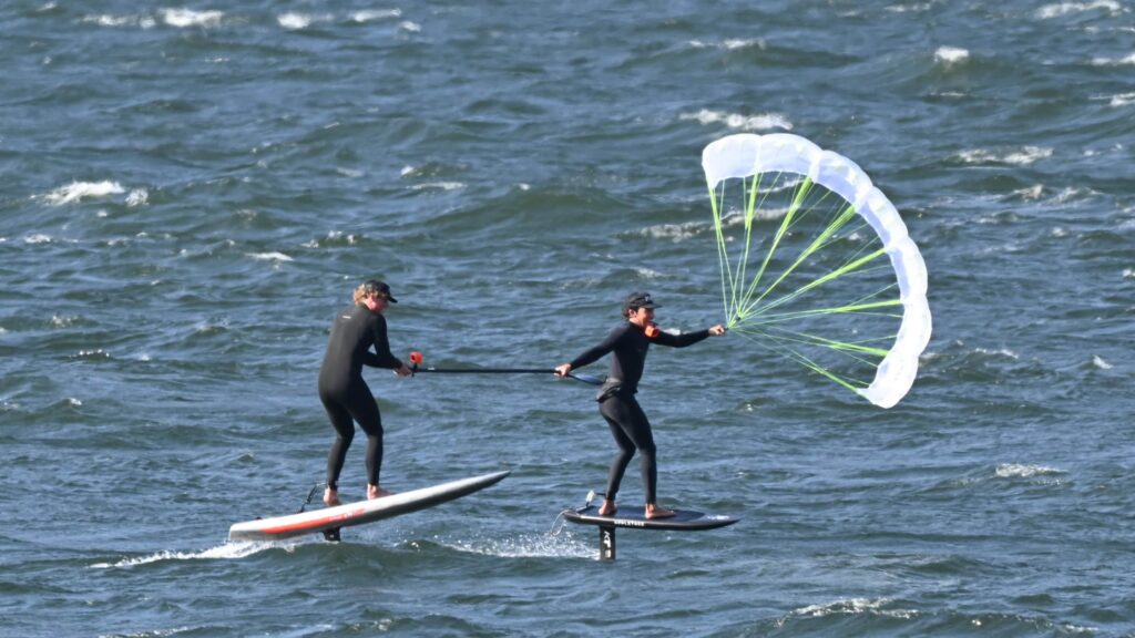
- SPORTS THAT LAUNCH HERE: kiteboarding, winging, windsurfing, parawing
- MAX SWELL SIZE: S/M
- BEST FOR: nuking easterlies, getting naked at the naked beach, short commute from the metro area
- AMENTIES: grassy rigging, flush toilets, shady hangout areas, nude beach, sandy beach
- COST / PARKING PASS: $10 daily, $30 for one year, $45 for two years via Oregon State Parks
Back in the day, long before Lewis and Clark wandered down the Columbia, the Siletz, Warm Springs, Clackamas, Yakama, and other tribes lived here. When they saw an enormous phallus-shaped monolith rising next to the Nch’i Wana (Big River, aka Columbia), they named it “Iwash” or “penis” in Chinook jargon.
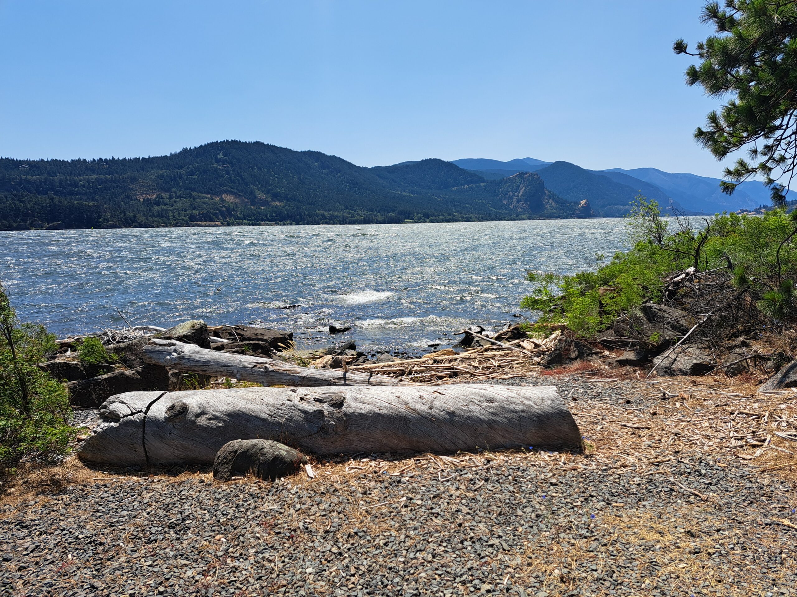
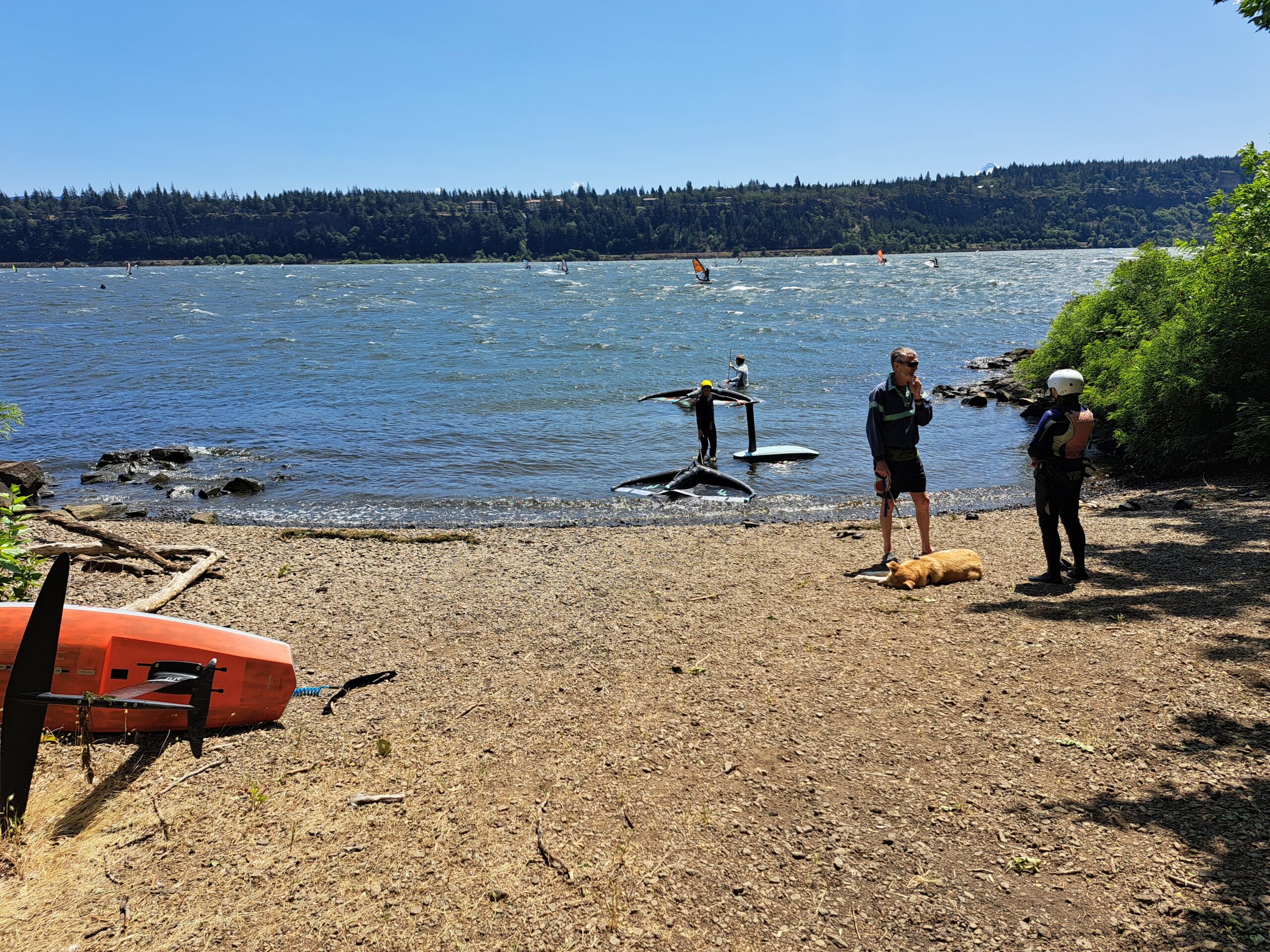
But you’re not there for the rock or the naked beach (it’s to the east of the wind sport launch and is clearly marked). You’re going to Iwash for windsports. You’ll only be headed there in the winter or late summer – it’s an east wind spot.
Expect a grassy launch and a long walk through sand to get to the water’s edge; during lower-flow times of year, the walk will be at least a couple hundred yards. At high water in the winter, the stairs down to the water will drop you right in the river.
While mellow days are possible at Iwash, it’s really known for super-nukers. Average speeds there can top 60mph on the windiest days. Smoke blows all the way across the river. Neither you nor me nor anyone else is going out.
While the swell isn’t huge here, it’ll show up on the windiest days, enough for you to jump and float and get at least some swell riding in.
Sports that will work here: all of them. Downwinders can be done from Dalton Point.
Skill level: if it’s nuking, you’d better be an expert. Be prepared for very cold water, very strong wind, and downwind hazards such as pilings. Current runs the same direction as the wind.
Amenities: flush toilets, sandy beach, grassy launch, naked beach.
STEVENSON
- WIND DIRECTION: westerly or easterly
- SKILL LEVELS YOU MIGHT SEE HERE: intermediate to advanced
- CURRENT: moderate
- SPORTS THAT LAUNCH HERE: kiteboarding, windsurfing, windsurf foiling, wing foiling, parawing, outrigger canoes, surfskis
- MAX SWELL SIZE: S
- BEST FOR: flat water shredding
- AMENTIES: sandy launch?
- COST / PARKING PASS: It’s free, but it’s also illegal to cross the railroad tracks.
BOB’S BEACH
- WIND DIRECTION: westerly or easterly
- SKILL LEVELS YOU MIGHT SEE HERE: intermediate to advanced
- CURRENT: moderate
- SPORTS THAT LAUNCH HERE: kiteboarding, windsurfing, windsurf foiling, wing foiling, parawing, outrigger canoes, surfskis
- MAX SWELL SIZE: S
- BEST FOR: flat water shredding
- AMENTIES: sandy launch?
- COST / PARKING PASS: It’s free, but it’s also illegal to cross the railroad tracks.
THE POINT AT STEVENSON
- WIND DIRECTION: westerly or easterly
- SKILL LEVELS YOU MIGHT SEE HERE: intermediate to advanced
- CURRENT: moderate
- SPORTS THAT LAUNCH HERE: kiteboarding
- MAX SWELL SIZE: S/M
- BEST FOR: flat water shredding
- AMENTIES: sandy launch?
- COST / PARKING PASS: It’s free, but it’s also illegal to cross the railroad tracks.
HOME VALLEY
- WIND DIRECTION: westerly or easterly
- SKILL LEVELS YOU MIGHT SEE HERE: intermediate to advanced
- CURRENT: moderate
- SPORTS THAT LAUNCH HERE: windsurfing, parawing, wing foil, potentially outriggers/surfskis, SUP foil on easterlies
- MAX SWELL SIZE: S
- BEST FOR: flat water shredding, launching for east wind downwinders
- AMENTIES: blackberries, lots of them
- COST / PARKING PASS: free
VIENTO
- WIND DIRECTION: westerly or easterly
- SKILL LEVELS YOU MIGHT SEE HERE: intermediate+
- CURRENT: moderate
- SPORTS THAT LAUNCH HERE: kiteboarding, winging, windsurfing, SUP downwind, SUP foil downwind, parawing, outrigger canoes, surfskis
- MAX SWELL SIZE: S
- BEST FOR: flat water shredding, downwind launching
- AMENTIES: grassy rigging, vault toilet, shady hangout areas, nearby camping
- COST / PARKING PASS: $10 daily, $30 for one year, $45 for two years via Oregon State Parks
HOOD RIVER WATERFRONT
THE HOOK
- WIND DIRECTION: westerly
- SKILL LEVELS YOU MIGHT SEE HERE: beginner on up
- CURRENT: moderate
- SPORTS THAT LAUNCH HERE: winging, windsurfing, kayaking, inflatable unicorns, etc.
- MAX SWELL SIZE: S
- BEST FOR: learning
- AMENTIES: porta-potty, great view, rentals, astro-turf rigging area
- COST / PARKING PASS: hourly parking $2.75/hr max $15/day
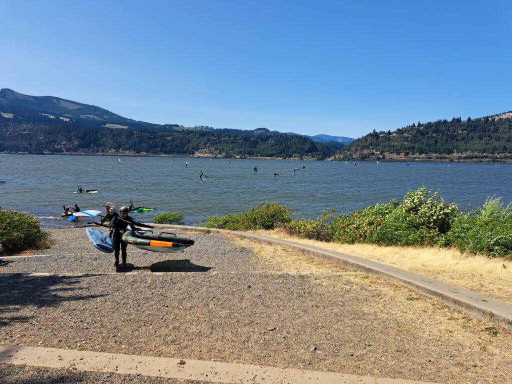
The Hook, located at the far west end of the Hood River Waterfront down a dusty dirt road, is a great place to learn winging and windsurfing – the wind is directly onshore, the current is minimal (except early in the season), and the water is shallow. Mess up, and you’ll get blown downwind to shore. The downside is that the wind is very gusty, and there’s a bit wind shadow behind Wells Island. There’s a semi-sheltered area you can rig your gear, but make sure you have a weight to hold your gear down; stuff often goes flying here as the wind whips over the embankment to the river. Head to The Hook and you’ll find lots of people learning to waterstart or wing. It’s also a great place to just chill in the river on a hot day. Head there at sunset for a spectacular view, and head there on a hot day for a bit of relief from the proximity to the Columbia.
Access to the river is down a wide paved path. When it’s really windy, navigating this can be tricky, as the wind blows directly onshore and accelerates up the hillside. Be careful! The river entrance is a mix of slippery river rock and sandy areas, but once you get out a little farther, it’s a pleasant sandy bottom.
It’s a comforting place to learn watersports, and it’s a decent place to advance. It can be hard to navigate the wind shadow east of Wells Island, but once you’re past it, you can make your way towards the main river channel. Swell increases in size the farther north you go. It can be a bit disorganized below the Spring Creek Hatchery area buoys and the White Salmon River, so make your way upwind of the channel marker buoys for better conditions. Expect the wind to increase the farther west towards the Hatchery you go. Once you’ve mastered this spot, you’re ready to advance to the Waterfront Park, Event Site or perhaps Mosier or Rowena or Stevenson.
WATERFRONT PARK / LUHR JENSEN
- WIND DIRECTION: westerly
- SKILL LEVELS YOU MIGHT SEE HERE: beginner on up
- CURRENT: minimal on the OR side, potentially strong on the WA side
- SPORTS THAT LAUNCH HERE: wing foil, windsurfing, windsurf foil, parawing. Takeout for downwinders for outriggers, surfskis, SUP foil.
- MAX SWELL SIZE: nearly flat on the OR side. M/L possible on the WA side.
- BEST FOR: learning flat-water tricks and progressing your skills
- AMENTIES: amazing grassy rigging area, picnic shelters, nearby restaurants, socializing
- COST / PARKING PASS: $125-$350 for parking in at Luhr Jensen, Event Site, and Lot 1. Free on-street parking, max 2 hours. Many people ride to here with their gear on e-bike trailers.
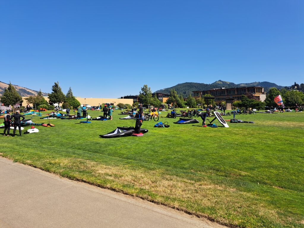
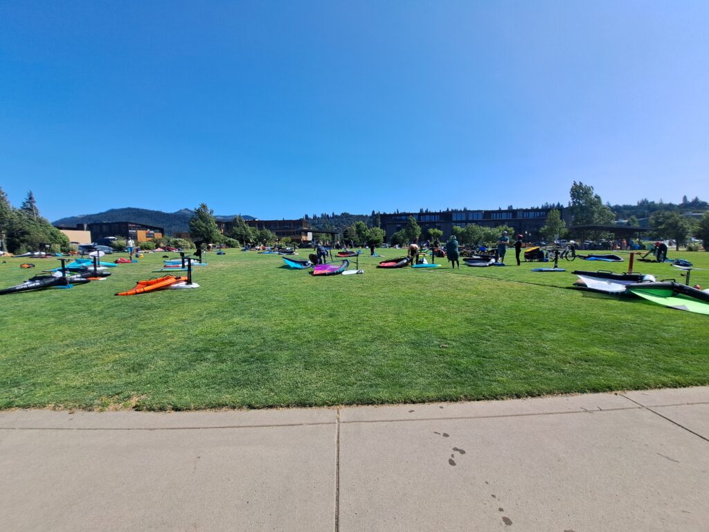
The Hood River Waterfront Park is luxurious as far as windsport launches go. A vast, perfectly manicured lawn is awaiting your gear and bare feet. Scattered trees provide shade. Access to the river is via a wide set of gradual stairs filled with pea gravel. The actual water entrance gets slippery, so be careful! Also available – lots of food! The Waterfront park is located across the street from breweries, restaurants, and a coffee shop.
The river near the launch is nearly swell-free. Swell size increases as you head north across the river; it’s a great place to progress your swell-riding skills and comfort level. Stay close to shore, and you’ll avoid all interactions with barges. While the wind can be quite gusty until you get into the river channel (where you’ll wish you had a half-meter or meter less sail), there’s usually plenty to get you up and going. And conditions near shore are great for learning tacks, jibes, and flat-water tricks.
Added bonus: this is THE social spot for local windsport enthusiasts who are into winging. Want to meet people who’ve been in the windsport world for decades? This is the place – they’re all hanging out mastering the latest sport, and they’re all catching up with each other on the beach after a good session on the river. Thanks to this, and thanks to the proximity of so many food/beverage spots, parking can be tight. Consider riding an e-bike with a trailer. Even having a parking pass won’t guarantee you parking; the Luhr Jensen lot fills quickly, and people stay in those spots all day.
EVENT SITE
- WIND DIRECTION: westerly
- SKILL LEVELS YOU MIGHT SEE HERE: beginner on up
- CURRENT: moderate
- SPORTS THAT LAUNCH HERE: windsurfing and winging on the west side. Kiteboarding on the east side. Takeout for downwind outrigger canoe, surfski, SUP downwind (not SUP foil).
- MAX SWELL SIZE: nearly flat on the OR side. M/L possible on the WA side.
- BEST FOR: learning flat-water tricks and progressing your skills
- AMENTIES: grassy rigging, flush toilets, picnic tables, some shade, nearby restaurants, socializing, sandbar downwind to catch you if you can’t stay upwind.
- COST / PARKING PASS: $125-$350 for parking in at Luhr Jensen, Event Site, and Lot 1. Free on-street parking, max 2 hours.
The Event Site is owned by the Port of Hood River, a private company whose cash cow, the Hood River Bridge, has helped fund waterfront access for years. It has a huge, but not huge enough, paved parking lot with a huge overflow dirt parking area just to the south. Best thing about the Event Site: lots of grassy rigging space.
In the past, the Port has restricted kite landing and launching to high-water times only, but that’s not the case now. The east end of the Event Site is reserved for kite launching and landing. West end: all other sports, conveniently located upwind of the launching and landing kiters.
Out in the river, you’ll find flat water on the inside and small to medium swell out in the river channel. If you’re in the channel, stay alert – it can be difficult to spot barges coming from the east due to downwind clutter such as the Hood River Bridge, the mill at Bingen, and parked barges. Upwind of this launch is the Hood River Waterfront Park, where you’ll see hundreds of wing-foilers zipping across the water like butterflies. There’s often quite a bit less wind in front of the Event Site than the WAterfront Park. Be on the lookout for wingers unable to get back on foil and beginning wingers getting blown down to the Sandbar. You too can count on the sandbar as a backstop to your downwind drifting, should you go to the Event Site. In low water, it’s generally possible to walk to the sandbar from the Event Site.
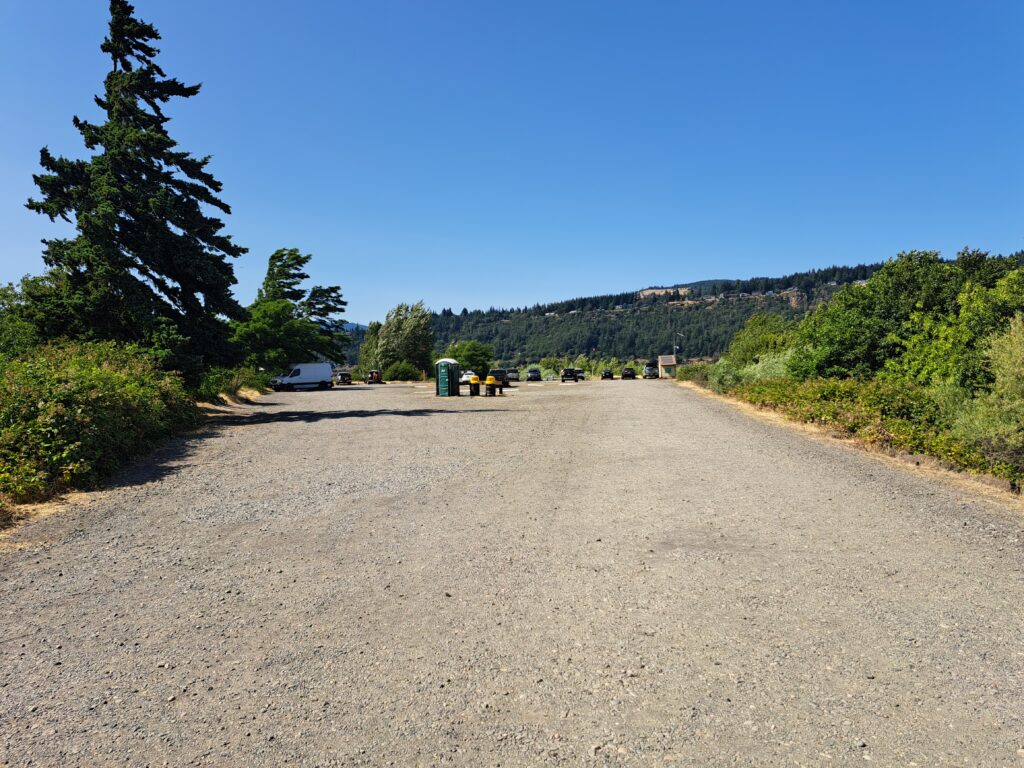
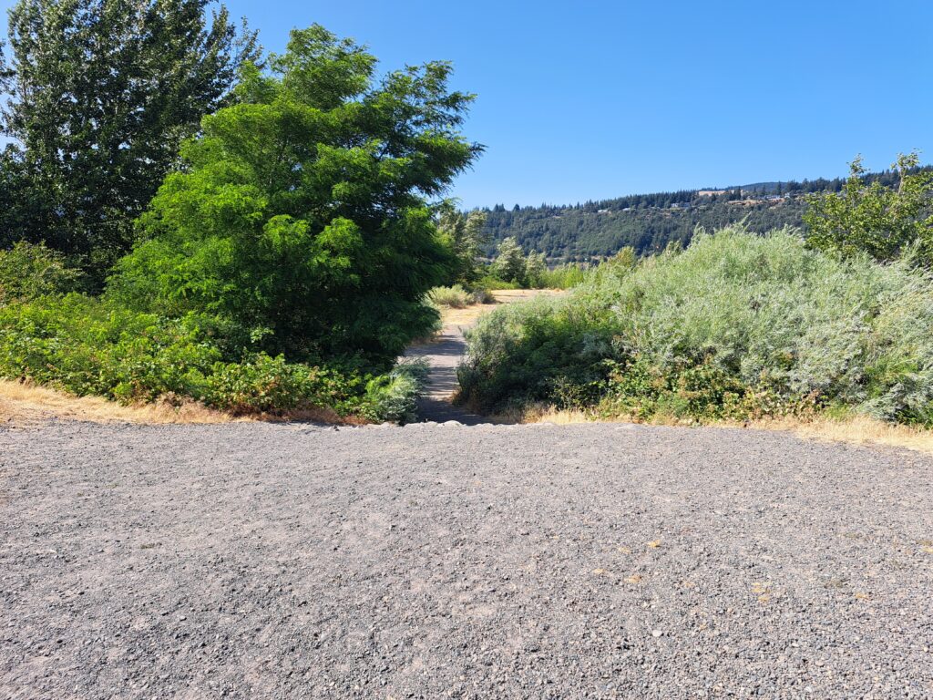
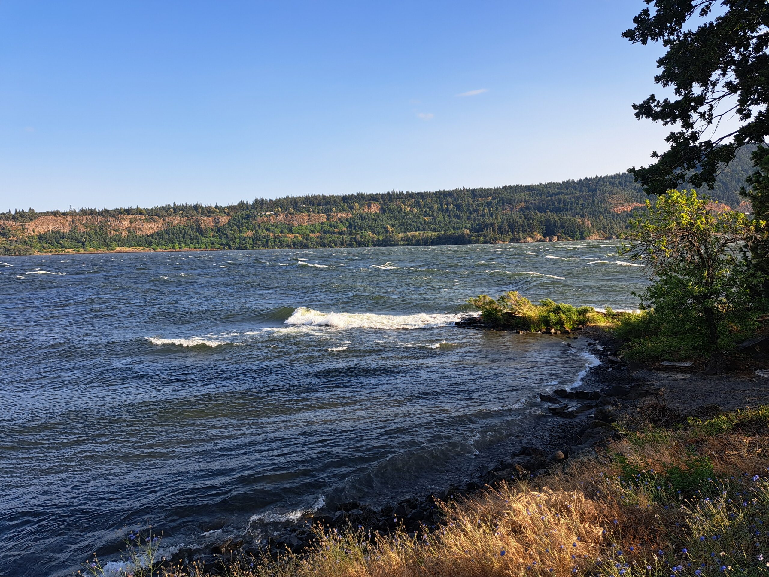
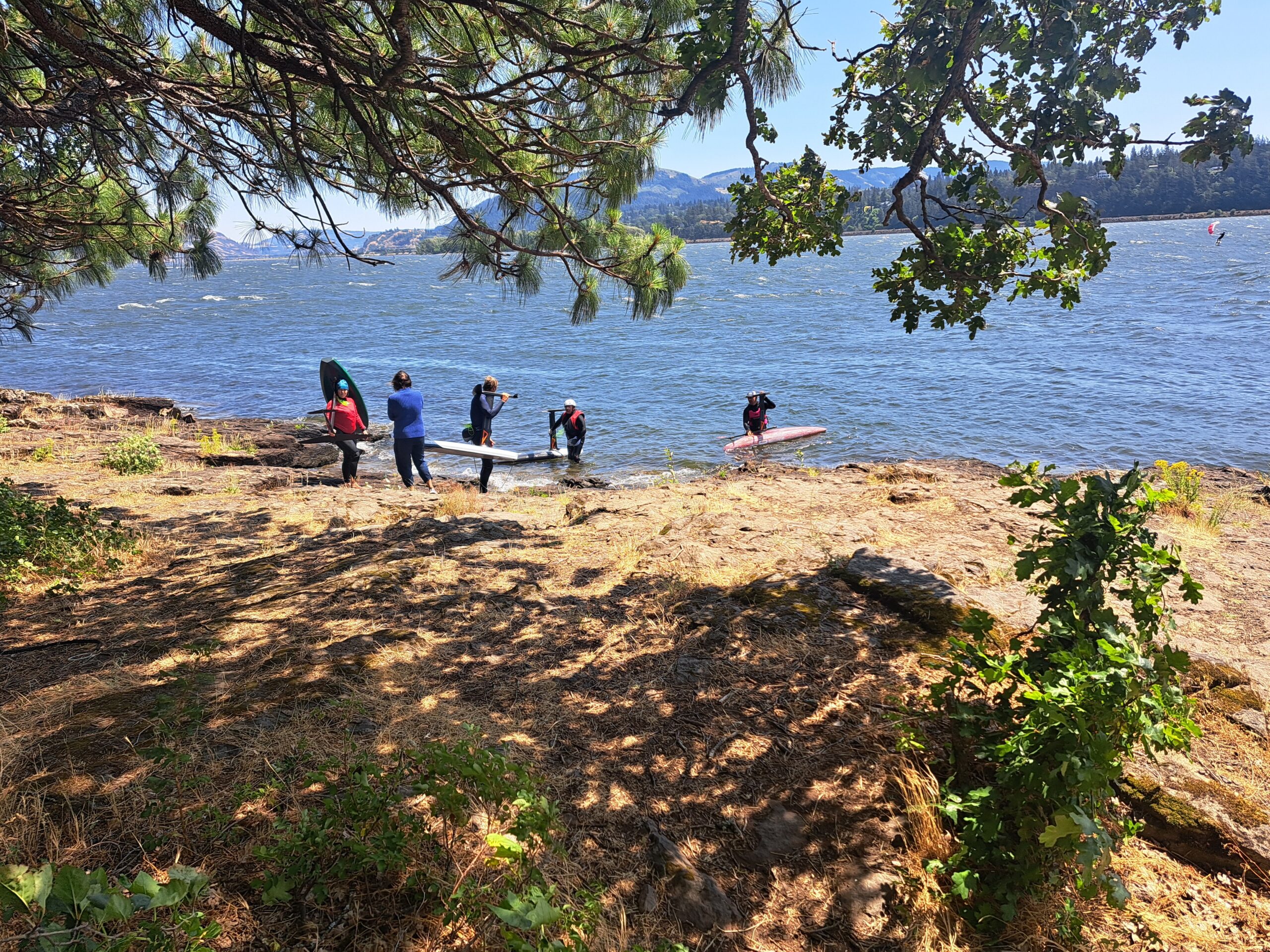
THE SPIT / KITE BEACH / SANDBAR
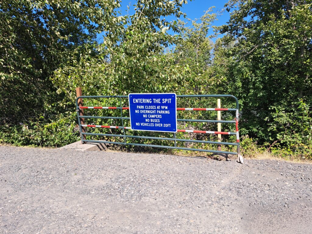
- WIND DIRECTION: westerly
- SKILL LEVELS YOU MIGHT SEE HERE: beginner on up
- CURRENT: unpredictable and sometimes strong
- SPORTS THAT LAUNCH HERE: kiteboarding, doggie walkers
- MAX SWELL SIZE: M
- BEST FOR: kiteboarding, downwind safety outlet for other sports
- AMENTIES: sandy launch, porta-potties, kite schools
- COST / PARKING PASS: $2.75/hr
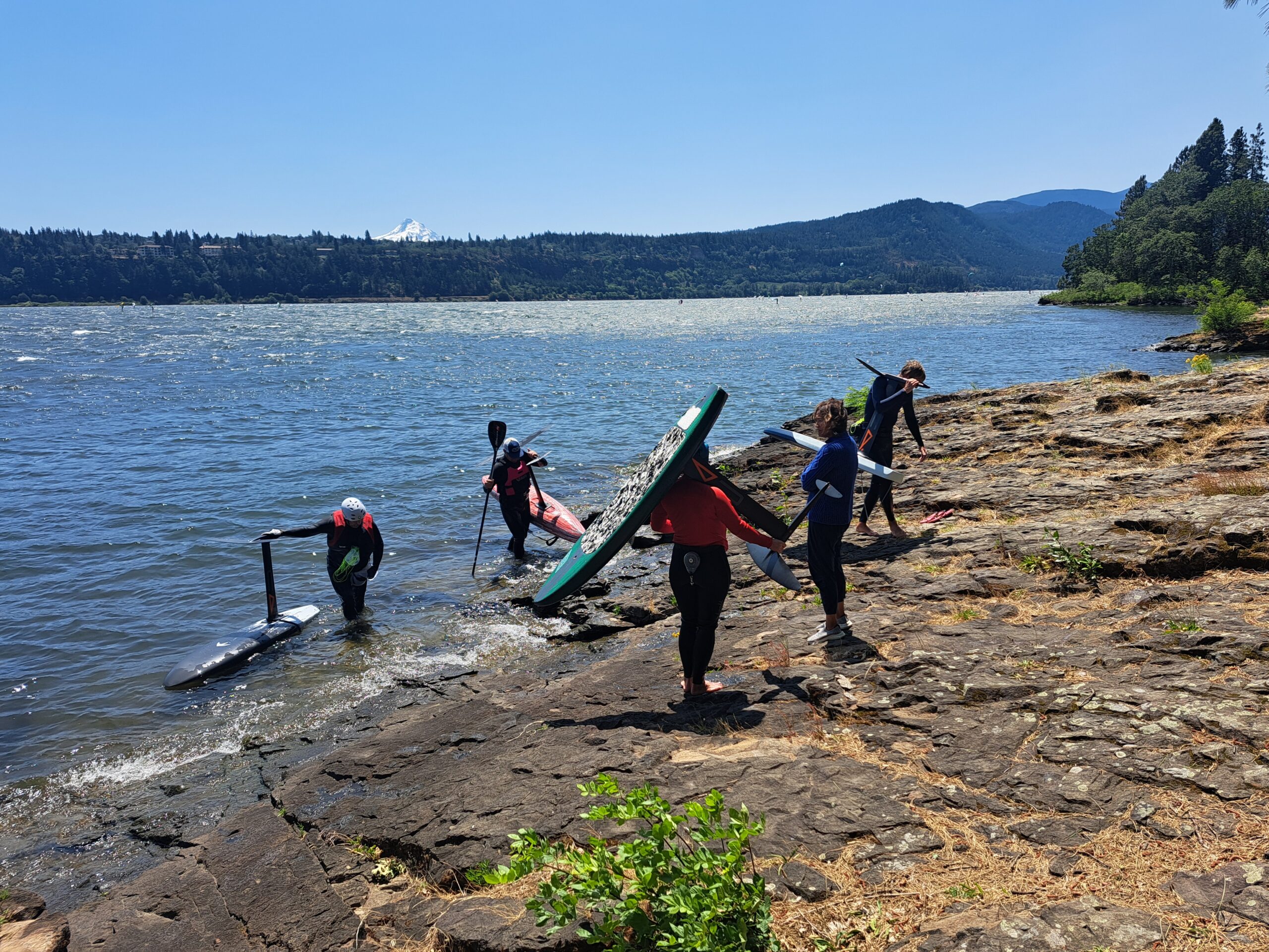
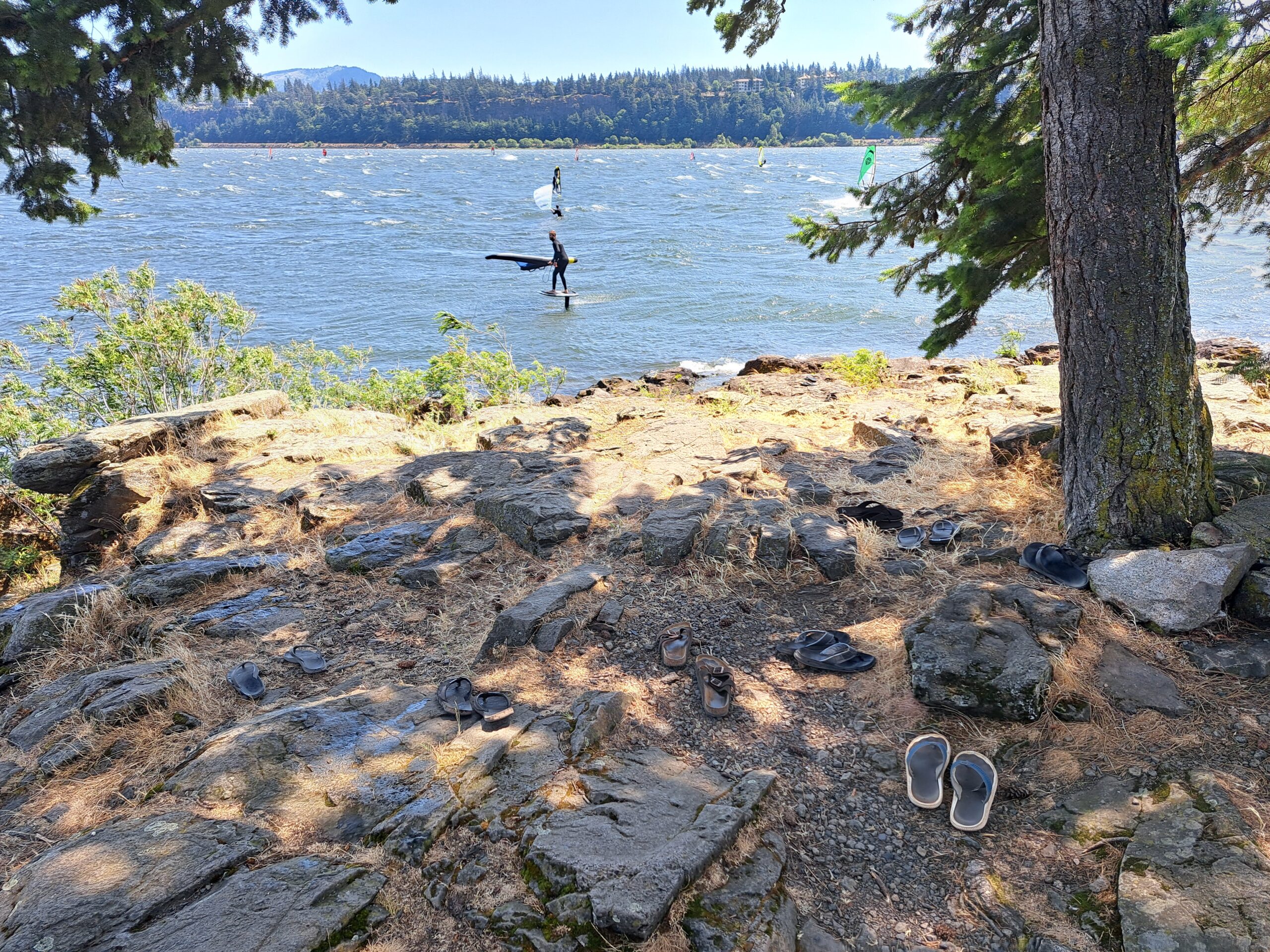
As the name implies, the Spit, the Sandbar, Kite Beach is the territory of kiters. Theoretically you could do other sports from here, but it would be a long walk carrying heavy gear. Walk out on the sandbar to access the launch area. The wind is onshore, so please be cautious. Also watch for dog doo-doo; this is a popular off-leash dog park as well as kiteboarding launch.
Depending on where you choose to ride, you’ll have flat water (downwind of the spit, or in the shallow ponds) or medium size swell (out in the river channel). Many folks work their way upwind of the White Salmon Bridge where the swell is larger and cleaner and the wind is stronger. At times, there are park features in the ponds. These, of course, are for expert riders. At least once a year there is a kiteboarding competition at the Spit.
SWELL CITY
- LOCATION: Washington, about 1 mile west of the Spring Creek Fish Hatchery; about 5 miles west of the Hood River Bridge on SR-14
- WIND DIRECTION: westerly
- SKILL LEVELS YOU MIGHT SEE HERE: advanced to expert
- SPORTS THAT LAUNCH HERE: windsurfing, winging, SUP foil, parawing, outriggers and surfskis
- CURRENT: strong
- MAX SWELL SIZE: XL
- BEST FOR: swell riding, jumping
- AMENTIES: porta-potties, picnic tables, easy launch
- COST / PARKING PASS: as of 2025, the Swell pass is $80, purchased through CGW2
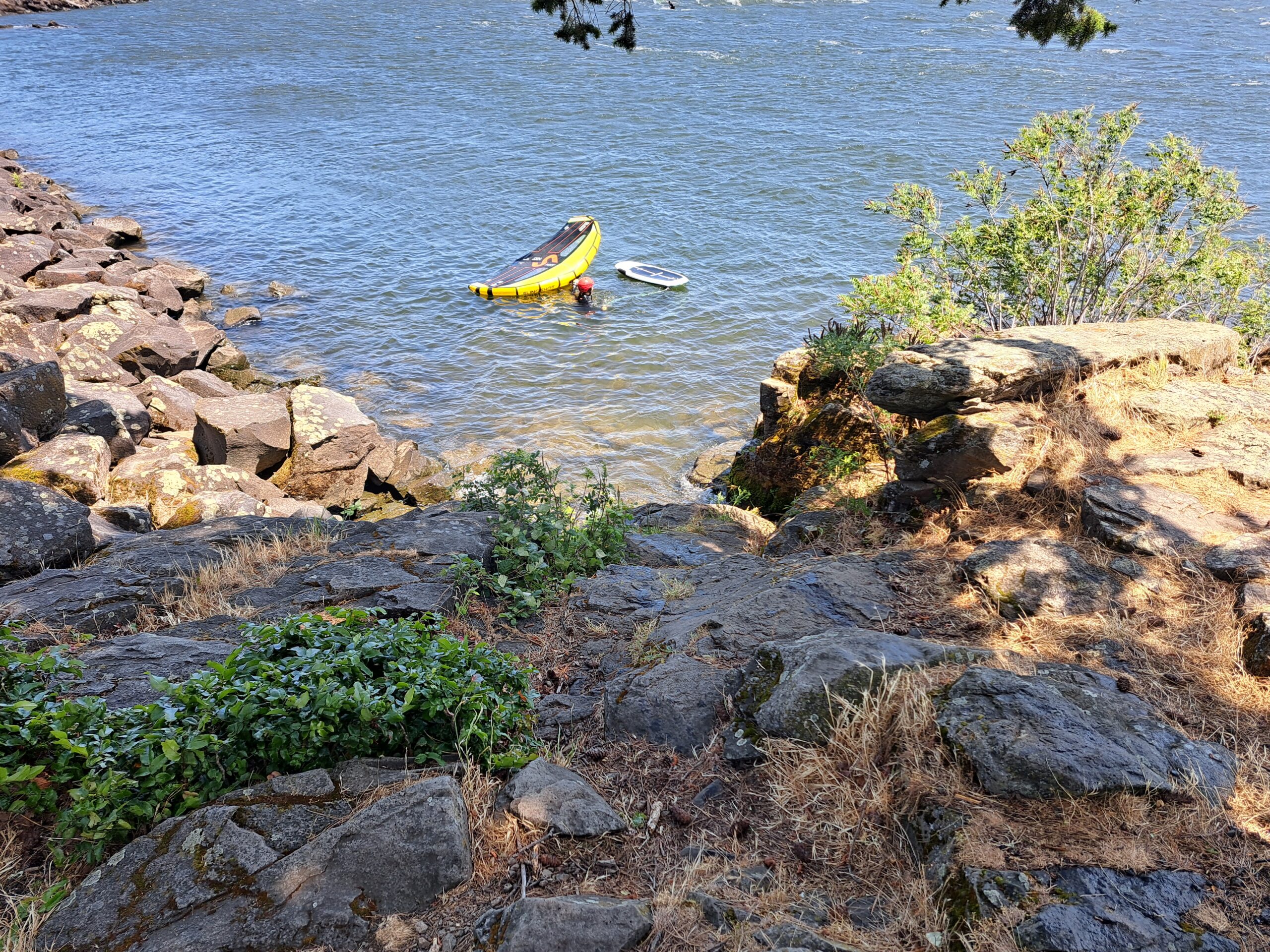
Swell City is the territory of old-school windsurfers, for the most part. Owned by Columbia Gorge Wind & Water Association (CGW2), Swell provides semi-exclusive access. Parking is back-in, single parking (no double parking) on WSDOT land. Launching is via private property and requires a launch pass.
For a rocky beach, Swell has a manicured launch. At the main launch, at the west end of the property, paved paths take you to a sheltered, shallow pea gravel cove. You can walk out to the wind line, and you’ll immediately be out in steep, big rollers. The downwind cove provides another access, but you’re likely to swim for the wind there. It is used as a takeout for DW paddlers.
THE HATCHERY
- LOCATION: Washington – 61552 State Road 14, Underwood, WA 98651
- WIND DIRECTION: westerly
- SKILL LEVELS YOU MIGHT SEE HERE: advanced to pro
- SPORTS THAT LAUNCH HERE: windsurfing, winging, SUP foil, parawing
- CURRENT: strong
- MAX SWELL SIZE: XL
- BEST FOR: swell riding, jumping, showing off, and, judging by the crowds, learning to SUP foil
- AMENTIES: vault toilet, limited grassy rigging
- COST / PARKING PASS: as of 2025, you need a Discover Pass. $11.50 daily, $30 annual prior to October 2025, then $45 through Washington State Parks
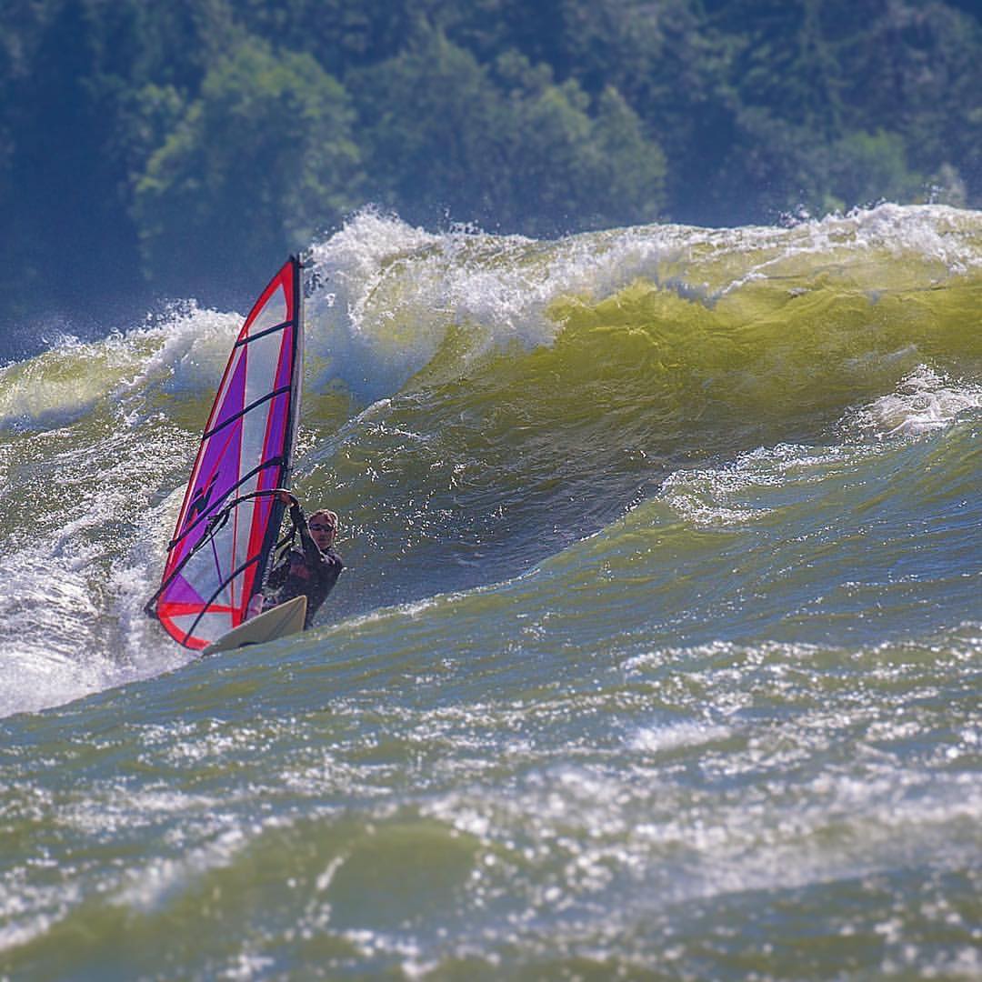
I don’t know about y’all, but when I first came to the Gorge in the 1990s, the launch site I’d heard the most about was “The Hatch”. And so it remains – this is the premier spot for advanced and expert riders. It’s also go history – lots of competitions have happened here, and plenty of conflict too. When the park first became pay-use, angry windsurfers tossed the toll booth into the river. Thankfully, that’s history, and the park is now well-managed by Washington State Parks.
The Hatch is legendary for good reason. When the wind picks up, so does the swell. Combine that with strong spring current for truly massive conditions. Yes, the photo of Dan MacDonald above is REAL. That’s the Hatch on Super Tuesday.
The Hatch is good spring, summer, and fall. It really fires when Portland is cloudy and Hood River is sunny; the combo of a stable air mass and temperature gradient makes for solid, long-lasting west wind. Clear sky in Portland often results in an afternoon die-off, at which point you’ll need to head to the near east (Lyle, Rowena, and Doug’s) for stronger, steadier wind.
The Hatch is not cushy. Rigging happens on dead grass, in the parking lot in the wind, or on pea gravel. But hey, there’s plenty of room to toss your gear down when you’re done.
Parking can be a real problem at the peak of summer. You can be part of the solution by parking as tight as you can. An old tradition at the Hatch is to double-park. Coordinate key locations with others. They’re boardheads too, and likely trustworthy. Join in this time-tested tradition, and double the number of cars can fit in the parking under the trees between the Point and the vault toilets.
Other things to know: don’t block the road, look both ways before crossing the road, and don’t let your pup run off-leash. Consider saving the Basement parking spots for folks actively engaging in downwind shuttling – they’re not allowed to park and load in the road.
MOSIER / ROCK CREEK PARK
- LOCATION: Oregon – Mosier, Exit 69 off I-84. Exit the freeway and go south into Moiser. Take a left towards the Twin Tunnels trail. The entrance to Rock Creek is a gated gravel road just before the sewage treatment plant. See it on the map.
- WIND DIRECTION: westerly
- SKILL LEVELS YOU MIGHT SEE HERE: intermediate to advanced
- CURRENT: moderate
- SPORTS THAT LAUNCH HERE: windsurfing, winging, kite, parawing
- MAX SWELL SIZE: M
- BEST FOR: cruising around on a really wide river
- AMENTIES: shady rigging area, porta potties, picnic tables
- COST / PARKING PASS: as of 2025, it’s $5/daily, $50 a year. Passes can be purchased at the Mosier Market.
LYLE SANDBAR
- WIND DIRECTION: westerly
- SKILL LEVELS YOU MIGHT SEE HERE: intermediate to advanced
- CURRENT: mellow to moderate
- SPORTS THAT LAUNCH HERE: kiteboarding
- MAX SWELL SIZE: S
- BEST FOR: flat water shredding
- AMENTIES: sandy launch?
- COST / PARKING PASS: It’s free, but it’s also illegal to cross the railroad tracks.
DOUG’S BEACH
- WIND DIRECTION: westerly
- SKILL LEVELS YOU MIGHT SEE HERE: intermediate to advanced
- CURRENT: moderate to strong
- SPORTS THAT LAUNCH HERE: windsurfing, wing foil
- MAX SWELL SIZE: L
- BEST FOR: starboard tack jumping, swell riding, getting the sh*t pounded out of your knees
- AMENTIES: sandy launch, mulberry trees
- COST / PARKING PASS: as of 2025, you need a Discover Pass. $11.50 daily, $30 annual prior to October 2025, then $45 through Washington State Parks
ROWENA
- WIND DIRECTION: westerly
- SKILL LEVELS YOU MIGHT SEE HERE: intermediate to advanced
- CURRENT: moderate
- SPORTS THAT LAUNCH HERE: kiteboarding (sketchy launch – not the best place), windsurfing, wing foil
- MAX SWELL SIZE: S/M
- BEST FOR: standard-issue bump and jump; progressing your skills
- AMENTIES: vault toilets, grassy rigging
- COST / PARKING PASS: $10 daily, $30 for one year, $45 for two years via Oregon State Parks
CELILO
- WIND DIRECTION: westerly
- SKILL LEVELS YOU MIGHT SEE HERE: intermediate to advanced
- CURRENT: moderate
- SPORTS THAT LAUNCH HERE: windsurfing, winging
- MAX SWELL SIZE: S/M, and quite disorganzied.
- BEST FOR: bouncing around and contemplating the karma of drowning Celilo Falls
- AMENTIES: grassy rigging, trees, vault toilet, shady areas
- COST / PARKING PASS: It’s free!
AVERY
- WIND DIRECTION: westerly
- SKILL LEVELS YOU MIGHT SEE HERE: intermediate to advanced
- CURRENT: moderate
- SPORTS THAT LAUNCH HERE: winging, windsurfing
- MAX SWELL SIZE: S/M
- BEST FOR: bump n’ jump windsurfing
- AMENTIES: near-zero crowds?
- COST / PARKING PASS: It’s free, but it’s also illegal to cross the railroad tracks.
MARYHILL
- WIND DIRECTION: westerly
- SKILL LEVELS YOU MIGHT SEE HERE: advanced to expert
- CURRENT: strong to very strong
- SPORTS THAT LAUNCH HERE: windsurfing, winging, SUP foil. You could also launch an outrigger or surfski if you’re a pro.
- MAX SWELL SIZE: L
- BEST FOR: camping out and shredding swell
- AMENTIES: spectacular grassy rigging area, flush toilets, camping, shade, pea-gravel walk-in launch, nearby fruit stands
- COST / PARKING PASS: as of 2025, you need a Discover Pass. $11.50 daily, $30 annual prior to October 2025, then $45 through Washington State Parks
THE WALL
- WIND DIRECTION: westerly
- SKILL LEVELS YOU MIGHT SEE HERE: advanced to pro
- CURRENT: strong to very strong
- SPORTS THAT LAUNCH HERE: windsurfing, winging, SUP foil, parawing
- MAX SWELL SIZE: XXL
- BEST FOR: swell riding, huge jumps
- AMENTIES: camaraderie and a porta potty, nearby excellent Indian food, nearby fruit stands
- COST / PARKING PASS: free
RUFUS
- WIND DIRECTION: westerly
- SKILL LEVELS YOU MIGHT SEE HERE: intermediate/advanced to pro
- CURRENT: strong to very strong. max flow to have swell is around 325,000, and that’s definitely experts only conditions.
- SPORTS THAT LAUNCH HERE: kiteboarding, windsurfing, winging, parawing, SUP foil. You could potentially launch a surfski or outrigger, but it’d be a short run.
- MAX SWELL SIZE: XL
- BEST FOR: swell riding, especially on foil – swells are generally less steep than at the Wall
- AMENTIES: vault toilets, plentiful parking, free camping, nearby excellent Indian food, nearby steaks
- COST / PARKING PASS: It’s free, but it’s also illegal to cross the railroad tracks.
BLALOCK & PHILIPPI
- WIND DIRECTION: westerly
- SKILL LEVELS YOU MIGHT SEE HERE: intermediate to expert
- CURRENT: moderate
- SPORTS THAT LAUNCH HERE: DW SUP foil, DW parawing, DW wingfoil. You could potentially launch a surfski or outrigger canoe here, but maneuvering into the culvert might be tricky!
- MAX SWELL SIZE: S at Blalock and Philippi, but L/XL downwind
- BEST FOR: a long and remote downwind run
- AMENTIES: zero
- COST / PARKING PASS: free
ROOSEVELT
- WIND DIRECTION: westerly
- SKILL LEVELS YOU MIGHT SEE HERE: intermediate to advanced
- CURRENT: moderate to strong
- SPORTS THAT LAUNCH HERE: windsurfing, winging
- MAX SWELL SIZE: small on the WA side, L on the OR side
- BEST FOR: progressing your swell riding skills, camping where you shred
- AMENTIES: grassy launch, flush toilets, camping, running water, shady areas
- COST / PARKING PASS: free
ARLINGTON
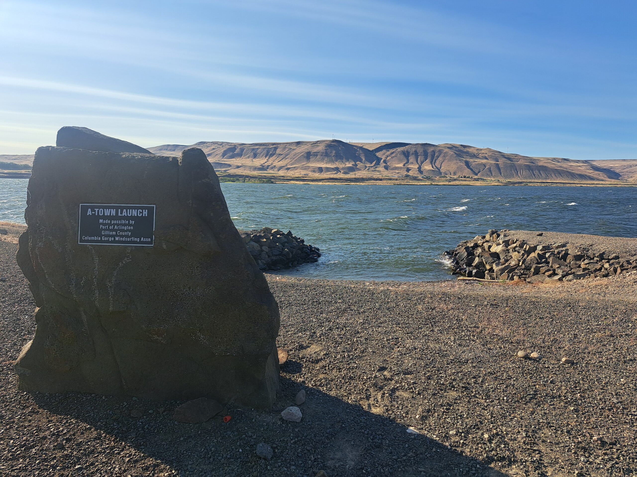
- WIND DIRECTION: westerly
- SKILL LEVELS YOU MIGHT SEE HERE: advanced to pro
- CURRENT: moderate to strong
- SPORTS THAT LAUNCH HERE: windsurfing, winging, kiteboarding (experts only – sketchy launch), SUP foil takeout
- MAX SWELL SIZE: L/XL
- BEST FOR: swell riding, jumping, and showing off
- AMENTIES: flush toilets, RV camping, the view, the swells
- COST / PARKING PASS: free
Arlington is yet another world-class windsport launch in the Gorge. Given the rocky launch directly into the swell, this is experts-only. When it gets really windy and the swells are breaking into the main launch, you can come in via the back door. For a friendlier launch, head to Roosevelt, located directly across the river. What makes this spot so great? Huge glassy swell and strong, steady wind.
Arlington fires up when it’s cloudy, rainy, and cool west of the The Dalles. You’ll find the best conditions here in spring, when clouds on the west side are frequent, and also in fall, when weather systems return to the Pacific Northwest after the dry summer. If you want giant swell, aim for spring when the current is higher.
For those of you with access to the iWindsurf/iKitesurf sensors, you’re looking for 30+; the sensor reads quite high compared to the Swell City sensor. 25 at Swell is equivalent to about 31-32 at Arlington. When the Arlington sensor is reading 38+, the swell is almost certain to be gigantic – big, smooth, and glassy with huge port ramps. For smaller ramps, head across the river towards Roosevelt – it’ll still be port tack ramps, and it’s fantastic bump-and-jump conditions. Downwind of the point at Arlington, the waves get big and glassy, and the wind is generally a little bit lighter.
THREEMILE CANYON
- WIND DIRECTION: westerly
- SKILL LEVELS YOU MIGHT SEE HERE: intermediate to expert
- CURRENT: moderate to moderately strong
- SPORTS THAT LAUNCH HERE: windsurfing, winging, kiteboarding (sketchy launch for kites)
- MAX SWELL SIZE: S/M on the OR side, XL on the WA side, XL and steep about 1/2 mile upwind
- BEST FOR: riding swell
- AMENTIES: sagebrush, lots of it
- COST / PARKING PASS: free to use, free to camp
BOARDMAN
- WIND DIRECTION: westerly
- SKILL LEVELS YOU MIGHT SEE HERE: intermediate to advanced
- CURRENT: moderate
- SPORTS THAT LAUNCH HERE:
- MAX SWELL SIZE:
- BEST FOR:
- AMENTIES:
- COST / PARKING PASS:
CLICK HERE FOR THE DOWNWINDING GUIDE FOR THE GORGE

Have an awesome day.
Love, Temira