Get the email free through the end of April – try it out! Click here.
Thank you for using this forecast. I offer it freely so you can have more fun and plan your life. It does take significant time and energy to produce. If you find yourself using it often, or if you feel your life is enhanced by this information, please make a donation. Click right here to donate. I count on your support to pay my bills, and am deeply grateful to you for choosing to help support me. You can get this forecast via email by donation. The email subscription isn’t $99/year. Not $50/year. Donating $12.34 or more gets you on the list for 12 months. Don’t PayPal? Send a check to Temira @ PO Box 841 in Hood River. Thank you for your support and thank you for trusting my forecast.
| 4a-8a | 8a-12p | 12p-4p | 4p-8p | 8p-4a | |
|---|---|---|---|---|---|
| Friday 6000′->12000′->7500′ |
 |
 |
 |
 |
 |
| Saturday 7500′->3500′ |
 |
 |
 |
 |
 |
| Sunday 3500′->2500′ |
 |
 |
 |
 |
 |
Mt. Hood Snow Forecast
It’s Friday morning, and it’s still drizzling up on ye old volcano. The not-snow will continue until sometime on Saturday before switching to heavy snowfall. Models do not agree on snowfall quantity for the weekend: the GFS brings in massive accumulation starting mid-morning Saturday, but the Euro is less optimistic. Details follow.
For Friday, we’ll have light rain in the morning, dry weather in the afternoon, and heavy rain overnight. The snow level will be 6000′ this morning, 12,000′ around midnight, and 7500′ after midnight. About 1/4” rain falls before the sky clears. About 3/4” falls tonight. Wind will be WSW 15 this morning, S 15 this afternoon, and SW 25-55 after midnight (SW wind tends to be much stronger up high than down low).
Saturday looks wet and windy during the day and windy and snowy overnight. Models disagree on when the rain will switch to snow; the GFS likes mid-morning, and the Euro like mid-evening. About 3/4” WV falls during the day, mostly as rain or wet snow. A few inches of accumulation are possible. The GFS has us in the bullseye of the precip Saturday night. The Euro takes it farther north. Up to 2” water value (WV) falls overnight, for somewhere around 6-20” of new snow (sorry – too much model disagreement to be more precise). Wind Saturday will be SW 25-60 (gusts to 100 are possible up high) all day, becoming more westerly after midnight.
Sunday currently looks very snowy and very windy. The snow level will be around 3500′ in the morning and 2500′ in the evening. About 1.7” WV falls during the day (GFS model – Euro has less), for 6-18” of new snow, depending on which model wins. Wind is likely to be problematic, at least early in the day: west 60 early (no lifts), slowly fading to WNW 35 in the afternoon (lifts return). If you go to the hill Sunday, bring a shovel to extricate yourself from snow drifting in the resort parking lots.
Monday looks clear, warm, and not-windy with the free air freezing level rising to 10,000′ in the afternoon. That’s going to do a number on all that fresh snow, so get it early.
Random Morning Thoughts
I’m looking out my window this morning, and it’s very gray. There’s light gray, dark gray, medium gray, and even some grey of various tones. Grey the house with a grey little window and a grey corvette and everything is grey…
Okay, I don’t have a Corvette, but it’s very gray out there this morning (whichever way you choose to spell that color). It’s downright impressive. It’s also impressive that on this particular morning, my mind has chosen to focus on the awe-inspiring portion of the colors rather than the dullness. This makes me wonder if this is how artists see all the time – the beauty in the colors (or lack thereof).
Anyway, I’m sure that you occasional find surprising moments of inspiration in everyday happenings. When you do, stop what you’re doing and really focus on what’s happening. Feel it in your body. Can you locate the source of the feelings, the sensations that go along with what you noticed in your thoughts and your head? Stay with it for a bit and cultivate the joy. Noticing the bodily part is the most important thing, because that’s what’s going to solidify the experience and make it arise more frequently in the future. May you find joy in the most mundane things. Have an awesome day.
Disclaimer required by my grad school program: I am not your therapist, but I am seeing clients at this time at Comprehensive Healthcare in White Salmon. In the meantime, I am your weather forecaster. Take everything I say with a grain of salt, and consult with your actual therapist about your mental health issues. One other thing: I plan to keep doing this forecast indefinitely. Forecasting and counseling are both deeply meaningful and nourishing to me.
Gorge Wind Forecast
For Friday, we’ll have light east wind in the western Gorge early with widespread E 5-10 in the afternoon. The wind will pick up to E 25-30 after 8pm. On Saturday, the Gorge will see E 10-15. It’s a bit difficult to predict what will happen during the day as a front slowly moves inland and a low pressure system slowly approaches Vancouver Island. My best guess is calm wind from Swell to The Dalles will pouring rain in the western Gorge and gusty westerlies at 19-26 east of The Dalles.
The low pressure system moves inland Sunday and weak high pressure builds along the northern California coastline. In the morning, we’ll have W 21-25 west of Swell and east of The Dalles. By mid-morning, the wind should pick up to gusty 26-30+ from Mosier to Arlington with 30-35 possible from Mosier to Rufus. Monday brings east wind at 15-20.
Gorge Weather Forecast
It’s showery out there this morning, and the sprinkles will continue through the morning with partly cloudy sky this afternoon. Temps will be near 50 early and just over 60 later. Light east wind. 33% chance of rainbows. Saturday looks rainy. Temps will be in the upper 40’s early and upper 50’s in the afternoon. Light wind. 14% chance of rainbows. Sunday looks rainy in the morning and showery in the evening with a slow taper in between Temps will be in the upper 40’s early and mid 50’s in the afternoon. Strong west wind. 99% chance of rainbows.
For weather specifically directed at travel through the Gorge, please visit Temira’s Awesome Travel Advisory Service on Facebook.
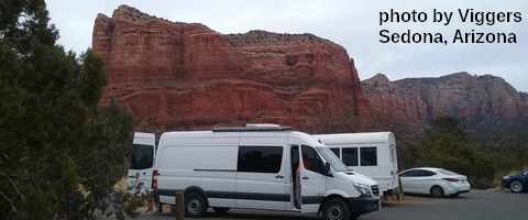
White Sprinter Van of the Week

Click here for the White Sprinter Van map of the world!!!
Road and Mountain Biking
About 1/4” rain fell last night, meaning it’s way to wet to ride the trails unless you enjoy damaging them. If you’ve been riding in the mud, consider giving back to the trails by attending the HRATS work party that meets at Family Man on Sunday at 9:30am. This afternoon looks good for road biking: partly cloudy, 62 degrees, with light wind.
Upcoming Events
This morning is the Kickstand Coffee run. Walk or jog 4.1 miles and get a free cup of coffee and a donut. There’s a trail run in Post Canyon at 8am tomorrow. There’s also a beach cleanup at Rowena (plus BBQ) at 9am, and a potluck (followed by work party) at Pacific Hermitage at 10:30am. The Fred Meyer Fuchsia Sale is tomorrow. On Sunday, there’s a trail work party meeting at Family Man at 9:30am. There are sailboat races in Cascade Locks all weekend. That’s gonna be wet!
Click here for the full events calendar.
Have an awesome day today!
Temira


