


Click on the image above to make a donation. Or, try it out! Get the email version free through the end of June – try it out! Click here.
Thank you for using this forecast. I offer it freely so you can have more fun and plan your life. It does take significant time and energy to produce. If you find yourself using it often, or if you feel your life is enhanced by this information, please make a donation. Click right here to donate. I count on your support to pay my bills, and am deeply grateful to you for choosing to help support me. You can get this forecast via email by donation. The email subscription isn’t $99/year. Not $50/year. Donating $12.34 or more gets you on the list for 12 months. Don’t PayPal? Send a check to Temira @ PO Box 841 in Hood River. Thank you for your support and thank you for trusting my forecast.
| Your favorite beach | Dawn Patrol |
9am- 11:30a |
11:30a- 3pm |
3pm- dusk |
|
|---|---|---|---|---|---|
| Rooster Rock | too | cold | hot dog | buns only | |
| Steven’s Locks | 5-10 | 10-13 | 13-16 | 18-22 | |
| Hatchery/Wunderbar | 5-10 | 10-13 | 13-16 | 18-22 | |
| Doug’s, Lyle, Rowena | 5-10 | 10-13 | 13-16 | 18-22 | |
| Rufus, etc. | 13-16 | 13-16 | 13-16 | 10-13 | |
| Roosevelt, etc. | 16-20 | 13-16 | 10-13 | 5-10 | |
Gorge Wind Forecast
Friday starts off with a deep marine layer in the west and the remains of yesterday’s weak weather system moving out to the east. As high pressure builds off the coast and inland today, we’ll see the wind shift to the western Gorge. The day starts with 13-16 east of The Dalles and 5-10 int eh western Gorge. We’ll see the wind slowly build to 18-22 from Stevenson to The Dalles this afternoon. Farther east, the wind will back off to 7-10. Flow today is way down: 353kcfs. My recollection is that the top end of “good” at Rufus is 330kcfs, but we’re certainly getting closer to that stretch of river being “open”. Speaking of “open”, The Dalles Public Works is still putting E. Coli into the river, and beaches from Riverfront Park to West Mayer (that includes Doug’s and Rowena) remain under a “no water contact” order.
I just read some reports on NW kite that the swell has been intermittently good in the Rufus-Wall stretch if the wind has been averaging 30 and gusting over 40. Do keep in mind that the current is still quite strong and the location should be considered “experts only”.
High pressure over the region knocks down the wind speeds down to the 0-5 range for much of Saturday. Models do suggest the wind will pick up late in the day, but they disagree on the timing and strength of this. Let’s go with W 5-10 starting around noon at Stevenson and around 2pm near Hood River. We’ll have W 10-13 from Stevenson to Hood River after 5pm with a possibility of 15-18 if the ECMWF wins the forecast battle.
An approaching system on Sunday combines with offshore high pressure and a desert heat low for big gradients and strong, gusty, hard-to-predict westerlies. The gradient forecast suggests Dawn Patrol at 21-25 from Viento to Mosier. That’s followed by a very quick build to 28-32 from Stevenson to Rufus with Arlington and Threemile joining in after 2pm. Looking at the sounding model, it does seem we’ll have a stable layer in the atmosphere below 5000′ all day. In theory, that should improve the reliability and stability of the wind field. If not, the most likely places for strong, steady wind, are Stevenson, Hood River, Avery, Celilo (in the afternoon), and Arlington. Wondering about Monday? Current forecast is 22-25.
BONUS: Jones Friday: 10-13. Saturday: 13-16. Sunday: 20-23. Sauvie’s Friday: 8-12 late. Saturday: 8-12 late. Sunday: 17-20. Coast (north/central/south). Friday: X/X/10-15, W swell 5′ at 12 seconds. Saturday: 15-20/15-20/25-30, W 5′ @ 10. Sunday: W 10-15/X/N 15-20, W 4′ @ 10.
Random Morning Thoughts
The random morning thoughts are currently on vacation!
Mt. Hood Mountain Weather Forecast
Friday’s mountain weather turns increasingly cloudy. Free air freezing level 6000′ early and 10,000′ later. NW wind at 15 in the morning, WSW 20 in the afternoon, SW 15 overnight. Saturday looks partly cloudy in the morning and sunny in the afternoon. FAF: 11,000′ early and 13,000′ in the afternoon. Wind: SW 15-20. Sunday looks clear in the morning with clouds in the afternoon and a chance of rain turning to flurries overnight. Snow level 13,000′ early, 12,000′ in the afternoon, and 5500′ Monday morning. No accumulation. Wind SW 20 rising to SW 35 and turning to WNW 20 after midnight.
Gorge Weather Forecast
We have partly cloudy sky this morning. Clouds will increase this afternoon. Temps will be near 50 early and in the low 70’s later. Light to moderate westerlies. No rainbows. Saturday may be partly cloudy in the morning, but it will turn clear. Temps will be near 50 early and in the low 80’s in the afternoon. Calm wind for much of the day, light westerlies late. No rainbows. Sunday starts off clear and turns cloudy. There’s a slight chance of rain overnight. Sprinkles, more likely. Temps will be in the mid 50’s early and mid 70’s in the afternoon. Strong westerlies. 1% chance of rainbows.
For weather specifically directed at travel through the Gorge, please visit Temira’s Awesome Travel Advisory Service on Facebook.
White Sprinter Van of the Week
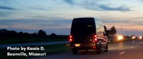
Click here for the White Sprinter Van map of the world!!!
Road and Mountain Biking
The Forest Loop road bike ride in the woods above Trout Lake is open, which means ALL the road rides are open! Saturday will be absolutely epic for road biking, especially in the morning. Light wind. Sunshine. Knebal, Eightmile and Surveyor’s are open. Fifteenmile is not. Lewis River is open. Falls Creek is open from the top down. Hospital Hill has cows on it, so there are no dogs allowed at this time. The ticks are horrendous over there right now – expect to get bitten if you ride there. Deet is your friend. Wednesday is the women’s Post n’ Pinot ride at Dirty Fingers at 5:30. Mountain View has a mountain bike ride at 5pm on Thursday, and the Post n’ Pint ride is Thursday at Dirty Fingers at 5:30.
Upcoming Events
Today is Friday. The Kickstand coffee and donut run (self-explanatory) is every Friday morning at 7. 4 miles. One donut. One coffee. There’s a mountain bike ride leaving Mountain View at 5 tonight. Gear Swap at 3pm at Husum Fire Station. Wild and Scenic Film Festival follows at the fire station. Trailkeepers has work parties at Wygant Peak today and tomorrow.
This weekend is the White Salmon Riverfest. There’s a gear swap at the Husum Fire Station 3-6 Friday and 4-6 Saturday. Drop off for the swap is Thursday afternoon. Friday evening is the Wild and Scenic Film Festival at the Husum Fire Station. Saturday is the Green Truss Extreme race during the day and the Riverfest Symposium in the evening. There are several work parties (Northwestern Park, Weldon Wagon Trail, BZ Falls, Trout Lake) on Saturday. There are Kayak and SUP competitions 2-5 Sunday afternoon. The annual $30 community raft trip (locals only) is Sunday – call Wet Planet Whitewater to sign up.
Other events: the Pine Hollow Paddle SUP race Saturday morning, a garden party at Pacific Hermitage Saturday, free BMC bike demos at Sandy Ridge on Sunday.
Click here for the full events calendar.
Have an awesome day today!
Temira
