

Mt. Hood Snow Forecast
Looks like the low clouds are higher than expected this morning, leading to mostly cloudy conditions with a few flurries on Mt. Hood. The snow level today will be at sea level, and temps on the mountain will be in the single digits to low double digits. No snow accumulation. NW wind at 15 in the morning turns more northerly at 15-20 in the afternoon. Continued after the chart…
 |
4a-8a | 8a-12p | 12p-4p | 4p-8p | 8p-4a |
|---|---|---|---|---|---|
| Friday 0′ |
 |
|
 |
|
|
| Saturday 0′ |
|
|
|
 |
|
| Sunday 0′->1000′? |
|
 |
|
|
|
Mt. Hood Snow Forecast, continued…
Saturday looks clear and cold to start, becoming cloudy mid-morning with light snow flurries possible in the afternoon. No accumulation. The free air freezing level will be at sea level with temps on the mountain in the low double digits or less, warming into the teens in the afternoon. Wind on Saturday will be NW 15 in the morning and NNW 25 in the afternoon.

Say “thanks for the forecasts”
by making a donation!
Keep the forecasts coming.
Does this forecast save you time, gas money, or help you have more fun in your life? Make a donation to support continued forecasting, and get the forecast in your inbox each day. Click on the button to donate. The email subscription isn’t $99/year. Not $50/year. No, just $12.34 or more gets you on the list for 12 months. Don’t PayPal? Send a check to Temira @ PO Box 841 in Hood River. Thank you for your support and thank you for trusting my forecast.

Mt. Hood Snow Forecast, finished
Sunday looks partly cloudy early, becoming cloudy mid-morning, with light flurries possible during the day and clear sky overnight. The snow level will be at sea level in the morning, possibly rising to 1000′ in the afternoon and falling back to sea level overnight. Wind on Sunday will be NW 15 for much of the day, becoming WNW 15 in the evening.
A very powerful storm whacks us Monday into Tuesday. I want to speak in general terms for now. Snow starts up around noon on Monday. The snow level will be around 4000′ at the start of this system, rising to 6000-6500′ by early Tuesday. If the models are correct, we’re going to see 12” of snow or so followed by 1-2” of rain. Let’s wait until we get a little closer to see what is really going to happen!
Simcoe Accounting
Simcoe Accounting, LLC is a full-service accounting firm. Serving clients throughout the Columbia gorge, dedicated to providing our clients with professional, personalized services and guidance in a wide range of accounting and business needs. We believe in getting it right the first time. The right service at the right time, at the right price. Contact us for a free quote by clicking the headline above.
Gorge Wind Forecast
East wind at 25-30 all day today. East wind at 15-20 on Saturday, becoming W at 5-10 if you believe the models. I prefer a prediction of light and variable. Light and variable wind all day Sunday. Light east wind on Tuesday, turning westerly at 30-40 in the afternoon!
Jones, Sauvie’s, Coast Beta Test Forecast
If you click right here , you’ll find NOAA’s coast forecast.
Random Morning Thoughts
Our minds are funny things – they sometimes get stuck in the clouds, much like the Gorge weather gets stuck in the Nothing. The clouds can stick around for a long time, and then suddenly something will happen, shifting our perspective and giving us more distance from our internal darkness.
It’s kinda like what’s happening with the weather as I write this. The Nothing cloud is dissipating, and the areas of blue outside my window are becoming larger and larger.
When this happens in our internal world, it’s important to notice what made the clouds start breaking up. Knowledge of this sort gives us a lever to start intentionally shifting our moods. Moods and emotions are largely out of our control, but we can learn ways to influence them.
It’s important to notice what shifts us out of a painful place into a happier place, and it’s also important to notice the opposite. You know how you sometimes suddenly shift into a grumpy place? Something caused that shift, and understanding what that something is will give it less power over you. The next time it happens, you can say to yourself, “Oh, that’s just ‘cuz of that thing,” and you’ll be able to shift yourself back out before you’re stuck. Know yourself, and you’ll be better placed to enjoy both the internal and external sunshine today. Have an awesome day!
Disclaimer required by my grad school program: I am not your therapist (but I could be 51 graduate school credits from now). I am your weather forecaster. Take everything I say with a grain of salt, and consult with your actual therapist about your mental health issues. One other thing: I plan to keep doing this forecast indefinitely, even when I am a therapist.
Gorge Weather Forecast
Looks like we have a big old Nothing happening this morning. The fun part about the Nothing is that if you are in it, you get to have freezing fog. If you are below it, you might find some snowflakes. Expect the Nothing to continue until this afternoon, when we should start to see blue sky and sunshine. If that happens, it will be f’ing cold tonight. Temps will be in the mid 20’s all day, dropping into the single digits tonight. East wind. No rainbows.
Saturday starts off clear and turns cloudy midday, with just a few scattered flurries possible. Temps will be in the single digits early and the mid 20’s in the afternoon. If you buy into the models, we’ll have light easterlies early and light westerlies late. No rainbows. Sunday looks cloudy with light snowfall possible. Less than 1” of snow, and probably not even near that. Temps will be in the upper teens early (maybe colder!) and, according to NWS, the mid-30’s in the afternoon (unlikely). Light wind. No rainbows.
Models seem to think we’ll be above freezing by midday Monday. Do not count on that, because models are usually way too aggressive on warming us up. This, however, makes for a tricky forecast. Precip starts around 11:30am, continuing in light to moderate form through 8pm Monday, and then becoming very heavy through 11am Tuesday. If we’re below freezing, this will start as snow and turn to freezing rain. My current best guess of the time we will certainly be above freezing is 7am Tuesday. Models currently show us receiving 1-2” of moisture in that time period, possibly leading to a complete disaster. If it’s just raining, then, well, it’ll just be wet!
For weather specifically directed at travel through the Gorge, please visit Temira’s Awesome Travel Advisory Service on Facebook.
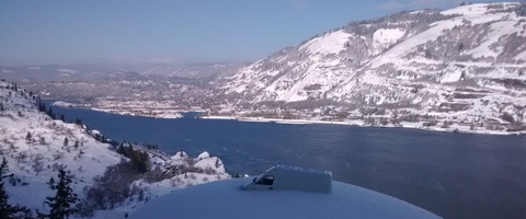
White Sprinter Van of the Day
Road and Mountain Biking
You can ride your bike if you have a fat bike. =)
Upcoming Events
On Friday, you can party with your local bike shop: 5-8 pm at Mountain View Cycles for our local’s appreciation party. There will be food, beer and wine, and many discounts storewide. It’ll be a great time to wrap up your holiday shopping too!
Have an awesome day today!
Temira
