


Thank you for using this forecast. Like it? Find it useful? Support it (and me!) by sending some cash my way. What’s it cost to support me and get the email version? Not $99 a year. Nope. Not $49. Just $19.99 or more gets you a year. People are added to this list on Thursday and Sunday. My day job is crisis mental health, and I don’t have time on other days. Thanks for your patience! Click below to contribute. Thank you!!
 |
|
 |
Thank you for contributing and keeping this forecast going! Not ready to subscribe? No problem – please share this forecast with all your friends too! I appreciate your support!
The Forecast
| 4a-8a | 8a-12p | 12p-4p | 4p-8p | 8p-4a | |
|---|---|---|---|---|---|
| Friday 2500′->4000′ |
 |
|
|
|
 |
| Saturday 4000′->5500′->4000′->8500′ |
|
 |
|
|
|
| Sunday 8500′->10,000′ |
 |
|
|
|
|
Mt. Hood Snow Forecast
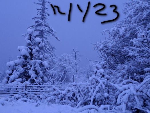
It’s been a great start to this storm system. Both Meadows and Skibowl picked up 11” of new snow. Lots more snow is forecast in the next couple days followed by lots and lots of rain. If the snow forecast holds, there should be enough snow to soak up all that rain. Let’s get this party started!
Friday brings lots of snow to the mountains – two to three feet on top of what’s there, most likely. The effective snow level (it’s snowing in the Gorge) based on 850mb temps will be 3000′ in the morning. It slowly rises to 4000′ by Saturday morning. Daytime precip will be around 1.4” WE for 12-16” of new snow. Overnight, another 0.7” WE is forecast for 6-8” more. Wind: W 50-55 early turns to NW 45-55 midday, WNW 40-45 in the afternoon, and WSW 30-50 overnight. Orographics will aid in snowfall accumulations, especially during the period of NW wind. We could easily beat the above forecast!
Saturday sees the snow level bounce around a bit, but as of this morning, the warm air stays just far enough south for most of the day. Fingers crossed. The snow level starts at 4000′, may briefly rise to 5500′ (with mixed precip) mid-morning before falling to 3500′ in the afternoon and then rising overnight. By midnight, the snow level will be at 5500′ or higher, and by 4am, 8500′. During the day Saturday call that 10-14” of snow depending on how warm it gets. Overnight, another 1.1” WE is forecast, 0.3” as snow (1-3” of Cascade Concrete) followed by 0.8” rain. Wind: WSW 30-50 prior to dawn picks up to W 65 (holy smokes), turns to NW 45-55 and then swings to SW 30-40 overnight and W 50 after midnight. Anything bearing “W” or “WNW” or “NW” may result in extra precipitation beyond what is forecast.
Impressive rain is forecast for Sunday. The snow level will be 8500′ in the morning and 9000′ from the afternoon on through the night. Temps at 5000′ will rise into the low 40’s. Wow. About 3” of rain is forecast during the day and 1” overnight. A couple more inches of rain is forecast on Monday when temps at 5000′ may approach 50 degrees. Wow. Just wow. Let’s leave it there for now and discuss a few caveats.
We’re dealing with the Pineapple Express (aka atmospheric river) here. This usually results in a pretty narrow band of precipitation. Timing and location is everything. Details of the above could change. The big takeaway is this: lots of snow – probably 3 feet or more of additional snow at 5000′ followed by lots and lots of rain. Avalanche hazard will be very high during this due to wind-loading of leeward slopes. Next: I’ll be on a retreat and totally offline (there is a housesitter at my place, and he does not do the forecast, sorry) until next Thursday. You have a wonderful week!
Gorge Wind Forecast
 Very light east wind this morning switches to westerlies midday. Expect very gusty 18-22 from Iwash (Rooster) Rock to Swell with 11-14 central and 23-26 eastern Gorge. The strongest wind will be prior to 1pm. After that, it’ll drop into the teens out east. Did I say gusty? And snowy? And the roads are a mess? River flow yesterday was 101-141kcfs, river temp is 49F, and high temp forecast is 45F.
Saturday brings another round of gusty westerlies along with rain all the way east. Expect gusty 15-25 from Iwash to Swell with 11-14 from Hood River to Doug’s and gusty 22-25 out east. The wind fades after 1pm. High temp: 47F. Sunday will be light and variable. Given the massive precipitation in the forecast, expect lots of debris in the river. Also, I’ll be gone until next Thursday. You have a great week.

| FORECAST SPONSORED BY / AWESOME COMPANIES TO SUPPORT | |
 |
|
Jones, Sauvie’s, Coast – On vacation ‘til summer unless otherwise noted
Hood River Weather Forecast
Clouds and light snow this morning give way to drizzle through the evening. Temps will be in the low 30’s early and mid 40’s later. Calm wind early. Moderate westerlies later. 89% chance of rainbows. Saturday will be rainy. Temps start in the upper 30’s and rises to the upper 40’s. Moderate westerlies. 99%chance of rainbows. Sunday will be rainy. Temps start in the upper 30’s and rise to the mid 50’s. Light and variable wind. Nor rainbows.
Looking for a complete Columbia Gorge forecast? Looking for more humor in your weather? Obscenities? You’re looking for my TATAS: Temira’s Awesome Travel Advisory Service on Facebook.
Local-ish Events
Please let me know of outdoor-related local-ish events. If you don’t tell me, I don’t know!
Regular weekly events:. NK Studio’s by-donation Tuesday morning yoga class is back. Ferment’s Tuesday night 4-mile walk/run is at 6pm. There’s meditation with monks at 5:15pm (an hour) and 6:30pm (30 minutes plus a talk) at Yoga Samadhi in White Salmon. The Tri Club is done for the season. At 7:15am on Wednesdays, there’s a run from the White Salmon Bakery. At 7am on Friday morning, there’s a run from Pine Street Bakery. On Fridays at 2:30pm, there’s a free meditation and stretching class at Yoga Samadhi. On Saturday at 9am, there’s a by-donation outdoor group fitness on the 2rd floor deck about Ferment Brewing.
Cycling
Regarding the trails in general: don’t ride in the mud. You’ll damage the trails. Don’t ride trails if it was below freezing the previous night and is above freezing when you want to ride. Ride gravel. Ride your trainer. Build trails. There are trail builders seeking extra hands on seven additional miles of trail on Whoopdee. Contact HRATS for more information. If you’re parking at Post Canyon, you will need a parking pass. Those can be purchased at many local shops or online.
Sprinter Van of the Week!
 Click here for the Sprinter Van map of the world!!!
Have an awesome day!
PREVIOUS POSTS
- Friday Gorge wind forecast: hosting provider issues… windy, tho!
- Thursday Gorge wind forecast: Westerlies are back, and they’re sticking around. High temps slowly cool through Monday, yay!
- Wednesday Gorge wind forecast: moderate easterlies for a couple hours followed by calm wind. Windier Thursday and into the foreseeable future.
- Tuesday Gorge wind forecast: a couple days of heat and light easterlies followed by at least four days of solid west wind…
- MONDAY GORGE WIND FORECAST: MY WHAT A WINDY ONE WE HAVE! LIGHTER WIND TUE-WED.

Have an awesome day.
Love, Temira