

| Snow level | 4a-8a | 8a-12p | 12p-4p | 4p-8p | 8p-4a |
|---|---|---|---|---|---|
| Friday 5500′->6000′ |
 |
|
|
|
 |
| Saturday 6000′->5000′ |
|
|
|
|
|
| Sunday 5000′->1000′ |
|
|
 |
 |
 |
Mt. Hood Snow Forecast
A couple days of nice spring skiing give way to a massive pattern change and lots of fresh powder. When? Late Sunday. Both the GFS and the ECMWF give us about 4-6” water equivalent (WE) between this Sunday and next Sunday (that’s your 10 day forecast). So, that’s up to four to six feet of snow in the next ten days. Some of that, quite a bit of it perhaps, will fall as dry, fluffy powder. Let’s dive in and see the deets, shall we? Friday will be sunny on the slopes with temps maxing out in the mid 30’s. The free air freezing level will be 5500′ during the day and 6000′ after midnight. A few high clouds arrive overnight, but probably not enough to keep the snow from snapping. That’ll give you Nordic folks a couple days of epic skate skiing. Anyway, wind will be SW 5-10 in the morning and W 15 from early afternoon on through the night. Conditions on Thursday ranged from fresh snow and packed powder up high to a mix of hardpack (shady areas) and corn snow (sunny areas) on lower slopes.
Saturday will be mostly clear for the 24 hour period. The free air freezing level will be 6000′ in the morning, 5000′ in the afternoon, and somewhere between 3000′ and 5000′ overnight. Wind: W 15 in the morning, WNW 20-25 in the afternoon, and WNW 2530 overnight. Temps max out in the low-mid 30’s. Alpine conditions will be a mix of hardpack and granular depending on elevation. Nordic: mostly transitioned and fast.
Sunday starts clear. Snow kicks in mid-afternoon and intensifies overnight. The timing could shift some, but for now…. The snow level will be 5000′ during the day, 3500′ in the evening, and 1000′ overnight. About 0.1” WE is forecast prior to 4pm for an inch of new. Overnight, thanks to orographic effects, we expect 1.5” WE for 14-20” of increasingly dry powder. Wind will be WNW 25-35 in the morning, W or WSW 55-60 in the evening (that SW component would help keep lifts open – W 55-60 would shut them down), and W 40-45 after midnight.
The snow level on Monday will be around 1000′ with strong westerlies. Not strong enough to shut down lifts, probably, but strong enough to keep you on your toes. Models currently call for about 0.5” WE during the day and 0.2” WE overnight. That’s 5-7” champagne powder during the day and 2-4” overnight. Models like the idea of a mostly dry Tuesday. After that, they drag in a LOT more precip. It’s rather unclear what the temps will be at that point – probably warmer, almost certainty warmer, but probably not warm enough for a switch to rain. Anyway, it’s a bit far out to know for sure. Generally speaking, there’s a LOT of precip headed this way next week and a LOT of snow. Yay!
A poem:
Was that forecast helpful?
Did it save you time or gas money?
Did it make your life more fun?
Then please make a contribution.
Writing this takes me an hour or two a day.
Without your support, I can’t keep it up.
Keep the forecast going.
Subscribe or donate.
And share my forecast with your friends!
 |
 |
 |
|
Not ready to subscribe? No problem – please share this forecast with all your friends too!
Or try a month for free!

Gorge Wind Forecast
Hi friends! As mentioned yesterday, the wind speeds in the forecast are bouncing up and down some, but the general picture of extended westerlies remains. Friday’s west wind has dropped out of the picture, but we’re still on track for Saturday, Sunday, and Monday. Friday starts with E 20-25 at Stevenson and Iwash (Rooster) Rock. By late morning or early afternoon, the wind drops to 15 at Stevenson and goes calm at Iwash. Later: light easterlies at Stevenson. River flow Thursday was 80-146kcfs, river temp is 41.72F, and high temp forecast is 53F.
Saturday starts with W 10-13 from Stevenson to Biggs. Thanks to unseasonably strong offshore high pressure, westerlies should be solid and relatively steady. Expect 21-24 from Stevenson to Doug’s with 10-13 out east midday. Afternoon wind drops in the western Gorge (maybe – I’m not sure I believe the models!) and fills in at 17-20 from Stevenson to Rufus. High temp: 54F under mostly clear sky. Warm! Almost 100 combined air and water! Sunday starts with 11-14 in the west, 7-10 central, and 22-25 out east. Afternoon wind picks up to 21-24 from Stevenson to Mosier and Biggs to Arlington with less between Mosier and Doug’s. High temp: 50F with rain as far east as Rowena after 1pm.
 |
|
Jones, Sauvie’s, Coast Forecast – On vacation ‘til summer unless otherwise noted
Very basic Hood River weather forecast. Don’t plan your life around this. You really should read TATAS
Friday starts with Nothing and turns mostly clear. Temps start in the mid 30’s and rise to the low 50’s. Light easterlies then calm. No rainbows. Saturday will be mostly clear. Temps start in the mid 30’s and rise to the mid 50’s. Moderately strong westerlies. No rainbows. Sunday starts mostly cloudy and adds rain mid afternoon. Temps start near 40 and rise to 50 or so. Moderately strong westerlies. 45% chance of rainbows. Read Temira’s Awesome Travel Advisory Service on Facebook for a detailed forecast that may help you plan your day.
Local-ish Events
Please let me know of outdoor-related local-ish events. If you don’t tell me, I don’t know!
Amayah’s Indian Cafe (Biggs) offers a free meal every first Thursday from 1-4pm.
Regular weekly events:. NK Studio’s by-donation Tuesday morning yoga class is back. Ferment’s Tuesday night 4-mile walk/run is at 6pm. There’s meditation with monks at 5:15pm (an hour) and 6:30pm (30 minutes plus a talk) at Yoga Samadhi in White Salmon. The Tri Club is done for the season. At 7:15am on Wednesdays, there’s a run from the White Salmon Bakery. At 7am on Friday morning, there’s a run from Pine Street Bakery. On Fridays at 2:30pm, there’s a free meditation and stretching class at Yoga Samadhi. On Saturday at 9am, there’s a by-donation outdoor group fitness on the 2rd floor deck about Ferment Brewing.
Cycling
Regarding the trails in general: don’t ride in the mud. You’ll damage the trails. Don’t ride trails if it was below freezing the previous night and is above freezing when you want to ride. Ride gravel. Ride your trainer. Build trails. There are trail builders seeking extra hands on seven additional miles of trail on Whoopdee. Contact HRATS for more information. If you’re parking at Post Canyon, you will need a parking pass. Those can be purchased at many local shops or online.
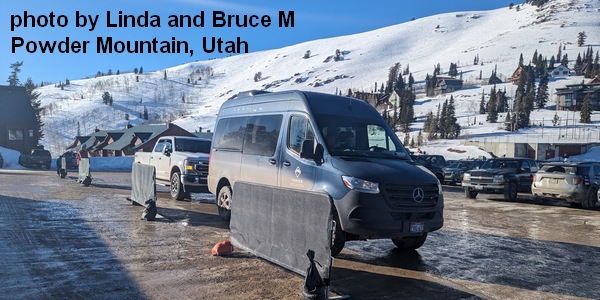
Sprinter Van of the Week!
 Click here for the Sprinter Van map of the world!!!
Have an awesome day!
PREVIOUS POSTS
- Friday Gorge wind forecast: today’s probably the lightest of the bunch. TATAS Weather: too hot for TATAS.
- Thursday Gorge wind forecast: breezy and warm through Monday. Gorge weather forecast: building heat…
- Wednesday Gorge wind forecast: strong today, windy through the weekend despite the heat. if you’re seeing yesterday’s forecast, try an private browser window.
- Tuesday Gorge wind forecast: breezy through Thursday, then breezy again for the weekend. TATAS weather: mostly 90+ degrees.
- Monday Gorge wind forecast: hot, and maybe just enough. Gorge weather: cooler Tuesday/Wednesday and breezy.

Have an awesome day.
Love, Temira