


Thank you for using this forecast. Like it? Find it useful? Support it (and me!) by sending some cash my way. What’s it cost to support me and get the email version? Not $99 a year. Nope. Not $49. Just $19.99 or more gets you a year. Click below to contribute. Thank you!!
Click here to use your PayPal
Venmo: @theGorgeismyGym
Snail Mail: PO Box 841, Hood River, Oregon 97031
(note: I am not a non-profit entity. The only way to accept credit cards with a user-defined amount is to use the ‘donate’ button. Thanks for understanding!)
Auto-renewing subscription. New! Awesome!
The Forecast
Today’s Gorge Wind – these are ranges for the average speed, not a predicted wind range. =)
Your favorite beach
Dawn
Patrol
9am-
11:30a
11:30a-
3pm
3pm-
dusk
Rooster Rock
clouds
and
cold
buns
Steven’s Locks
5-10
5-10
10-13
10-13
Swell-Hood River
5-10
5-10
10-13
10-13
Lyle to Doug’s
5-10
5-10
LTV
LTV
Rufus, etc.
W5-10
W5-10
NNE10-15
NNE10-15
Roosevelt & Arlington
W5-10
W5-10
NNE10-15
NNE10-15
Gorge Wind Forecast
| Your favorite beach | Dawn Patrol |
9am- 11:30a |
11:30a- 3pm |
3pm- dusk |
|
|---|---|---|---|---|---|
| Rooster Rock | clouds | and | cold | buns | |
| Steven’s Locks | 5-10 | 5-10 | 10-13 | 10-13 | |
| Swell-Hood River | 5-10 | 5-10 | 10-13 | 10-13 | |
| Lyle to Doug’s | 5-10 | 5-10 | LTV | LTV | |
| Rufus, etc. | W5-10 | W5-10 | NNE10-15 | NNE10-15 | |
| Roosevelt & Arlington | W5-10 | W5-10 | NNE10-15 | NNE10-15 | |
Mt. Hood Snow Forecast
Today will be a mostly cloudy day on the mountain with clear sky overnight. The freezing level will be 500′ in the morning, 1500′ in the afternoon, and 0′ overnight. No precip. Wind: NE 15-20 in the morning, N20-30 in the afternoon, NE 20 overnight.Monday starts clear and ends with light snowfall. The snow level will be 0′ in the morning, 1500′ in the afternoon, and 2500′ after midnight. About 0.05” water value (WV) falls overnight, for up to 1/2” new snow. Wind: NE 20 in the morning, W 10-15 in the afternoon, NE 20-25 in the evening, and W 35-40 overnight.
Tuesday brings light orographic snowfall all day and all night. The snow level will be 2500′ during the day and 1500′ after midnight. About 0.3” WV falls daytime, for about 3” of relatively dry snow. Same overnight – another 0.3” WV for 3” of fresh. Wind: W 35-40 in the morning, WNW 40 in the afternoon, and NW 20-25 overnight.
As of this morning, the forecast for Wednesday is light snowfall in the morning. From Thursday afternoon through Saturday morning, significant precipitation is forecast for the Mt. Hood area. The current path of incoming weather systems keeps the snow level low enough for at least Meadows and Timberline to pick up significant snow. By significant, I mean about 3.5” WV is forecast for that time period. While the snow levels will fluctuate some, between two and three feet of snow seems possible for 5000′ if nothing changes in the path/timing/temperature of the incoming systems. Fingers crossed, and we’ll keep watching the models together.
Coast, Jones, Sauvie’s
Done for the season, most likely!Hood River Weather Forecast
Cloudy sky this morning stays at least partly cloudy all day. Temps will be in the mid 30’s early and upper 40’s later. Light westerlies. No rainbows. Monday starts clear and cold and turns drizzly midday. Temps will be in the mid 20’s early and low 40’s later. Calm wind early. Light to moderate westerlies in the afternoon. 88% chance of rainbows. Tuesday will be partly to mostly cloudy with occasional sprinkles. Temps will be in the mid 30’s early and mid 40’s in the afternoon. Light to moderate westerlies. 99% chance of rainbows. Looking for a complete Columbia Gorge forecast? Looking for more humor in your weather? Obscenities? You’re looking for my TATAS: Temira’s Awesome Travel Advisory Service on Facebook.Cycling
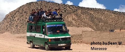
11/8: GP will be closed through December for upgrades. Contact HRATS if you’d like to help. Motorized use is open on ALL Hood River County Land now. Do be aware of the possibility of freeze-thaw (muddy) conditions\. Do not ride if it was below freezing last night and is above freezing when you want to ride. The soil structure will be liquefied, and you will do permanent damage to trails.Sprinter Van of the Week!
 Click here for the Sprinter Van map of the world!!!
Local Events
Weekly events: The Kainos Coffee run happens in The Dalles every Tuesday morning at 6am. There are sailboat races at the Hood River Marina every Wednesday evening. Dirty Fingers has a group mountain bike ride (bring lights) Wednesday nights at 5:30pm. Cheno has an outdoor HIIT workout at Griffin House in Hood River at 6pm on Wednesday nights. There is a BLM rally every Tuesday evening at 5:30 at the Salmon Fountain in Hood River, and there’s a White Coats for BLM rally every Thursday at noon at 12th and May in Hood River. Have an awesome day!Temira