Thank you for using this forecast. Like it? Find it useful? Support it (and me!) by sending some cash my way. Why? It takes me an hour or two each morning to produce this, and it makes your life better, safer, and more fun. That’s worth something! You can get the email version sent to you. Not $99 a year. Nope. Not $49. Just $12.34 or more gets you a subscription. Click below to give financial support. Thank you!!
Credit card payments click here – – – – – – – – – Click here to use your PayPal
Venmo: @theGorgeismyGym
Snail Mail: PO Box 841, Hood River, Oregon 97031
(note: I am not a non-profit entity. The only way to accept credit cards with a user-defined amount is to use the ‘donate’ button. Thanks for understanding!)
Auto-renewing subscription. New! Awesome!
The Forecast
| 4a-8a | 8a-12p | 12p-4p | 4p-8p | 8p-4a | |
|---|---|---|---|---|---|
| Wednesday 0′-500′ |
 |
 |
 |
 |
 |
| Thursay 0′->2000′ |
 |
 |
 |
 |
 |
| Friday 2000′->2500′ |
 |
 |
 |
 |
 |
Mt. Hood Weather Forecast
This relatively dry winter pattern we’ve been experiencing sticks around for the better part of the next five days. Model disagreement is apparent for a weak system on Friday, and also for the general picture starting Sunday. That said, Sunday’s currently our best chance for a significant mountain snowfall.Christmas day on the hill starts with scattered snow flurries and ends mostly cloudy. The sky clears overnight. The snow level will be 0-500′ all day long near Mt. Hood. Wind won’t be a problem – the forecast is for light and variable breezes all day long.
Thursday starts out clear on the hill and stays that way. The free air freezing level will be 0′ early, 500′ in the afternoon, and 2000′ after midnight. Wind will be NE 10 early, W 5 midday, and will rise to WNW 30 overnight.
While there won’t be much moisture around on Friday, that NW wind may be enough to squeeze some snow out of the next weak system. The snow level will be 2000′ early, 2500′ in the afternoon, and will rise to 5500′ overnight, thankfully after the moisture is gone. At best, the mountain will see 0.1” to 0.2” water value (WV) during the day Friday, for 1-2” of snow. I suspect we’ll see the lower end of that. Wind will be WNW 30 in the morning, NW 20 int eh afternoon, and NNW 15 after midnight.
As of right now, Saturday looks partly cloudy and warmer with the free air freezing level around 5500′. Sunday’s forecasts are consistent in bringing a snow-bearing weather system to Mt. Hood. They don’t agree on how much snow will fall. For now, let’s call it about 0.5” WV with the snow level at 3000’ish, setting us up for 4-6”. After Sunday, all weather will stop, as I am going to be on a silent retreat and away from E-devices for the next week.
Gorge Wind Forecast
Christmas morning easterlies will be in the 25-30 range near Rooster and 15-20 near Stevenson and Viento. The wind levels out to 20-25 from Rooster to Stevenson by late morning. Thursday starts with 25-30 near Rooster and 10-15 near Stevenson. Both locations end up at 20-25. Friday looks to bring light west wind in the 8-11 range, maybe a touch more between Stevenson and Viento.COAST, JONES, SAUVIE’S: Detailed forecast is on winter break.
Hood River Weather Forecast
A cloudy morning gives way to a mostly cloudy afternoon. Temps will be right at freezing early and in the mid to upper 30’s later. East wind. No rainbows. The Nothing sticks around Thursday morning and dissipates to partly cloudiness in the afternoon. Temps will be in the low 30’s early and low 40’s later. East wind. No rainbows. Friday might bring some light rain. Temps will be in the mid 30’s early and near 40 in the afternoon. Light westerlies. 86% chance of rainbows. Looking for a complete Columbia Gorge forecast? Looking for more humor in your weather? Obscenities? You’re looking for my TATAS: Temira’s Awesome Travel Advisory Service on Facebook.Road and Mountain Biking
Given that temps were below freezing on Monday night and will rise above freezing during the day Tuesday, all trails are under a freeze-thaw alert. Syncline, especially, is susceptible to this, as it is south-facing. Please don’t ride it, because you’ll do significant damage to those thawing trails. Your best bet for riding today is anything under the canopy of trees. Don’t ride up Seven Streams, as areas in the clearcut are freeze-thaw. A fun thing to do is ride up Post Canyon Road and ride down Mitchell Ridge. Repeat.Upcoming Events
It’s Christmas. Who knows what events are or are not happening!
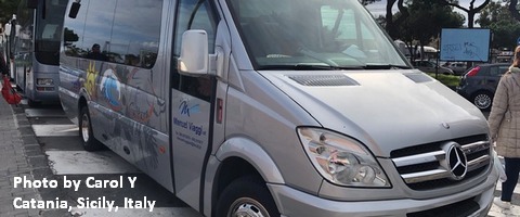
White Sprinter Van of the Week!

Click here for the White Sprinter Van map of the world!!!
Random Morning Thoughts: on vacation.
Click here for the full events calendar.
Have an awesome day today!
Temira


