It’s looking like our amazing week of dumping snow is coming to an end. Wow. What a storm cycle that was! The end of powder means the beginning of the storm recovery process on the higher lifts at Timberline and Meadows. Best of luck to those lift maintenance guys. I have no idea how they do it – sounds like a pretty brutal job to me. If you want to thank them for their hard, cold work, bake them something nice (Without weed, please. Weed baked goods are legal in Oregon, but so is drug testing, and you wouldn’t want those nice guys to get fired, would you? So, regular baked goods only!) Anyway, on to the forecast… Continued after the chart.
 |
4a-8a | 8a-12p | 12p-4p | 4p-8p | 8p-4a |
|---|---|---|---|---|---|
| Today 500′-1000′ |
 |
 |
 |
 |
 |
| Tomorrow 0′-500′ |
 |
 |
 |
 |
 |
| The next day 0′-1000′ |
 |
 |
 |
 |
 |
Mt. Hood Snow Forecast, continued…
You can expect a sunny day on Mt. Hood today with some on-and-off clouds possible and just-plain-clear sky by tonight. The free air freezing level will be 500′ today, dropping to the surface tonight. Temps at 5000′ will be in the low double digits. No new accumulation. NW wind at 10-15 all day long.
Tomorrow starts out clear and ends up with high overcast sky in the late afternoon. There’s just a slight chance of a few flurries overnight. The free air freezing level will be at the surface all day. 5000′ temps will be in the low double digits early and in the upper 20’s in the afternoon. Wind tomorrow will be NW 10-15 early, switching to SW 10-15 in the afternoon and rising to SW 15-20 in the evening.

Donate and keep the forecasts coming
See below for details.
Sunday may either be clear or high overcast in the morning. Clouds move in midday and snow starts around noon or 1pm. The snow level will be at the surface, possibly rising to 1000′ after midnight, but temps at 5000′ will be in the upper 20’s. It’s not going to be continental powder, but it will be fresh snow. We’ll see .4-.6” water value (WV) between noon and 10pm, for 4-6” of new snow. After 10pm, the snow should stop. Wind on Sunday will be SW 15-20 early, rising to WSW 20-25 midday and becoming W 20 after 4pm.
Monday looks clear in the morning with a few flurries possible midday and clear sky in the afternoon. The free air freezing level will be 1000′. Wind will be N 10-15. Next chance for snow is Wednesday.
Saturday looks clear and sub-freezing (highs in the mid 20’s at 5000′) with some high clouds possible. The free air freezing level will be 500′ or less all day, dropping to the surface in the evening. No new snow. Light and variable wind. In other words, it’s going to be a ridiculous, epic, amazing packed powder groomer day. If all three resorts don’t park out on Saturday, I’m going to be surprised.
Sunday will probably start out clear and end up with high clouds. It’s possible we’ll see an inch or two of snow into Monday morning, but models aren’t agreeing on that. The free air freezing level will likely be at the surface, but the sounding model is showing +1 degree C between 4000′ and 7000′ for a period of time in the morning. In other words, the snow may warm up a little bit, so Saturday is more epic than Sunday if you’re looking for groom. Wind on Sunday will be SW 10-15.
There’s really not much precip in the forecast for the next five to seven days. But that, of course, could change.
Support your forecaster, Temira!

Thank you for using this forecast. Does it save you time, gas money, or help you have more fun in your life? Make a donation! Get your forecast here for free or donate and get on the mailing list for year-round wind forecasts and ski season snow forecasts. Just click on my photo to donate via PayPal or credit card. The email isn’t $99/year. Not $50/year. No, just $12.34 or more gets you on the list for 12 months, and sometimes there are cool prizes. Don’t PayPal? Send a check to Temira @ PO Box 841 in Hood River. Thank you for your support, and thank you for trusting my forecast.
Gorge Wind Forecast
We have light west wind at 5-10 this morning with a cross-Cascade gradient of W .04. Models say the wind will pick up to W 13-16 from Swell to The Dalles this afternoon. Tomorrow starts off with light and variable wind and picks up to E 40+ in the evening. Sunday starts off with E 50 and backs off to E 25 in the evening. Models suggest we’ll see the east wind fade Sunday night and switch to W 10 in the morning, but the models are notoriously bad with the switch from east to west. I suspect we’ll stay with light easterlies, meaning we’ll stick with sub-freezing temps and icy-snowy roads.
Random Morning Thoughts
An odd thing happened to me at the mountain yesterday, and that got me thinking about how we reach out to connect with people. There are people in my life, and I’m sure in yours as well, who greet you with negativity. Perhaps they make a sarcastic comment about your hairstyle, your clothing, or some other aspect of your life. This is how these people try and connect with others. It’s not a helpful way to connect, and ends up driving people away and creating distance (and that’s probably their unconscious desire) As a public figure, I’m occasionally greeted with someone hollering at me about a blown forecast, a cut-and-paste error, or some other aspect of imperfection in my work.
When people greet me with negativity, I’m a little baffled. Is this an attempt to connect without being vulnerable? It it an attempt to take power over me? I find it really confusing, and am often uncertain how to reply. I suspect you’ve had the same experience on more than one occasion. One thing I’ve learned is that greeting negativity with defensiveness isn’t the right answer. And meeting it with vulnerability (saying, for example, “That didn’t feel good to me”) usually results in a response of, “Oh, don’t be so sensitive.”
I’m starting to suspect that the best response, at least in a casual situation, is to greet negativity or sarcasm with positivity. If someone says, sarcastically, “Oh, that’s a nice haircut,” the best response may be “Thank you!”. It’s disarming, it’s positive, and it removes the power of sarcasm, which in my book, always carries an undercurrent of insult. So, three takeaways: be kind, drop the sarcasm, and greet negativity with positivity. Have an awesome day!
Disclaimer required by my grad school program: I am not your therapist. I am your weather forecaster. Take everything I say with a grain of salt, and consult with your actual therapist about your mental health issues.
Gorge Weather Forecast
I stepped outside earlier to get my boots and mittens out of the car, and all I saw was clouds above. It’s clear on Mt. Hood, and that means we’ve got the Nothing around to bother us this morning. If the sounding model is correct, the low clouds will stick around today. If the prediction of west wind is correct, the clouds will burn off. So, let’s call it partly cloudy today. Temps will be in the low 30’s below the clouds and the mid 20’s above the clouds. High temps today will be around 40. Light west wind early, moderate late, no rainbows. Icy roads tonight.
Tomorrow looks clear to partly cloudy in the morning with high clouds overnight. Morning temps will be in the low 20’s where there’s no snow on the ground and colder than that where there is snow on the ground. Highs will be in the mid 30’s. It’s possible, although unlikely, that we’ll see a few flurries late Saturday night. Light and variable wind early picks up to strong east wind in the afternoon. Icy spots on the roads. No rainbows.
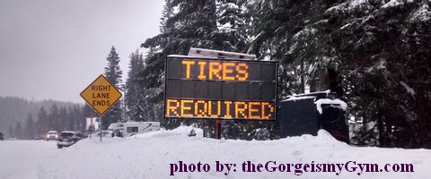
Here’s where Temira’s Awesome Travel Advisory Service (TATAS) is going to step in. Sunday looks a bit sketchy for travelers. We’ll start off the day overcast, and then we’ll see precip start around noon or 1pm. Temps will be in the upper 20’s early and the low to mid 30’s in the afternoon, making the p-type a tricky call. Given the deep cold air mass to the east, I suspect we’re looking at 1-3” of snow between 1pm and 10pm. With the shady roads (like I-84) sub-freezing, we’re looking at sticking snow. Models suggest we’ll go to west wind Monday morning (good luck with that actually happening with E 50 predicted for Sunday morning), meaning we’ll see slushy roads then. No rainbows.
Monday morning is a tricky call. If we actually see west wind, Hood River will be above freezing. If the gradient is still easterly, we’ll have snowy roads to contend with. I think we’ll just have to wait a day to see what the models say. Looking ahead a few days, there’s a good chance of more snow and/or freezing rain Tuesday night.
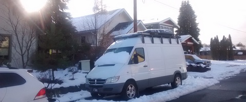
White Sprinter Van of the Day

Road and Mountain Biking
It’s likely the under-the-canopy trails are now frozen enough to ride early in the morning or with your bright headlamp at night. The trails will be more frozen after today. The trails outside the canopy, Syncline, Hospital Hill, and Whoopdee, are about to get hit by a freeze-thaw cycle. Please do not ride them if it was below freezing last night and is above freezing right now.
Holistic Simcoe Accounting
Simcoe Accounting is a full-service accounting firm serving clients throughout the Columbia gorge, dedicated to providing our clients with professional, personalized services and guidance in a wide range of financial and business needs. We believe in getting it right the first time. The right service at the right time, at the right price. Contact us for a free quote: www.simcoeaccounting.com
Upcoming Events
I’m going to assume all events are canceled today. It is, after all, Christmas. Enjoy the holiday!
Have an awesome day today!
Temira
The Clymb: free membership.
Cheap gear.
Temira approves. Click to join.


