Mt. Hood Snow Forecast
I’m not usually the queen of pessimism, nor am I the party pooper. Today, however, I’m going to rain on our parade. Mother Nature pulled a fast one yesterday, keeping the majority of the precipitation over the city instead of over the mountains. My least optimistic forecast called for 10” of snow. We got… 3”. Yeah. Disappointing. But we’ll all make the most of it, and Meadows is still opening up for at least this weekend. Continued after the chart…
 |
4a-8a | 8a-12p | 12p-4p | 4p-8p | 8p-4a |
|---|---|---|---|---|---|
| Friday 2500′-6000′ |
 |
 |
 |
 |
 |
| Saturday 4000′->1500′ |
 |
 |
 |
 |
 |
| Sunday 1500′-6000′ |
 |
 |
 |
 |
 |
Mt. Hood Snow Forecast, continued…
Today’s weather calls for continued light snow this morning followed by heavier precip (possibly mixed) tonight. The snow level will be 2500′ early, 4000′ in the afternoon, 5500-6000′ overnight, and 4000′ on Saturday morning. We’ll see .1-.2” water value (WV) between this morning and 4pm, for 2” of new snow. We’ll see another .5” overnight, but it’s going to be pretty warm. If we see snow, we’ll see 2-3” of dense, gooey Cascade concrete. It’s entirely possible we’ll see some rain mixed in, but it’s impossible to know for sure. Anyway, wind today will be SW 10 for much of the day, picking up to SSW 20 overnight.
Saturday sees continued light snowfall with the snow level at 4000′ early, 3000′ midday, and 1500′ overnight. We’ll see .2” WV during the day, for a couple inches of new snow. We’ll see another .1” WV overnight, for another inch. Wind on Saturday will be WSW 25 early, SW 20 midday and WSW 20 in the afternoon.
Say “thanks for the forecasts”
by making a donation!
Keep the forecasts coming.
Does this forecast save you time, gas money, or help you have more fun in your life? Make a donation to support continued forecasting, and get the forecast in your inbox each day. Click on the button to donate. The email subscription isn’t $99/year. Not $50/year. No, just $12.34 or more gets you on the list for 12 months. Don’t PayPal? Send a check to Temira @ PO Box 841 in Hood River. Thank you for your support and thank you for trusting my forecast.

Mt. Hood Snow Forecast, finished
Sunday sees the upper flow turning to the NW, bringing light orographic flurries under mostly clear sky during the day. A powerful weather system smacks Mt. Hood Sunday night. That one comes in, once again, with borderline temps. It currently looks like the snow level will be 1500′ Sunday morning and 6000′ on Sunday night, dropping to 2500′ after midnight. We’ll see 1-1.5” WV between 7pm Sunday and 4am Monday. That should start off as snow, switch to either very wet snow or mixed precip, and turn back to snow after midnight. I’m guessing here, but I’d say we’ll get 5-8” of snow from this system. The most interesting part of this is the wind: W 10 early Sunday builds to W 35 in the afternoon. The wind turns to WSW 35 in the evening and a brutal and lift-stopping WNW 50 after midnight.
Monday currently looks snowy and windy until afternoon when the sky will clear. The snow level will be 2000′ early and 1500′ for the rest of the day. We’ll see about .8-1” WV during the day Monday for 9-12” of new snow. Monday’s wind will be WNW 50 early, turning to NW 45 mid-morning and fading to NW 30 in the afternoon. The next big system is forecast for Tuesday night, but it’s looking like it’ll come in with a snow level of 6000′. Wait and see, right?
Gorge Wind Forecast
It’s Friday. You can expect light west wind for most of the day and east wind at 15-20 at Iwash and Steven’s Locks from 4pm on. Saturday starts off with east wind at 15-20, but we’ll see a quick switch to W 5-10 just after sunrise. Sunday currently looks like W 20-23 for most of the day through most of the Gorge. Monday’s still looking interesting with high pressure of the coast and low pressure inland. Models are still suggesting W 26-30 through Monday afternoon.
Jones, Sauvie’s, Coast Beta Test Forecast
If you click right here , you’ll find NOAA’s coast forecast.
Random Morning Thoughts
Today is Black Friday, no longer the biggest shopping day of the year, but still the day that epitomizes all that is materialism and consumerism. As you head out into the world to do your shopping today, I encourage you to carefully consider your purchases.
As you walk to your front door on the way to the store, do a mental inventory of all the stuff you own. What’s been around longest? What’s brought you the most joy? What gifts from years past are still around impacting your life? What is it about your favorite objects that makes them your favorite?
I have two favorites, and both are paintings. I came home one random day many years ago to a garbage-bag wrapped present in my room. Inside was my favorite-ever painting by my friend Mark Nilsson, a painting I could never have afforded to buy. Each time I see it, I’m touched by his generosity and friendship. My other favorite object is an Ellen Dittebrandt painting given to me by my friend Jayme. Same thing there – generosity and friendship and memories of a dear friend who was gone way before I was ready to lose her.
I bet you have similar stories. Contemplate them while you’re out buying stuff today and over the next few weeks. Make intentional purchases so your purchases have the most impact possible. Object aren’t just stuff, you know. They’re memories and emotions. You’re awesome. Have an awesome day.
Disclaimer required by my grad school program: I am not your therapist (but I could be 51 graduate school credits from now). I am your weather forecaster. Take everything I say with a grain of salt, and consult with your actual therapist about your mental health issues. One other thing: I plan to keep doing this forecast indefinitely, even when I am a therapist.
Gorge Weather Forecast
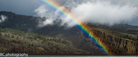
It sounds rather wet on the roads right now, and the radar image confirms that. The great thing about modern meteorology and poorly insulated windows is that you don’t have to leave your desk to do a weather forecast! Expect continued showers today with more rain tonight. Temps won’t budge much, remaining in the mid 40’s all day. Light wind. 14% chance of rainbows. Saturday looks cloudy and showery. Temps will be near 40 early and in the upper 40’s in the afternoon. Light easterlies early, light westerlies later. 97% chance of rainbows. Sunday looks partly cloudy during the day with rain overnight. Temps will be in the upper 30’s early and the mid 40’s in the afternoon. Moderate west wind. 97% chance of rainbows.
For weather specifically directed at travel through the Gorge, please visit Temira’s Awesome Travel Advisory Service on Facebook.
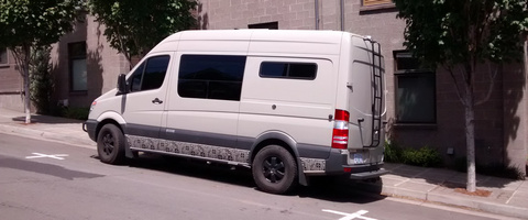
White Sprinter Van of the Day

Road and Mountain Biking
No, really. Post Canyon and Whoopdee are too muddy to ride. Really. It’s almost too muddy to jog in Post Canyon right now. I jogged there yesterday, and came home muddy. Consider riding the gravel roads instead. There are lots of them around here, and you won’t be doing trail damage if you ride on the roads.
Upcoming Events
This morning at 7am is the Kickstand Coffee Run. Meet at the coffee shop at 7am for a free cup of coffee and a donut. Well, you have to jog 4 miles first… Coming up tomorrow, there’s community yoga in Spanish at 7am at Flow Yoga in Hood River. There’s a trail run at 8am in Post Canyon.
Have an awesome day today!
Temira


