

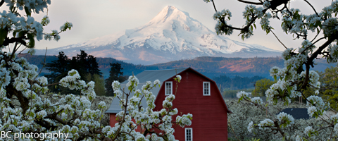
A few inches of snow fell on Mt. Hood last night, and that should freshen up the groomers for all y’all. Expect continued snowfall today, light in the morning and heavier in the afternoon and evening, tapering off after midnight. The snow level today will be 3000′ early, rising to 4500′ in the afternoon. We’ll see .3-.5” water value (WV) today, for 3-5” of new snow. We’ll see another .2” WV tonight, for another 1-2” of new snow. Wind today will be SW 15 for much of the day, turning to NW 15 in the evening. Continued after the chart.
 |
4a-8a | 8a-12p | 12p-4p | 4p-8p | 8p-4a |
|---|---|---|---|---|---|
| Thursday 3000′-> 4500′ |
 |
|
 |
|
|
| Friday 1500′-> 6500′ |
 |
 |
|
|
|
| Saturday 8000′-> 10,000′ |
|
|
|
|
|
Mt. Hood Snow Forecast, continued…
Friday may start off with lingering snow flurries interspersed with sunbreaks. The weather turns clear and sunny by the afternoon, although models do indicate the possibility of high clouds overnight. The snow level / freezing level on Friday will be 1500′ early and 7000′ in the afternoon, rising to 8000′ overnight. Wind will be NNW 20-25 early, fading to W 5-10 in the afternoon.

Donate and keep the forecasts coming
See below for details.
Saturday may start off with some high clouds or might just be sunny all day long. The free air freezing level will be 8000′ in the morning and 10,000′ in the afternoon, with 5000′ temps maxing out in the mid 40’s. Wind on Saturday will be light and variable. Sunday looks sunny and warm with 5000′ temps maxing out in the upper 50’s.
Support your forecaster, Temira!

Thank you for using this forecast. Does it save you time, gas money, or help you have more fun in your life? Make a donation! Get your forecast here for free or donate and get on the mailing list for year-round wind forecasts and ski season snow forecasts. Just click on my photo to donate via PayPal or credit card. The email isn’t $99/year. Not $50/year. No, just $12.34 or more gets you on the list for 12 months, and sometimes there are cool prizes. Don’t PayPal? Send a check to Temira @ PO Box 841 in Hood River. Thank you for your support, and thank you for trusting my forecast.
Gorge Wind Forecast
All we have out there on this Thursday morning is a little bit of light east wind. We’ll see a switch to light westerlies at 5-10 through the whole Gorge early in the afternoon. As an upper level low moves inland mid-afternoon or so, we’ll see the wind pick up to gusty 22-25 from Rowena to Arlington. The western Gorge, from Stevenson to Mosier, will likely be under the clouds and rainy, with gusty westerlies at 11-14.
Friday starts out with a decent setup: offshore high pressure combines with inland low pressure for solid cross-Cascade gradients. As the day goes on, high pressure will build inland, knocking down the wind speeds. You can expect Dawn Patrol at 25-29 from Mosier to Arlington. As the clouds burn off during the day, the wind will back off. For the afternoon, you can expect 22-25 from Hood River to Arlington. Stevenson’s a bit of a question mark – if the clouds burn off, it’ll probably see 20-23 tomorrow afternoon.
High pressure builds across the Northwest on Saturday, giving us a light and variable start. We’ll see easterlies at 10-15 at Rooster and Stevenson in the afternoon. Sunday sees east wind at 20-30 at Rooster and Stevenson early. By the afternoon, we’ll see widespread east wind at 10-15, with stronger east wind in the western Gorge.
Random Morning Thoughts
Ack. I’m already running behind today. The only thing randomly running through my head today is my massive list of to-dos and readings that I need to get done before the end of the weekend. You have an awesome day, okay?
Disclaimer required by my grad school program: I am not your therapist. I am your weather forecaster. Take everything I say with a grain of salt, and consult with your actual therapist about your mental health issues.
Gorge Weather Forecast
It would appear, judging by the grey color of the sky, that it is cloudy this morning. You can expect clouds this morning with mostly cloudy sky, sunbreaks and rain this afternoon. Temps will be in the low 40’s early and the upper 50’s in the afternoon. Light west wind early, moderate west wind this afternoon. 72% chance of rainbows. Friday starts off partly cloudy and turns sunny. Temps will be in the low 40’s early and the low 60’s in the afternoon. Strong west wind. 1% chance of rainbows. Saturday looks sunny. Temps will be in the low 40’s early and the low 70’s this afternoon. Light east wind. No rainbows. Sunday looks like Saturday but a little warmer.
For weather specifically directed at travel through the Gorge, please visit Temira’s Awesome Travel Advisory Service on Facebook.
White Sprinter Van of the Day

Road and Mountain Biking
I went for a quick ride in Post yesterday morning, and it was a little bit slick. Just a little. Then we had .1” of rain in the last 12 hours or so, meaning it’s going to be even more slick. You’re probably better off on Whoopdee, Hospital, Syncline or Nestor today. Nestor, by the way, is snow-free with just a couple trees down. In road biking news, this morning looks showery with light enough wind. Tomorrow looks dry but very windy. Saturday looks epic, with a high temp around 70 and light east wind. On to other news… if you have an old bike sitting around (even if it’s not in working order), please bring it to the Anson’s Bike Buddies bike drive on the 24th from 10am-3pm at Cascade Eye Center.
Upcoming Events
Happy Thursday! There’s pickup touch rugby this evening at 5:15 at the Waterfront Park in Hood River, the Post n’ Pint group mountain bike ride leaves Dirty Fingers at 5:30, there’s community yoga at Samadhi at 6pm, community Tai Chi at Our Savior Church in Bingen at 6:30pm, and community Zumba at the Parkdale Community Center at 6:30pm.
Have an awesome day today!
Temira

The Clymb: free membership.
Cheap gear.
Temira approves. Click to join.
