| Your favorite launch | dawn patrol |
morning max | afternoon max | executive session |
|
|---|---|---|---|---|---|
| Iwash (Rooster) Rock | sun’s | coming | buns | are too! | |
| Stevenson | 13-16 | 17-20 | 18-21 | 18-21 | |
| Viento | 21-24 | 21-24 | 18-21 | 18-21 | |
| Swell-Hood River | 17-20 | 21-24 | 18-21 | 18-21 | |
| Lyle to Doug’s | 11-14 | 17-20 | 22-25 | 22-25 | |
| Rufus, etc: 72-107kcfs flow | 10-13 | 13-16+ | 22-25 | 22-25 | |
| Roosevelt & Arlington | 7-10 | 10-13 | 13-16 | 17-20 | |
| River flow last 24 hours: 68-107kcfskcfs | =River temp: 69.80F | HR High temp: 82F | |||
Gorge Wind Forecast
Hi friends! Looks like westerlies will stick around in some form for a while. Strongest days this week will probably be today, Tuesday, and Thursday, but there’s quite the range in the possibilities for Thursday. It could be very windy, and it could be unexceptional. Do keep an eye on it. Now, before we dive into the forecast, let’s have a quick review and discussion of the navigational rules of the road. This follows several situations I experienced recently. If I’m experiencing these things, so are others.
Is this feeling helpful? If so, go ahead and make a contribution using Paypal to support it. Send $19.99 or more, and I’ll send the forecast to your inbox for a year.
Maritime law isn’t intended to set rules so you get in trouble. Rather, it gives us a common language for safety. Starboard tack has right of way over port tack – that rule’s in place so you don’t have to discuss the situation and you know who should yield. If you’re playing in a west wind, and you’re headed towards Oregon, you have the right of way, but you still have some responsibility to avoid collisions. This applies to the winger on port tack yesterday who was yelling at me and everyone else, “Coming through, coming through.” Nope. You gotta yield to wingers/kiters/windsurfers on starboard tack. Ditto to the guy near Cheap Beach a couple weeks ago yelling, “Fuck no!” at me as he came blazing directly towards me on Port tack..
Next rule, and I’ll quote: “Every vessel shall maintain a proper lookout…so as to make a full appraisal of the risk of collision”. In other words, downwinders must look all around, and cross-winders must look upwind. So, the windsurfer who never looked upwind yesterday, whom I was desperately trying to avoid by taking evasive action, who nearly hit me, forced me off my board, and then yelled at me and took off, please look upwind too. Next: “every vessel shall use all means to determine if risk of collision exists.” See rule 8 for actions to avoid a collision.
Next, the rules are clear that barges have the right of way followed by vessels actively fishing and then sailboats. They are silent on windsurfers/paddlers, etc., but the Coast Guard has ruled on this (FAQ 13). Essentially, craft that are less maneuverable have the right of way over craft that are move maneuverable, and the USCG believes that paddle craft (and surfers, but they are silent on that) are generally less maneuverable than craft under wind or motor power. That would imply that an outrigger canoe, a surfski, a SUP foiler, and anyone schlogging has the right of way over planing kiters/windsurfers/wingers. If you are planing/on foil, it is your responsibility (rules 2,7,8) to avoid a collision by taking action such as changing course. And please, remember to look upwind. Paddlers: put on a bright jersey and helmet so the cross-winders can see you. Finally, the rules would imply that an E-foil that’s powered up is a powered craft and must yield to other craft. Please, folks, have a good read of the rules and work together out there – you may have to jibe or tack to avoid causing a collision with someone who is less maneuverable than you are. Let’s keep each other safe.
Now that we’re safer… on to the forecast. I woke up sooooo early. The 6am gradients were 29.97/29.87/29.82 for 0.10 and 0.05. Offshore, we have weak high pressure. Metro area: marine clouds. Inland, we have a departing trough. That should be enough for 21-24 this morning from Viento to Swell with 17-20 from Hood River to Mosier. To the east: 11-14. Stevenson: 13-16 to start and 17-20 mid-morning. Once those clouds burn off in the metro area, and burn off they shall, we’ll see the standard shift. Early to mid afternoon wind between Stevenson and Hood River levels out at 18-21. Lyle to Avery rises to 22-25. Rufus is likely to join in the evening. Arlington eventually climbs to 17-20. River flow over the last 24 hours was 68-107kcfs, river temp is 69.80F, and high temp forecast is 82F.
Writing the complete forecast takes me 1-2 hours a day. If it saves you time, gas money, or helps you plan your life, please consider contributing.

An approaching weather system on Tuesday knocks down the synoptic-scale gradients, but we’ll still have wind. It’s likely we’ll see a period of 21-24 from Viento to Swell for a couple hours in the morning, but it’s going to drop and stay down: 17-20 from Stevenson to Hood River for the afternoon. From Lyle to Rufus, the wind rises to gusty 23-26 in the afternoon. Arlington joins at 23-26 in the evening. Remember that those eastern Gorge sensors read high, and that this forecast predicts those sensor readings. High temp: 76F for Hood River and low 80s to the east.
That was helpful in planning your life, wasn’t it? Go ahead and subscribe to the forecast using the fancy auto-renew option. Don’t like electronic payment? No problem! You can send a check or cash to: Temira / PO Box 841 / Hood River, Oregon, 97031. Thank you so much for supporting the forecast. I’m glad you find it helpful, and I appreciate your kindness in supporting the work I’m doing!

Rain is likely on Wednesday. To find wind, you’ll have to head east. Areas west of The Dalles will stay in the 10-13 range or less. Models suggest 18-22mph is possible east of Hood River in the afternoon, but there’s quite a bit of range in the forecast still. Extended: Thursday looks a bit stronger, and it looks focused on areas between Lyle and Rufus. That said, models have quite a bit of range still. Fingers crossed for the strongest possible outcome! Gusty westerlies near 20mph probably stick around Friday through Sunday. Headed out today? Remember to look around, yield to starboard tack riders if you’re on port tack, yield to less maneuverable craft, and take active steps to avoid collisions. Have a great day on the river!

Jones, Sauvie Island, Oregon Coast
North/Central/South coast, waves (swell forecast provided by NWS). Wind forecast for the afternoon (unless it’s a storm on the coast, in which case that’s peak wind during the day). Wind direction N (coast/Sauvie Island) and W (Jones) unless otherwise noted. Monday: 10-15/20/20-25, W swell 3′ at 10 seconds. Tuesday: LTNW/NW10/N25, NW 4′ @ 10. Wednesday: LTW/LTW/LTV, NW 4′ @ 9. Jones Monday: 14-17. Tuesday: 13-16. Wednesday: LTW. Sauvie Island Monday: 11-14. Tuesday: 10-13. Wednesday: LTV and wet.   Alan’s Sauvie Island Wind Sensor
Mt. Hood Weather Forecast
I’m tired. It’s on vacation.
Very basic Hood River weather forecast. Don’t plan your life around this. You really should read Temira’s Awesome Travel Advisory Service on Facebook
Monday brings high clouds. Temps start in the low 60s and rise to the low 80s. Moderately strong westerlies. No rainbows. Tuesday will be partly high cloudy. Temps start in the mid 50s and rise to the mid 70s. Moderate westerlies. No rainbows. Wednesday starts rainy and turns dry and partly cloudy. Temps start in the low 50s and rise to the mid 60s. Moderate westerlies. 99% chance of rainbows.
Link to my Local-ish Outdoorsy Events Google Calendar
Please let me know of outdoor-related local-ish events. If you don’t tell me, I don’t know!
Cycling
All vehicles on HR County forest roads need a gallon of water and a shovel. Fire or fire danger closures: Whoopdee, Underwood, Hospital Hill, most of Post Canyon, Gorge 400, trails around Mt. Adams. Dog River is closed for logging and rerouting until mid-September. Open: 44 Road Trails, Ape Canyon, Lewis River, Falls Creek, Columbia Hills, Gunsight, Boulder Lakes, Siouxon, Sandy Ridge. Twin Tunnels reopened for a day or two, and then it closed again – I have photo evidence to prove this! Remember that E-bikes are not allowed on USFS non-moto trails. They are allowed on moto trails.
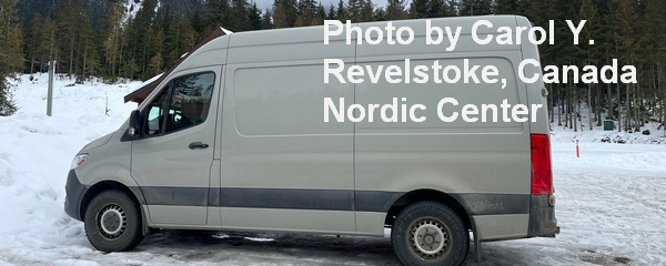
Sprinter Van of the Week!
 Click here for the Sprinter Van map of the world!!!
Have an awesome day!


