

| Your favorite launch | dawn patrol |
morning max | afternoon max | executive session |
|
|---|---|---|---|---|---|
| Iwash (Rooster) Rock | sunburn | those | buns. | again. | |
| Stevenson | 10-13 | 17-20 | 20-23 | 20-23 | |
| Viento | 21-24 | 25-28 | G20-23 | 17-20 | |
| Swell-Hood River | 21-24 | 25-28 | G20-23 | 17-20 | |
| Lyle to Doug’s | 10-13 | 16-20+ | 23-26 | 20-23 | |
| Rufus, etc: 108-179kcfs flow | 10-13 | 16-20+ | 26-29 | 20-23 | |
| Roosevelt & Arlington | 10-13 | 16-20+ | 26-29 | 20-23 | |
| River flow last 24 hours: 99-179kcfskcfs | =River temp: 69.44F | High temp: 88F | |||
Gorge Wind Forecast
Hi friends! I woke up early this morning, and the dawn patrol is firing. All ya Oregon folks have to do is wait until 7am for the bridge to reopen. Don’t forget that it’s only open between 7am and 7pm through the 21st. In wind news, today looks like a good one. The wind shuts off tomorrow and returns in a rather gusty way for Wednesday through Friday. After that, models are all over the place for the weekend, but there’s at least some potential for a cooldown and accompanying stronger westerlies Sunday or Monday.
Is this feeling helpful? If so, go ahead and make a contribution using Paypal to support it. Send $19.99 or more, and I’ll send the forecast to your inbox for a year.
To start off Monday, we have pressures of 30.12/30.00/29.95 for gradients of 0.12 and 0.05. In a delightful twist, there’s a pretty solid deck of marine clouds in Vancouver and at least some marine layer in Portland. Westerlies started the day at 10-13 in Stevenson and 21-24 from Viento to Hood River and probably Mosier to. East of there: 10-13, generally. We’ll see a quick jump to 25-28 from Viento to Mosier this morning with 20-23 at Stevenson and 20-23 east to Rufus. Models suggest the wind will drop to gusty 20-23 between Stevenson and Mosier early afternoon while the Lyle-Arlington zone rises to 23-26, perhaps 26-29 at Rufus (but remember that sensors at The Wall and Arlington read higher than the sensors at Swell, Hood River, and the Rowena stretch, for whatever reason). Evening wind drops to 17-20 west of Lyle and 20-23 east of Lyle. River flow over the last 24 hours was 99-163kcfs, river temp is 69.44F, and high temp forecast is 88F for Hood River and 100F for Arlington.

Offshore high pressure falls apart on Tuesday as a weak low shoots up the coast. Result: way less wind. Expect 10-13 from Viento to Swell early in the morning. That doesn’t last. The wind turns light/variable by mid-morning and stays that way. Temps head for 100, humidity increases, and there’s a chance of thunder/lightning late. Moving on…
Writing the complete forecast takes me 1-2 hours a day. If it saves you time, gas money, or helps you plan your life, please consider contributing.

Tuesday’s disturbance moves north on Wednesday morning only to be replaced by another weak offshore low late afternoon. But don’t you worry: it’ll be matched by a beast of a heat low in the desert, and this will keep the onshore gradients going. This is not an ideal setup, and the wind is likely to under-perform the models, but still… we should see wind. Dawn Patrol is tricky, actually impossible, to predict thanks to the potential for lingering instability. Let’s take a guess: 21-24 from Stevenson to Mosier. Afternoon westerlies pick up to (at least) 23-26 from Mosier to Rufus (wrong direction, almost certainly) with the potential for 26-29 from Mosier to Arlington later. Hold this forecast lightly – the setup is far from ideal.
That was helpful in planning your life, wasn’t it? Go ahead and subscribe to the forecast using the fancy auto-renew option. Don’t like electronic payment? No problem! You can send a check or cash to: Temira / PO Box 841 / Hood River, Oregon, 97031. Thank you so much for supporting the forecast. I’m glad you find it helpful, and I appreciate your kindness in supporting the work I’m doing!
Extended: Models are more hopeful, and there’s more consensus present, for Thursday. Call it 25-28. That said, we’ll still be dealing with an offshore low, so the setup is imperfect. Lesser wind, but probably still “enough”, 17-20ish in the Corridor is my best current guess for Friday. Saturday’s forecast is all over the map. Models then hint at a cooldown and strong wind for Sunday and/or Monday. But that’s way too far out for certainty. Get out there today and make the most of it!
Jones, Sauvie Island, Oregon Coast
North/Central/South coast, waves (swell forecast provided by NWS). Wind forecast for the afternoon (unless it’s a storm on the coast, in which case that’s peak wind during the day). Wind direction N (coast/Sauvie Island) and W (Jones) unless otherwise noted. Monday: 15-20/20-25/LTV, NW swell 5′ at 8 seconds. Tuesday: 15-20/S15/S15, NW 5′ @ 7 and SW 2′ at 17. Wednesday: SW15/SW15/S10, W 4′ @ 9 and SW 2′ @ 17. Jones Monday: 11-14. Tuesday: LTW. Wednesday: 14-17. Sauvie Island Monday: 10-13. Tuesday: 10-13. Wednesday: LTV.
Alan’s Sauvie Island Wind Sensor
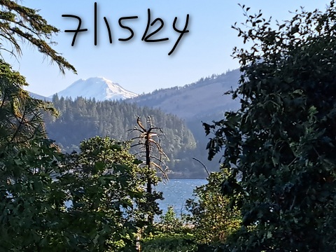
Mt. Hood Weather Forecast
I’m tired. It’s on vacation.
Very basic Hood River weather forecast. Don’t plan your life around this. You really should read Temira’s Awesome Travel Advisory Service on Facebook
Clear sky this morning adds a few high clouds later. Temps start in the mid 60s and rise to the upper 80s. Moderately strong westerlies. No rainbows. Tuesday will be partly high overcast with a chance of elevated thunderstorms in the evening. Temps start near 60 and rise near 100. Muggy. Light west wind early. Calm later. No rainbows. Wednesday will be partly high overcast in the morning with a chance of thunder. Afternoon: clear. Temps start near 70 and rise to the low 90s. Muggy. Moderately strong westerlies. No rainbows.
Local-ish Events
Please let me know of outdoor-related local-ish events. If you don’t tell me, I don’t know!
There’s a weekly social for Wind Johnnies (The Gorge Wind Social) at Ferment Brewing every 3rd Monday this summer.
The Columbia Gorge Junior Kayak Club offers free roll sessions (gear provided) for kids at the Hood River Pool every other Tuesday from 5:30 to 7pm. Visit their website for more deets: https://www.columbiagorgejuniorkayakclub.org/. Amayah’s offers a free meal every First Thursday from 1pm to 4pm. Regular weekly events:. NK Studio’s by-donation Tuesday morning yoga class is back. Ferment’s Tuesday night 4-mile walk/run is at 6pm. There’s meditation with monks at 5:15pm (an hour) and 6:30pm (30 minutes plus a talk) at Yoga Samadhi in White Salmon. Columbia Gorge Tri Club meets at Mayer State Park at 6pm Tuesdays. At 7:15am on Wednesdays, there’s a run from the White Salmon Bakery. At 7am on Friday morning, there’s a run from Pine Street Bakery. On Fridays at 2:30pm, there’s a free meditation and stretching class at Yoga Samadhi. On Saturday at 9am, there’s a by-donation outdoor group fitness on the 2rd floor deck about Ferment Brewing.
Wingfoil racing starts July 2nd: https://www.regattanetwork.com/clubmgmt/mgmt_event_menu.php?regatta_id=28193
Post Canyon Junior Enduro MTB series: https://cooperspuralpineteam.org/mountain-bike/fun-fridays-kids-enduro-series-post-canyon/
Cycling
Ape Canyon and Plains of Abraham are open per USFS website. Patchy snow and downed trees were there as of last report, 6/24. 44 Road trails are all open and clear, including upper 450 and Fifteenmile. As of 6/30, Gunsight is open. Boulder Lakes and other more remote trails are not bucked out yet. Remember that E-bikes are not allowed on USFS non-moto trails. They are allowed on moto trails.
Sprinter Van of the Week!
 Click here for the Sprinter Van map of the world!!!
Have an awesome day!
