| Your favorite launch | dawn patrol |
morning max | afternoon max | executive session |
|
|---|---|---|---|---|---|
| Iwash (Rooster) Rock | sun’s | out | buns | out | |
| Stevenson | LTW | 10-13 | G24-27 | G27-30 | |
| Viento | 10-13 | 10-13 | 24-27 | 27-30 | |
| Swell-Hood River | LTW | 10-13 | G24-27 | G27-30 | |
| Lyle to Doug’s | LTW | 10-13 | 24-27 | 27-30+ | |
| Rufus, etc: 213-260kcfs flow | LTW | 10-13 | 24-27 | 27-30 | |
| Roosevelt & Arlington | LTW | 10-13 | 24-27 | 27-30 | |
| River flow last 24 hours: 197-284kcfs | =River temp: 61.34F | High temp: 79F | |||
Gorge Wind Forecast
Hi friends! Well, yesterday was a bit of a puzzler. I was looking at the models trying to figure it out, and came up with a few ideas, but nothing conclusive. Fortunately, the next few days are more predictable, if a bit uncertain. Dynamic processes rather than a steady state setup (like yesterday) make it a little trickier to predict, and they also make the forecast quite changeable from day to day. Okay. Enough of that.
Today starts with pressures of 30.07/30.02/30.03 for gradients of W 0.05 and E 0.01. The only place with wind at dawn was Viento, in the upper teens. Westerlies slowly build to 12-15 from Stevenson to Mosier this morning. As cool air from an approaching trough pushes in to the west side this afternoon (please let it arrive on time!), westerlies build. If the timing holds, westerlies pick up to gusty 20-23 from Stevenson to Mosier by 2pm and keep on building. Late afternoon brings 24-27 from Stevenson to Rufus with 13-16 at Arlington. Evening: 27-30 from Stevenson to Arlington with a chance of 30-33 from Lyle to Rufus (current 213-284kcfs at Rufus). There’s some hint from the models that the Hatch won’t cooperate. At worst, I think we’ll have very up-and-down wind with big gusts at the Hatch. That’s fine for some sports, but not so much for others! River flow over the last 24 hours was 197-284kcfs, river temp is 61.34F, and high temp forecast is 79F.
Apparently there are small boat paddler hatch laps and a BBQ at the hatch for the executive session tonight. Keep that in mind. If you’re doing a current-perpendicular sport (winging, windsurfing, windsurf foiling), don’t go within 20-30′ downwind of a small boat (outrigger, surfski) or a SUP foiler who’s not on foil. Those current-parallel people can get picked up by random swells. This results in rapid downwind acceleration. Go upwind of boats. Go upwind of paddlers who are not on foil. And remember that starboard tack (heading to Oregon) has the right of way. We have these rules so we have a common language and know who is going where when! It’s about safety and communication, folks, not about who’s right or wrong or deserves to be out there!
We’ll be sitting under cool air on Friday as a weak system swings through. This limits thermal assistance, but we’ll still have some. Some equals enough! Offshore high pressure slowly regains some traction, but not early enough to really help. The day starts with a brief frontally driven dawn patrol (prior to 8am) of 22-25 from Viento to Mosier. East of there, all the way to Arlington, you’ll find 14-17 to start the day. Once this system moves through, the wind drops to 10-13 from Stevenson to The Dalles. The Rufus area (probably not the right direction, but still possessing the best Indian food around) rises to 19-23, and areas to the east pick up to 13-16. Afternoon wind rebounds to 14-17 from Stevenson to Hood river. The Mosier to Arlington zone gets 22-25. High temp will only be 70 degrees.
A cold front plows inland on Saturday and drives another round of somewhat gusty westerlies. Intermittent rain will fall west of Rowena. Westerlies shift east in response. The day starts with 25-28 from Avery to Threemile with drizzle and 10-13 west of The Dalles. For the rest of the day, westerlies rise to 27-30 from Avery to Boardman (maybe from Lyle to Doug’s, but maybe not) with 13-16 to the west. The wind starts to drop after 5pm. It’s worth noting that the cold air aloft will combine with sun at the surface for atmospheric instability. This can increase the gustiness of the wind and kick off thunderstorms. High temp: only 61F for Hood River and 65F for Arlington. There may be a downwind paddle race happening somewhere out east on Saturday. Stay tuned.

Extended:according to the deterministic GFS, Sunday looks light and variable as a low pressure system approaches the coast and quashes gradients. But ensembles hold the possibility of wind, so don’t write it off yet. Ensembles are more hopeful on Monday, but the range of possibilities is huge. Uncertainty increases headinag into Wednesday. That’s all for today. Have a great day on the water!

A poem:
Was that forecast helpful?
Did it save you time or gas money?
Did it make your life more fun?
Then please make a contribution.
Writing this takes me an hour or two a day.
Without your support, I can’t keep it up.
Keep the forecast going.
Subscribe or donate.
And share my forecast with your friends!
 |
 |
 |
|
Not ready to subscribe? No problem – please share this forecast with all your friends too!
Or try a month for free!
Jones, Sauvie Island, Oregon Coast
North/Central/South coast, waves (swell forecast provided by NWS). Wind forecast for the afternoon (unless it’s a storm on the coast, in which case that’s peak wind during the day). Wind direction N (coast/Sauvie Island) and W (Jones) unless otherwise noted. Thursday: 15-20/15-20/25-30, W swell 7′ at 11 seconds and SW 2′ at 16 seconds. Friday: WSW15-20/SW10/N20-25, W 5′ @ 11 and SW 2′ @ 15. Saturday: W10/W10/N25, W 6′ @ 10 and SW 2′ @ 14. Jones Thursday: 25-28 fading after 5pm. Friday: LTW. Saturday: 11-14. Sauvie Island Thursday: 13-16. Friday: 10-13. Saturday: W15.
Alan’s Sauvie Island Wind Sensor
Mt. Hood Weather Forecast
I’m tired. It’s on vacation.
Very basic Hood River weather forecast. Don’t plan your life around this. You really should read Temira’s Awesome Travel Advisory Service on Facebook
Clear sky this morning adds some high clouds. Temps start in the mid 40s and rise to the upper 70s. Light wind early. Strong westerlies late. No rainbows. Friday will be partly cloudy. Temps start in the upper 40s and rise to 70 or so. Moderate westerlies. No rainbows. Saturday will be mostly cloudy with intermittent light drizzle or sprinkles. Temps start in the upper 40s and rise to 60. Light westerlies. 99% chance of rainbows.
Local-ish Events
Please let me know of outdoor-related local-ish events. If you don’t tell me, I don’t know!
There’s a weekly social for Wind Johnnies (The Gorge Wind Social) at Ferment Brewing every 3rd Monday this summer. On June 25th, Brave Endeavors hosts a pride MTB ride at Post Canyon at 5:30pm. June 30th is Vortex #3, a paddling race.
The Columbia Gorge Junior Kayak Club offers free roll sessions (gear provided) for kids at the Hood River Pool every other Tuesday from 5:30 to 7pm. Visit their website for more deets: https://www.columbiagorgejuniorkayakclub.org/. Amayah’s offers a free meal every First Thursday from 1pm to 4pm. Regular weekly events:. NK Studio’s by-donation Tuesday morning yoga class is back. Ferment’s Tuesday night 4-mile walk/run is at 6pm. There’s meditation with monks at 5:15pm (an hour) and 6:30pm (30 minutes plus a talk) at Yoga Samadhi in White Salmon.
Sign-ups are open for the Gorge Ultimate Summer League: https://gorge.ultimatecentral.com/e/summer-league-2024
Wingfoil racing starts July 2nd: https://www.regattanetwork.com/clubmgmt/mgmt_event_menu.php?regatta_id=28193
Post Canyon Junior Enduro MTB series: https://cooperspuralpineteam.org/mountain-bike/fun-fridays-kids-enduro-series-post-canyon/
Cycling
Post, Whoopdee, Hospital Hill, Syncline, Columbia Hills, and Nestor are open. Eightmile, Knebal, Bottle Prairie, Surveyor’s, Dog River, Sueprconnector, and Cook Meadows are open. Fifteenmile is clear of snow but has not been cleared of downed trees. Lewis River is open. Lower Falls Creek is open, but the area above Horse Camp is not. Cows are out on Hospital Hill. NO DOGS. That means you, all of you, even your dog that’s [insert adjective]. No dogs. Do not risk access for everyone. No parking at the corral.
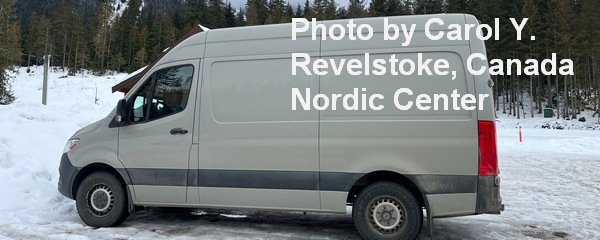
Sprinter Van of the Week!
 Click here for the Sprinter Van map of the world!!!
Have an awesome day!


