

| Snow level | 4a-8a | 8a-12p | 12p-4p | 4p-8p | 8p-4a |
|---|---|---|---|---|---|
| Tuesday 3500′->2500′->3000′ |
 |
|
|
 |
|
| Wednesday 3000′->1500′ |
|
 |
|
|
|
| Thursday 1500′->1000′? |
|
|
|
|
 |
Mt. Hood Snow Forecast
Hey everyone! Here’s the forecast for Tuesday. Gosh golly did Mt. Hood underperform last night. I was thinking 3-5”, and we just got one measly inch, just enough to change the snow surface from granular to a mix. As of the time of this forecast (4:10pm Monday), the resorts had picked up a couple inches of wet snow today with temps hovering right around freezing. We’ll see temps drop tonight and stay low this week. Light snowfall is forecast Tuesday and Wednesday, and then there’s a fair bit of uncertainty Thursday and Friday.
For the rest of Tuesday, we’ll have light wet snow. Just a trace is forecast overnight with the snow level around 4500′. Light snow continues Tuesday morning and gives way to clear sky in the afternoon. Models hint at the possibility of a little more snow overnight, but they’re far from certain on this. The snow level Tuesday will be 3500′ to start the day, 2000′ in the afternoon, and 3000′ or less overnight. About 0.1” water equivalent (WE) is forecast during the day for an inch of new. Overnight. Models call for 0-0.2” WE as new snow. That’s a big range there. I’d guess the lower end of that rather than the high end. Wind will be SW 5-10 in the morning, light in the afternoon, and WNW 10-15 after midnight.
Wednesday may have a few intermittent flurries as clouds move in and out. The snow level will be 3000′ early, 2000′ in the afternoon, and 1500′ or less overnight. Depends on the path of an incoming system and also how much clear sky we have how late. Just a trace to an inch of snow is forecast for the 24 hour period. Wind: WNW 10-15 most of the day building to NW 25-30 overnight.
Beyond Wednesday, there’s quite a bit of uncertainty in the models. Generally speaking, the weather should be cool thanks to NW flow. How much snow will we get? I’m not even going to venture a guess yet. It should be noted that the total snow predictions from now through Friday morning from the Euro range from 5” (10th percentile) to 12.2” (90th percentile). The bulk of that actually comes prior to that uncertain Thursday-Friday time period. As always, we vote for the 90th. Enjoy the snow!
A poem:
Was that forecast helpful?
Did it save you time or gas money?
Did it make your life more fun?
Then please make a contribution.
Writing this takes me an hour or two a day.
Without your support, I can’t keep it up.
Keep the forecast going.
Subscribe or donate.
And share my forecast with your friends!
 |
 |
 |
|
Not ready to subscribe? No problem – please share this forecast with all your friends too!
Or try a month for free!

Gorge Wind Forecast
Hi friends. We have a few days of light to moderate westerlies on tap. As always in the middle of winter, models aren’t all that accurate. I’m counting on reality overperforming a bit thanks to a couple days of offshore high pressure. Still, it’ll be right on the edge. Tuesday starts rainy with light westerlies. By late morning or early afternoon, the wind picks up to W 13-16 from Stevenson to Biggs. River flow Monday was 95-139kcfs, river temp is 38.66F, and high temp forecast is 47F under partly to mostly cloudy sky. Wednesday starts with 10-13 from Viento to Arlington. Midday wind rises to 14-17 from Stevenson to Rufus. It then drops to 10-13 from Stevenson to Hood River and rises to 19-22 from Mosier to Arlington. High temp: 44F with mostly cloudy sky. Thursday starts with 7-10 all through the Gorge. By late morning, we’ll have 12-15 from Stevenson to Arlington. Afternoon: 18-22 from Avery to Rufus. High temp: 44F under partly cloudy sky. Just FYI: models are most optimistic about Wednesday and Thursday. Tuesday would be the bonus day. Fingers crossed!
 |
|
Jones, Sauvie’s, Coast Forecast – On vacation ‘til summer unless otherwise noted
Very basic Hood River weather forecast. Don’t plan your life around this. You really should read TATAS
Clouds and drizzle Tuesday morning give way to partly to mostly cloudy sky in the afternoon. Temps start in the upper 30’s and rise to the upper 40’s. Light westerlies early. Moderate later. 88% chance of rainbows. Wednesday starts cloudy with a little drizzle, maybe, and stays mostly cloudy. Temps start in the mid 30’s and rise to the mid 40’s. Moderate westerlies. 14% chance of rainbows. Thursday will be mostly cloudy and then mostly clear. Temps start in the low-mid 30’s and rise to the mid 40’s. Light westerlies early. Moderate westerlies later. 1% chance of rainbows. Read Temira’s Awesome Travel Advisory Service on Facebook for a detailed forecast that may help you plan your day.
Local-ish Events
Please let me know of outdoor-related local-ish events. If you don’t tell me, I don’t know!
Amayah’s Indian Cafe (Biggs) offers a free meal every first Thursday from 1-4pm.
Regular weekly events:. NK Studio’s by-donation Tuesday morning yoga class is back. Ferment’s Tuesday night 4-mile walk/run is at 6pm. There’s meditation with monks at 5:15pm (an hour) and 6:30pm (30 minutes plus a talk) at Yoga Samadhi in White Salmon. The Tri Club is done for the season. At 7:15am on Wednesdays, there’s a run from the White Salmon Bakery. At 7am on Friday morning, there’s a run from Pine Street Bakery. On Fridays at 2:30pm, there’s a free meditation and stretching class at Yoga Samadhi. On Saturday at 9am, there’s a by-donation outdoor group fitness on the 2rd floor deck about Ferment Brewing.
Cycling
Regarding the trails in general: don’t ride in the mud. You’ll damage the trails. Don’t ride trails if it was below freezing the previous night and is above freezing when you want to ride. Ride gravel. Ride your trainer. Build trails. There are trail builders seeking extra hands on seven additional miles of trail on Whoopdee. Contact HRATS for more information. If you’re parking at Post Canyon, you will need a parking pass. Those can be purchased at many local shops or online.
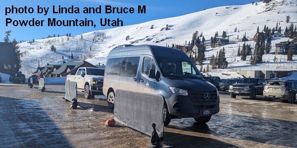
Sprinter Van of the Week!
 Click here for the Sprinter Van map of the world!!!
Have an awesome day!
PREVIOUS POSTS
- Wednesday: another sunny day forecast for mt. hood. new snow? soon, soon…
- Tuesday: need more sun in your life? This Mt. Hood forecast just might have what you need.
- Monday: and now for something different for Mt. Hood
- Thursday: mt hood is tossing some oddball weather at us
- MONDAY: MT HOOD GETS DUMPING SNOW TODAY!

Have an awesome day.
Love, Temira