


Thank you for using this forecast. Like it? Find it useful? Support it (and me!) by sending some cash my way. What’s it cost to support me and get the email version? Not $99 a year. Nope. Not $49. Just $19.99 or more gets you a year. People are added to this list on Thursday and Sunday. My day job is crisis mental health, and I don’t have time on other days. Thanks for your patience! Click below to contribute. Thank you!!
 |
|
 |
Thank you for contributing and keeping this forecast going! Not ready to subscribe? No problem – please share this forecast with all your friends too! I appreciate your support!
The Forecast
| Snow level | 4a-8a | 8a-12p | 12p-4p | 4p-8p | 8p-4a |
|---|---|---|---|---|---|
| Monday 0′->8000′ |
 |
|
|
|
|
| Tuesday 8000′->4000′ |
|
 |
 |
 |
|
| Wednesday 4000-4500′ |
 |
|
|
|
|
Mt. Hood Snow Forecast
Well. Sunday was a rough one for some of the resorts. Icing. Power outages. Network outages. Websites down. Skibowl closed. Our resorts can’t seem to catch a break this season. Be nice to them and their staff. They are doing the best they can. The not-so-fun continues this week. After a brilliant and sunny Monday (Meadows is open for night skiing, btw – It’s the annual Hood River Rotary fundraiser), we return to rain-ice-snow Tuesday afternoon followed by a deicing, snow, and wind mess on Wednesday. Thursday probably starts with snow, but there’s quite a bit of uncertainty in the forecast later this week.
Monday’s going to be mostly sunny. The free air freezing level starts at 0′ with temps all over the map again. Everything from -12C to -2C. The freezing level rises to 6500′ in the afternoon and 8000′ overnight. No precip. Wind will be NW 10-20 in the morning up high and easterly down low. Afternoon wind holds and then turns to W 15 overnight.
Clear sky Tuesday morning gives way to clouds, then rain, then ice, then snow after midnight. The free air freezing level will be 8000′ early, 9000′ mid-morning, and the snow level will fall to 7000′ when the precip arrives. The freezing level then drops to 4000′, but warm air aloft could result in freezing rain instead of snow. About 0.1” water equivalent (WE) is forecast by sunset. That’s rain. About 0.7” WE is forecast overnight as a messy mix of wintry precip that sticks to lifts and causes all sorts of icing problems. Wind: W 15 early, SW 20 n the afternoon, SW 30-45 around midnight, and WSW 40-50 after midnight.
Wednesday’s going to be a mess. Lifts will start iced up, and it’ll be dumping snow. Add in very strong west wind. The snow level will be 4000′-4500′ all day and will rise to 5500-6000′ after midnight. About 1.2” WE is forecast during the day for 10-12” dense new snow. Overnight: 0.1” WE of mixed precip. Wind: WSW 35-50 early quickly turns to W 45-50 and builds to WNW 60 in the afternoon. This shuts down most of the lifts at all of the resorts. Possible exception: the new six-pack at Meadows, which doesn’t seem perturbed by wind. But it might suffer from icing. Overnight, the wind drops to W 20.
As of right now, minimal precip is forecast on Thursday. Generally speaking, the weather looks too warm for snow below 6000′ for at least several days. Let’s hold off on any precision forecasting for a day or two. Enjoy the gorgeous day on the mountain Monday!
Gorge Wind Forecast
 Hi friends! It’s easterly season. Go skate skiing! Monday brings 60mph at Iwash (Rooster) all day with 40ish at Stevenson. River flow Sunday was 75-148kcfs, river temp is 40.46F, and high temp forecast is a miserly 17F. Tuesday starts with 60 at Iwash and drops to 50. Cascade Locks: 40 falling to 35. High temp: 18F. Wednesday starts with E 30-40 at Iwash and Stevenson. If the low crosses the Cascades, westerlies pick up to 24-27. If it doesn’t, the westerlies may pick up from Iwash to Stevenson or maybe Viento. Actually, we don’t really know yet, but given the super-strong west wind aloft, we cold see lee-side troughing and a return to west wind. After that: easterlies again.
| FORECAST SPONSORED BY / AWESOME COMPANIES TO SUPPORT | |
 |
|
Jones, Sauvie’s, Coast – On vacation ‘til summer unless otherwise noted
Hood River Weather Forecast
Nothing in the morning dissipates midday and adds some high clouds later. Temps start in the single digits and rise to the teens. Easterlies. No rainbows. Tuesday will be partly Nothing to start then cloudy then snow, then sleet, then freezing rain. Temps start in the single digits and rise to the teens. Easterlies. No rainbows. Wednesday will be ice storm to start maybe followed by rain if we get lucky. Temps start in the teens. After that? You’ll have to read TATAS for the discussion. See TATAS for full forecast. Please do not rely on this as your weather forecast. Read Temira’s Awesome Travel Advisory Service on Facebook.
Local-ish Events
Please let me know of outdoor-related local-ish events. If you don’t tell me, I don’t know!
The Teacup Tea Party has moved to Sunday, 1/14. Snacks, tea, and free beginner and intermediate skate and classic ski lessons. Hood River Rotary Night at Meadows is Monday, 1/15. Registration is open for Gorge Ultimate winter league. Sign up here: https://gorge.ultimatecentral.com/e/winter-league-2024 – Teacup has an après ski fundraiser at the Ruins on January 27th. $25. Amayah’s Indian Cafe (Biggs) offers a free meal every first Thursday from 1-4pm.
Regular weekly events:. NK Studio’s by-donation Tuesday morning yoga class is back. Ferment’s Tuesday night 4-mile walk/run is at 6pm. There’s meditation with monks at 5:15pm (an hour) and 6:30pm (30 minutes plus a talk) at Yoga Samadhi in White Salmon. The Tri Club is done for the season. At 7:15am on Wednesdays, there’s a run from the White Salmon Bakery. At 7am on Friday morning, there’s a run from Pine Street Bakery. On Fridays at 2:30pm, there’s a free meditation and stretching class at Yoga Samadhi. On Saturday at 9am, there’s a by-donation outdoor group fitness on the 2rd floor deck about Ferment Brewing.
Cycling
Regarding the trails in general: don’t ride in the mud. You’ll damage the trails. Don’t ride trails if it was below freezing the previous night and is above freezing when you want to ride. Ride gravel. Ride your trainer. Build trails. There are trail builders seeking extra hands on seven additional miles of trail on Whoopdee. Contact HRATS for more information. If you’re parking at Post Canyon, you will need a parking pass. Those can be purchased at many local shops or online.
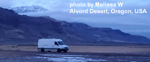
Sprinter Van of the Week!
 Click here for the Sprinter Van map of the world!!!
Have an awesome day!
PREVIOUS POSTS
- Monday Mt Hood snow forecast & Gorge wind n’ weather: incoming snow for Mt Hood; incoming big westerly day for the Gorge.
- Sunday Mt Hood snow forecast & Gorge wind n’ weather: a little snow for the mountain. More snow next week!
- Saturday Mt Hood snow forecast & Gorge wind n’ weather: another mild weekend… solid snowstorm incoming next Wednesday-Thursday!
- Friday Mt Hood snow forecast & Gorge wind n’ weather: an actual snowstorm for Mt Hood next week!
- Wednesday-Thursday Mt Hood snow & Gorge wind n’ weather forecast: a little snow for Mt Hood and strong westerlies for the Gorge.

Have an awesome day.
Love, Temira